Subject: Eastern United States & Canada
Period: 1815 (circa)
Publication:
Color: Hand Color
Size:
14.8 x 16.1 inches
37.6 x 40.9 cm
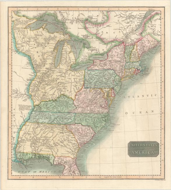
This map of the United States extends to the Mississippi River and features a huge Western Territory bounded by the Ohio River, Canada, and the Mississippi. The Western Territory includes today's Minnesota, Wisconsin, Michigan, Illinois, Indiana, and Ohio. Maine is shown with British boundary claims. Georgia is shown with its western boundary extending all the way to the Mississippi River, and Florida is divided into East and West. The map is filled with notations concerning the navigability of rivers and other items of interest. Engraved by J. & G. Menzies.
References:
Condition: A
Bold contemporary color on a sheet with a partial watermark of "179(?)" and remnants of hinge tape on verso.