Filtered by Category:Books, Atlases, Travel Guides, Geography & Reference Books(Show All Categories)
Showing results for:Auction 185
Catalog Archive
58 lots
Page 1 of 2
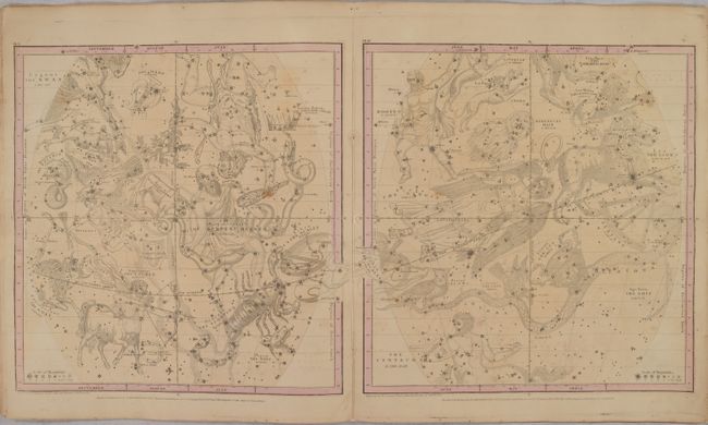
Auction 185, Lot 47
Subject: Celestial Atlas
Burritt, Elijah H.
Atlas, Designed to Illustrate the Geography of the Heavens, Comprising the Following Maps or Plates, 1850
Size: 14.3 x 16.6 inches (36.3 x 42.2 cm)
Estimate: $375 - $450
Sold for: $275
Closed on 11/17/2021
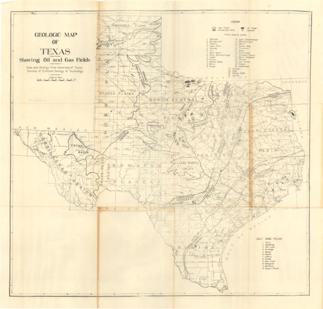
Auction 185, Lot 224
Subject: South Central United States, Texas
[3 Maps with Book] Geologic Map of Texas Showing Oil and Gas Fields [and] Geologic Map of Kansas and Oklahoma Showing Oil and Gas Fields [and] [Osage Oil Lots] [with] Oil and Gas in the Mid-Continent Fields, 1920
Size: 6.9 x 10 inches (17.5 x 25.4 cm)
Estimate: $200 - $230
Early and Rare Texas and Oklahoma Oil Maps
Sold for: $200
Closed on 11/17/2021
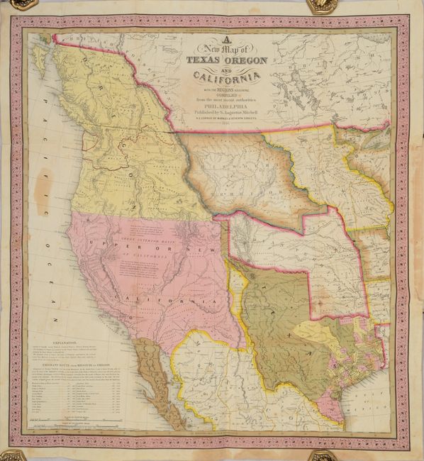
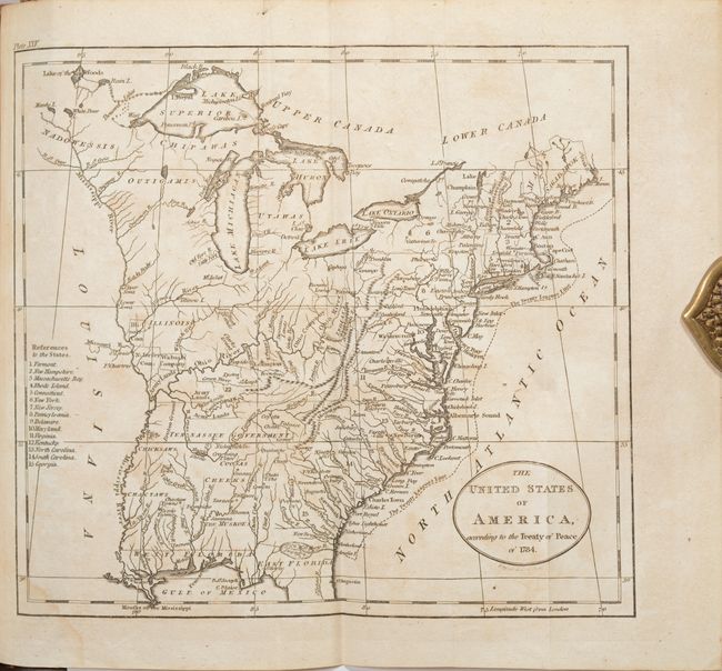
Auction 185, Lot 238
Subject: Western United States, Texas
Mitchell, Samuel Augustus
[Map in Book] A New Map of Texas Oregon and California with the Regions Adjoining. Compiled from the Most Recent Authorities [in] A General View of the United States..., 1846
Size: 20.7 x 22.3 inches (52.6 x 56.6 cm)
Estimate: $9,500 - $12,000
One of the Most Influential Maps of Westward Expansion
Sold for: $7,000
Closed on 11/17/2021
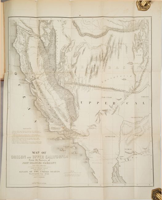
Auction 185, Lot 239
Subject: Western United States
Fremont/Preuss
Map of Oregon and Upper California from the Surveys of John Charles Fremont and Other Authorities [in report], 1850
Size: 16.6 x 19.5 inches (42.2 x 49.5 cm)
Estimate: $500 - $650
Sold for: $425
Closed on 11/17/2021
Auction 185, Lot 243
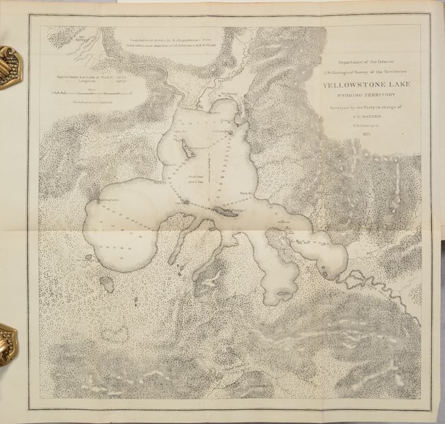
Subject: Montana, Wyoming & Yellowstone
Hayden, Ferdinand Vandeveer
Preliminary Report of the United States Geological Survey of Montana and Portions of Adjacent Territories; Being a Fifth Annual Report of Progress, 1872
Size: 5.9 x 9 inches (15 x 22.9 cm)
Estimate: $300 - $375
Sold for: $150
Closed on 11/17/2021
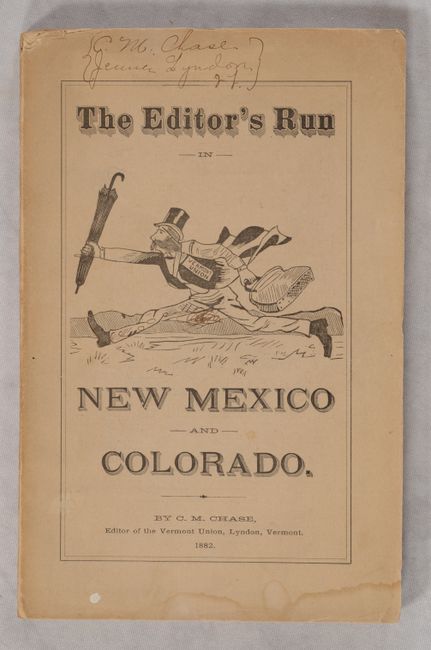
Auction 185, Lot 246
Subject: Southwestern United States
The Editor’s Run in New Mexico and Colorado Embracing Twenty-Eight Letters on Stock Raising, Agriculture, Territorial History, Game, Society, Growing Towns Prices, Prospects, &c…, 1882
Size: 5.8 x 9 inches (14.7 x 22.9 cm)
Estimate: $180 - $220
Sold for: $120
Closed on 11/17/2021
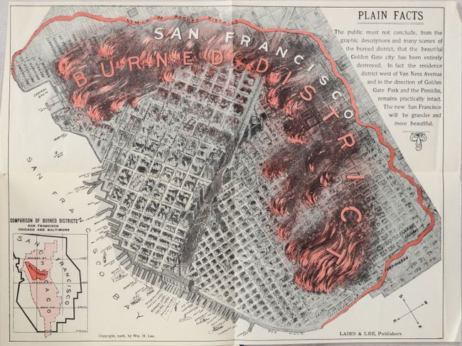
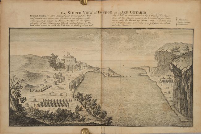
Auction 185, Lot 263
Subject: San Francisco, California
[Map in Book] San Francisco Burned District [in] Glimpses of the San Francisco Disaster Graphically Depicting the Great California Earthquake and Fire..., 1906
Size: 13.2 x 10.1 inches (33.5 x 25.7 cm)
Estimate: $250 - $325
Sold for: $375
Closed on 11/17/2021
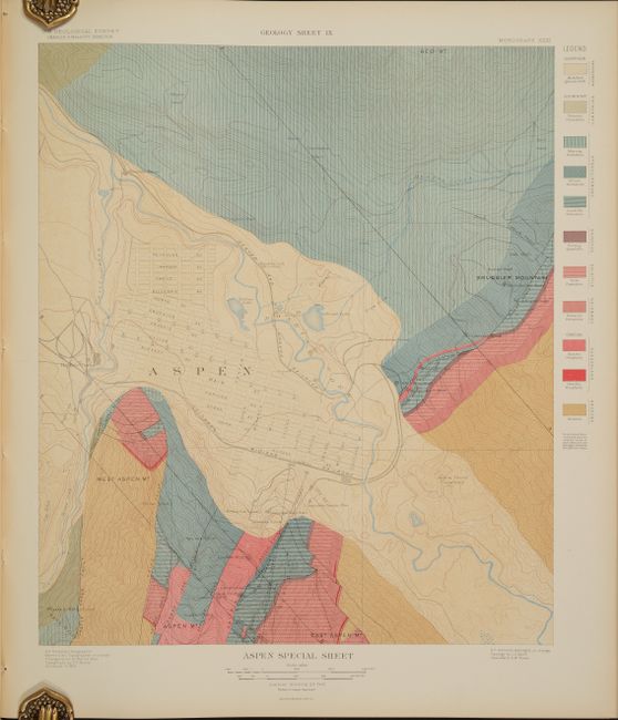
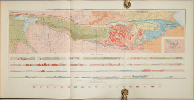
Auction 185, Lot 278
Subject: Central Colorado, Aspen
U.S. Geological Survey (USGS)
Atlas to Accompany Monograph XXXI on the Geology of the Aspen District Colorado, 1898
Size: 18.6 x 21.4 inches (47.2 x 54.4 cm)
Estimate: $600 - $750
Sold for: $450
Closed on 11/17/2021
Auction 185, Lot 302
Subject: Upper Peninsula, Michigan, Geology
U.S. Geological Survey (USGS)
Atlas to Accompany Monograph XXVIII on the Marquette Iron-Bearing District of Michigan, 1896
Size: 18.6 x 21.2 inches (47.2 x 53.8 cm)
Estimate: $200 - $230
Sold for: $90
Closed on 11/17/2021
Auction 185, Lot 314
Subject: New York
Smith, William
The History of the Province of New-York, from the First Discovery to the Year M.DCC.XXXII..., 1757
Size: 8.5 x 10.5 inches (21.6 x 26.7 cm)
Estimate: $2,000 - $2,400
A Foundation Piece for New York Collectors
Sold for: $1,200
Closed on 11/17/2021
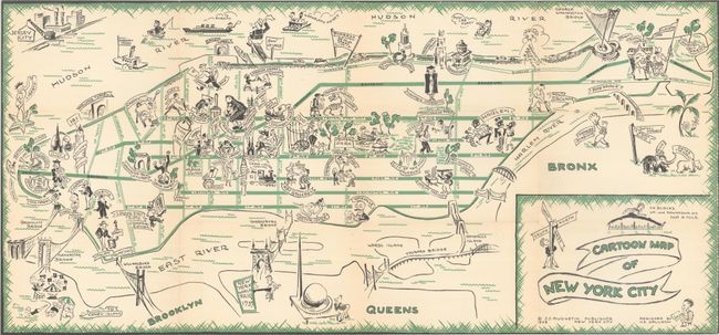
Auction 185, Lot 317
Subject: New York City, New York
Cartoon Map of New York City [with] Cartoon Guide of New York City, 1938
Size: 26 x 12.1 inches (66 x 30.7 cm)
Estimate: $300 - $375
Sold for: $170
Closed on 11/17/2021
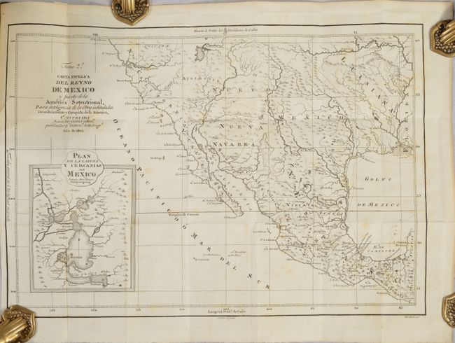
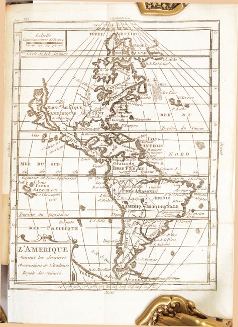
Auction 185, Lot 358
Subject: Southwestern United States & Mexico
[Map in Book] Carta Esferica del Reyno de Mexico y Parte de la America Setentrional... [in] Descubrimiento y Conquista de la America, o Compendio de la Historia General del Nuevo Mundo ... Tomo II, 1803
Size: 18.1 x 12.5 inches (46 x 31.8 cm)
Estimate: $1,800 - $2,200
A Scarce Spanish Map of the Southwest
Sold for: $3,250
Closed on 11/17/2021
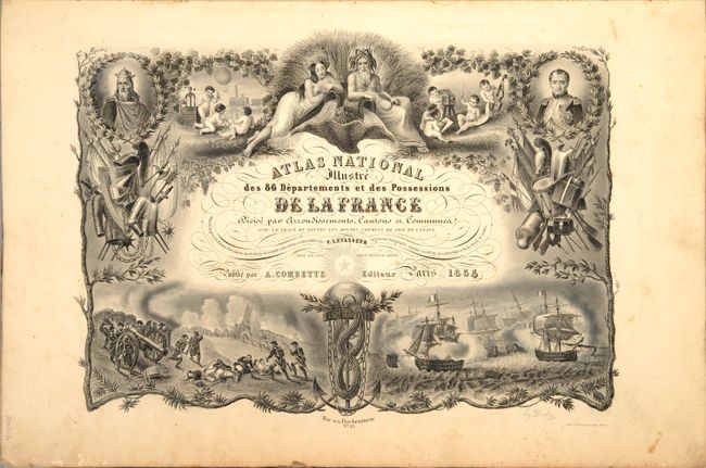
Auction 185, Lot 500
Subject: France, Atlas
Levasseur, Victor
Atlas National Illustre des 86 Departements et des Possessions de la France Divise par Arrondissements, Cantons et Communes..., 1854
Size: 14.8 x 21.3 inches (37.6 x 54.1 cm)
Estimate: $550 - $700
Sold for: $550
Closed on 11/17/2021
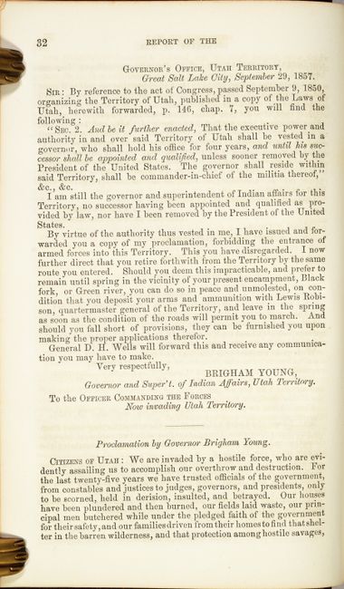
Auction 185, Lot 763
Subject: Document - Mormon War & Western Exploration
U.S. War Department
[Mormon War] Message from the President of the United States, to the Two Houses of Congress at the Commencement of the First Session of the Thirty-fifth Congress ... Vol. II, 1857
Size: 5.9 x 9.3 inches (15 x 23.6 cm)
Estimate: $400 - $475
Reports on the Mormon War and Western Exploration
Sold for: $200
Closed on 11/17/2021
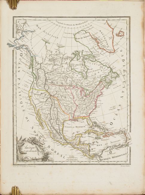
Auction 185, Lot 765
Subject: Atlases
Malte-Brun, Conrad
Atlas Complet du Precis de la Geographie Universelle de M. Malte-Brun..., 1812
Size: 11.1 x 14.8 inches (28.2 x 37.6 cm)
Estimate: $700 - $850
First Edition
Sold for: $1,800
Closed on 11/17/2021
Auction 185, Lot 766
Subject: Atlases
Carey & Lea
A Complete Historical, Chronological, and Geographical American Atlas, Being a Guide to the History of North and South America, and the West Indies..., 1822
Size: 12.4 x 18 inches (31.5 x 45.7 cm)
Estimate: $7,000 - $8,500
Complete First Edition of Carey & Lea's Atlas
Sold for: $7,000
Closed on 11/17/2021
Auction 185, Lot 767
Subject: Atlases
Finley, Anthony
A New General Atlas, Comprising a Complete Set of Maps, Representing the Grand Divisions of the Globe..., 1824
Size: 10.9 x 13.9 inches (27.7 x 35.3 cm)
Estimate: $4,750 - $6,000
First Edition of Finley's General Atlas - Complete
Sold for: $5,500
Closed on 11/17/2021
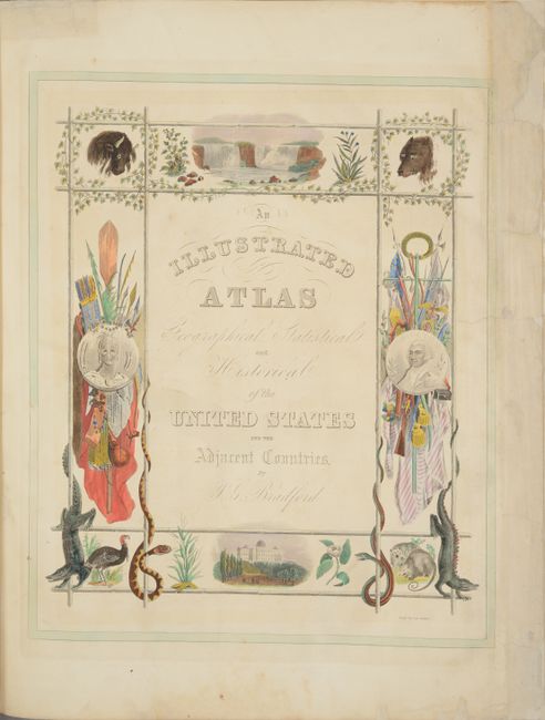
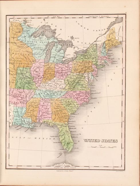
Auction 185, Lot 768
Subject: Atlases
Bradford, Thomas Gamaliel
An Illustrated Atlas, Geographical, Statistical, and Historical, of the United States, and the Adjacent Countries, 1838
Size: 16.1 x 20 inches (40.9 x 50.8 cm)
Estimate: $5,500 - $7,000
Large Edition of Bradford's Elaborate Illustrated Atlas
Sold for: $4,000
Closed on 11/17/2021
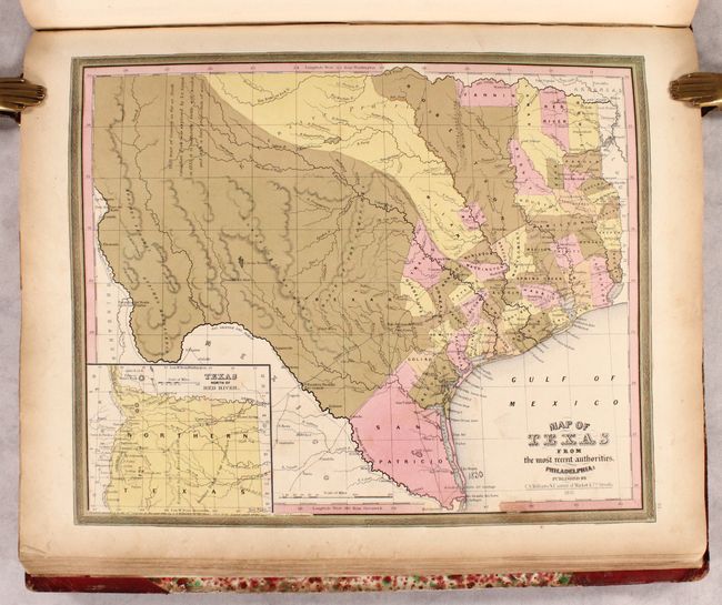
Auction 185, Lot 769
Subject: Atlases
Tanner, Henry Schenck
A New Universal Atlas Containing Maps of the Various Empires, Kingdoms, States and Republics of the World..., 1846
Size: 14 x 17.8 inches (35.6 x 45.2 cm)
Estimate: $3,750 - $4,500
Rare, Complete Tanner Atlas with Important Maps of Texas & Iowa
Unsold
Closed on 11/17/2021
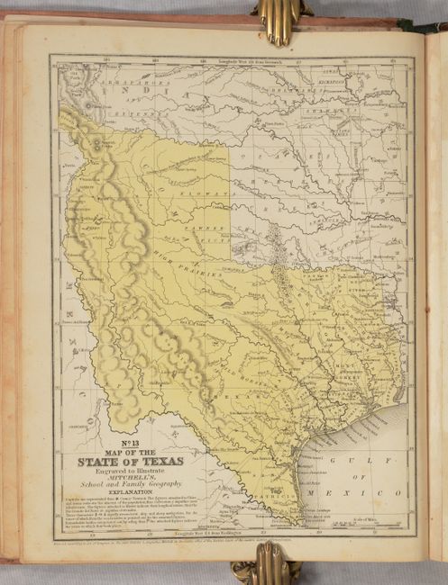
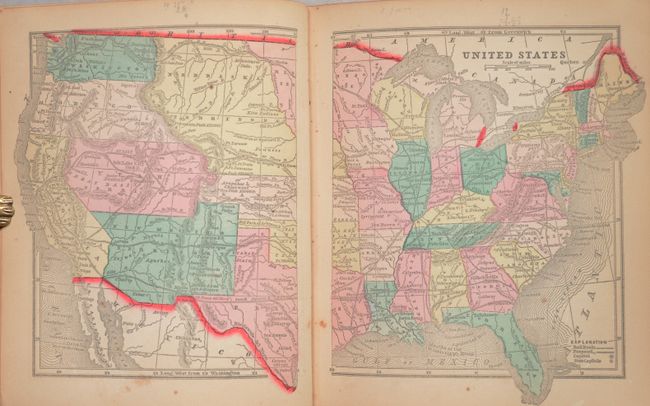
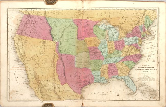
Auction 185, Lot 770
Subject: Atlases, Texas
Mitchell, Samuel Augustus
Mitchell's School Atlas: Comprising the Maps, Etc., Designed to Illustrate Mitchell's School and Family Geography, 1850
Size: 9.8 x 12.1 inches (24.9 x 30.7 cm)
Estimate: $450 - $550
Features Texas in Its Stovepipe Configuration
Sold for: $300
Closed on 11/17/2021
Auction 185, Lot 771
Subject: Atlases
Morse & Gaston
The Diamond Atlas. With Descriptions of All Countries: Exhibiting Their Actual and Comparative Extent, and Their Present Political Divisions... The Western Hemisphere, 1857
Size: 6.4 x 7.6 inches (16.3 x 19.3 cm)
Estimate: $350 - $425
Unsold
Closed on 11/17/2021
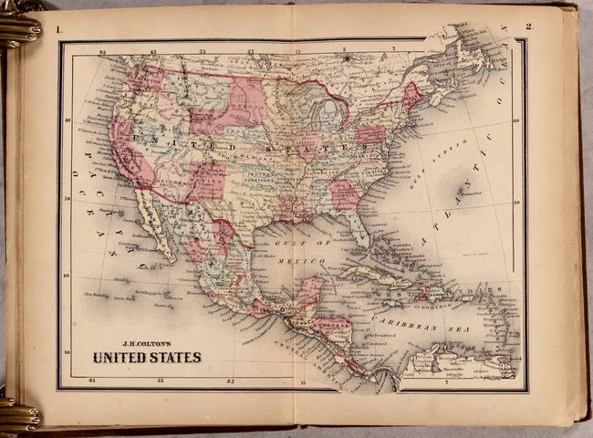
Auction 185, Lot 772
Subject: Atlases
Colton, Joseph Hutchins
Colton's Condensed Octavo Atlas of the Union: Containing Maps of All the States and Territories of the United States of America, 1864
Size: 9.6 x 6.6 inches (24.4 x 16.8 cm)
Estimate: $800 - $950
Unsold
Closed on 11/17/2021
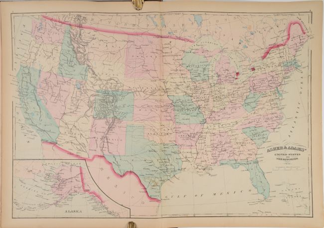
Auction 185, Lot 773
Subject: Atlases
Asher & Adams
Asher & Adams' New Commercial, Topographical, and Statistical Atlas and Gazetteer of the United States: with Maps Showing the Dominion of Canada, Europe and the World..., 1872
Size: 13.4 x 17.9 inches (34 x 45.5 cm)
Estimate: $1,000 - $1,300
Sold for: $750
Closed on 11/17/2021
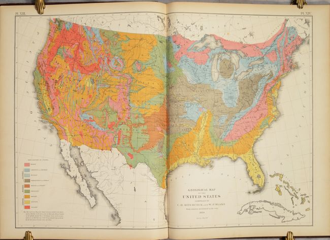
Auction 185, Lot 774
Subject: Atlases
Walker, Francis
Statistical Atlas of the United States Based on the Results of the Ninth Census 1870 with Contributions from Many Eminent Men of Science and Several Departments of the Government, 1874
Size: 16.8 x 22.1 inches (42.7 x 56.1 cm)
Estimate: $550 - $700
Sold for: $400
Closed on 11/17/2021
Auction 185, Lot 775
Subject: School Atlases
Lincoln & Edmands
School Atlas to Adams' Geography, 1825
Size: 7 x 8.3 inches (17.8 x 21.1 cm)
Estimate: $200 - $230
Sold for: $150
Closed on 11/17/2021
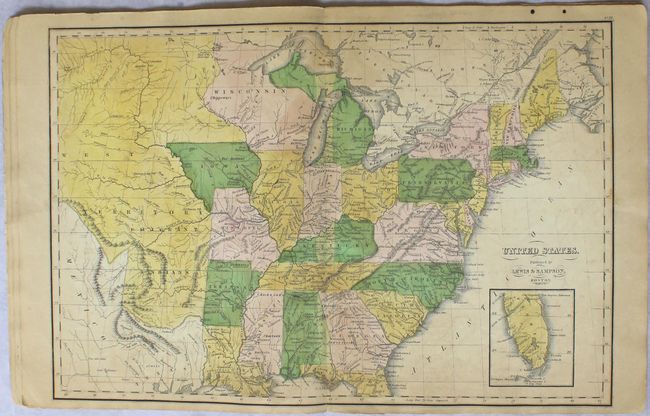
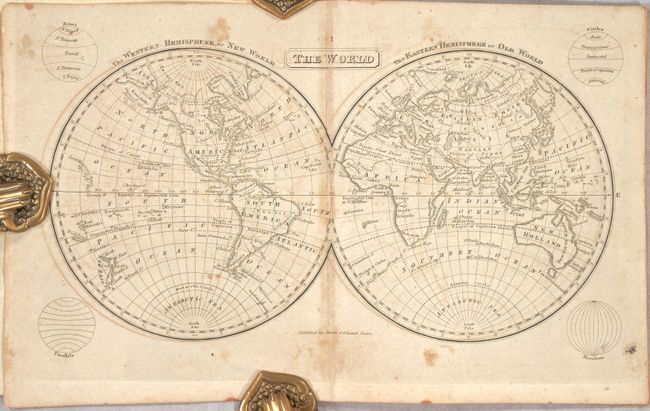
Auction 185, Lot 776
Subject: School Atlases
Lewis & Sampson
Worcester's Modern Atlas..., 1835
Size: 9.6 x 12.1 inches (24.4 x 30.7 cm)
Estimate: $275 - $350
Sold for: $175
Closed on 11/17/2021
Auction 185, Lot 777
Subject: School Atlases
Olney, A. N.
Olney's School Atlas, 1844
Size: 9.8 x 12.1 inches (24.9 x 30.7 cm)
Estimate: $275 - $350
Sold for: $200
Closed on 11/17/2021
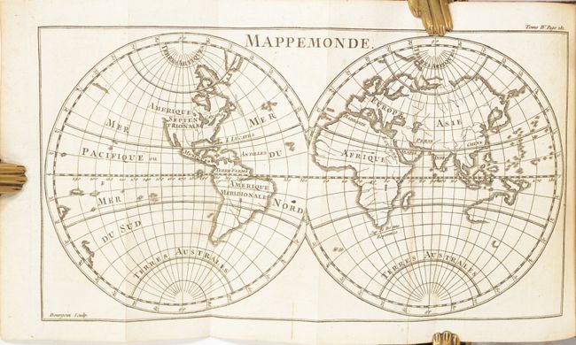
Auction 185, Lot 778
Subject: Geography Books
Buffier, Claude
Geographie Universelle, Exposee dans les Differentes Methodes qui Peuvent Abreger l'Etude, & Faciliter l'Usage de Cette Science ... Dixieme Edition, 1774
Size: 4 x 6.9 inches (10.2 x 17.5 cm)
Estimate: $550 - $700
Sold for: $400
Closed on 11/17/2021
Auction 185, Lot 779
Subject: Geography Books
Guthrie, William
[A New Geographical, Historical, and Commercial Grammar ... Volume II], 1800
Size: 5.4 x 8.9 inches (13.7 x 22.6 cm)
Estimate: $275 - $350
Sold for: $150
Closed on 11/17/2021
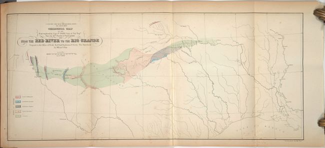
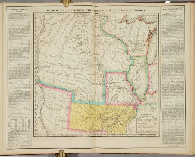
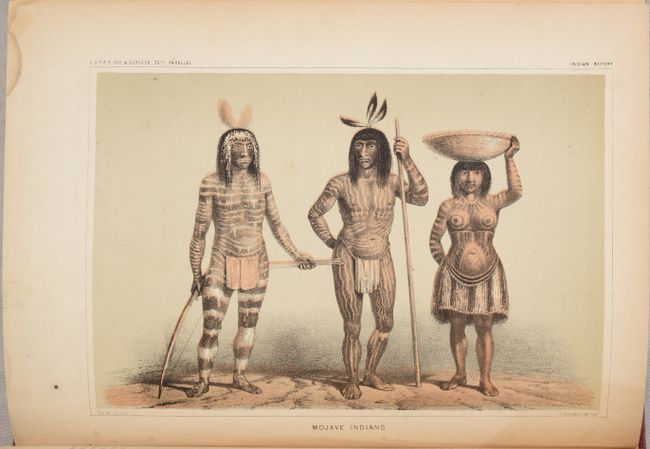
Auction 185, Lot 780
Subject: Railroad Surveys
U.S. Railroad Surveys
[Pacific Railroad Surveys - Volume II] Reports of Explorations and Surveys, to Ascertain the Most Practicable and Economical Route for a Railroad from the Mississippi River to the Pacific Ocean ... Volume II, 1855
Size: 9.1 x 11.9 inches (23.1 x 30.2 cm)
Estimate: $275 - $350
Sold for: $200
Closed on 11/17/2021
Auction 185, Lot 781
Subject: Railroad Surveys
U.S. Railroad Surveys
[Pacific Railroad Surveys - Volume III] Reports of Explorations and Surveys, to Ascertain the Most Practicable and Economical Route for a Railroad from the Mississippi River to the Pacific Ocean ... Volume III, 1856
Size: 9 x 11.6 inches (22.9 x 29.5 cm)
Estimate: $200 - $230
Sold for: $150
Closed on 11/17/2021
Auction 185, Lot 782
Subject: Miscellaneous Books
Le Spectacle de la Nature, ou Entretiens sur les Particularites de l'Histoire Naturelle ... Tome Quatrieme , 1742
Size: 4 x 6.8 inches (10.2 x 17.3 cm)
Estimate: $475 - $600
Unsold
Closed on 11/17/2021
Auction 185, Lot 783
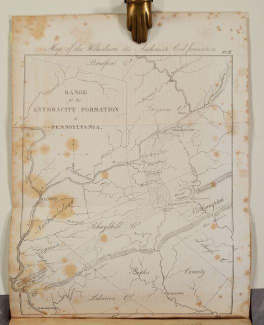
Subject: Miscellaneous Books, Lithography
[2 Maps in Book] Map of the Wilkesbarre &c Anthracite Coal Formation [and] Barton on the Catskills [bound in] The American Journal of Science, and Arts ... Vol. IV..., 1821-22
Size: 5.3 x 8.7 inches (13.5 x 22.1 cm)
Estimate: $250 - $325
Volume Includes the First Two Maps Lithographed in the United States
Sold for: $150
Closed on 11/17/2021
Auction 185, Lot 784
Subject: Miscellaneous Books
Beadle, D. W.
The American Lawyer, and Business-Man's Form-Book; Containing Forms and Instructions..., 1851
Size: 4.9 x 7.8 inches (12.4 x 19.8 cm)
Estimate: $110 - $140
First Edition
Sold for: $110
Closed on 11/17/2021
Auction 185, Lot 785
Subject: Miscellaneous Books
Turner, James
[2 Volumes] The Turner Gallery - A Series of One Hundred and Twenty Engravings from the Works of the Late J.M.W. Turner, R.A..., 1878
Size: 11.3 x 14.9 inches (28.7 x 37.8 cm)
Estimate: $800 - $950
Sold for: $500
Closed on 11/17/2021
Auction 185, Lot 786
Subject: Miscellaneous Books
The Manual of Statistics Stock Exchange Hand-Book 1899 Railroads, Street Railways Industrial Securities..., 1899
Size: 5.6 x 8 inches (14.2 x 20.3 cm)
Estimate: $140 - $170
Sold for: $70
Closed on 11/17/2021
Auction 185, Lot 787
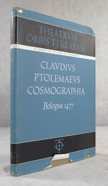
Subject: References, Facsimile Atlas
Ptolemy
[Facsimile] Cosmographia, 1963
Size: 12.2 x 17.6 inches (31 x 44.7 cm)
Estimate: $300 - $400
Sold for: $325
Closed on 11/17/2021
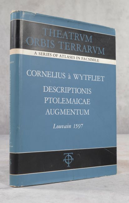
Auction 185, Lot 788
Subject: References, Facsimile Atlas
Wytfliet, Cornelis
[Facsimile] Descriptionis Ptolemaicae Augmentum sive Occidentis Notitia Brevis Commentario, 1964
Size: 8.6 x 12 inches (21.8 x 30.5 cm)
Estimate: $160 - $190
Sold for: $120
Closed on 11/17/2021
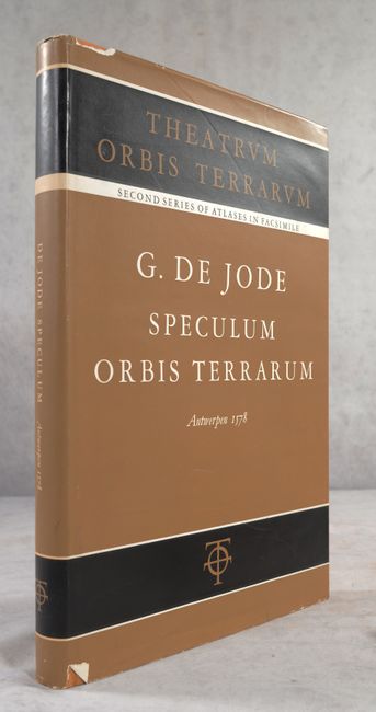
Auction 185, Lot 789
Subject: References, Facsimile Atlas
Jode, Gerard de
[Facsimile] Speculum Orbis Terrarum, 1965
Size: 11.8 x 17.5 inches (30 x 44.5 cm)
Estimate: $180 - $220
Sold for: $130
Closed on 11/17/2021
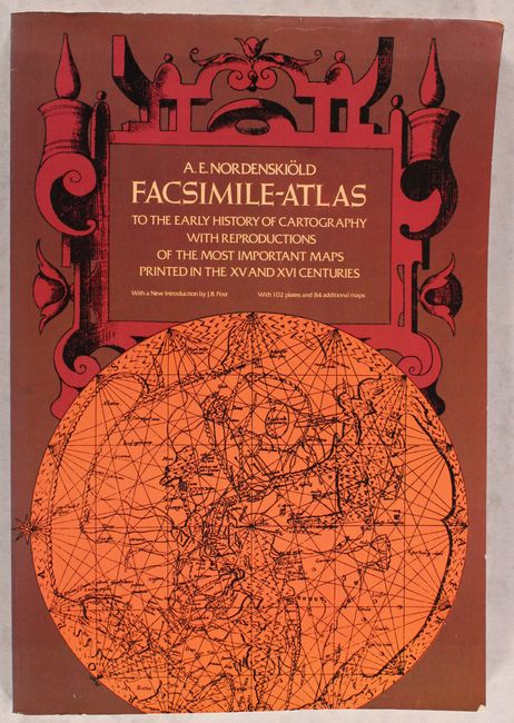
Auction 185, Lot 790
Subject: References
Nordenskiold, Nils Adolf E.
Facsimile-Atlas to the Early History of Cartography with Reproductions of the Most Important Maps Printed in the XV and XVI Centuries, 1973
Size: 11 x 16 inches (27.9 x 40.6 cm)
Estimate: $140 - $170
Sold for: $110
Closed on 11/17/2021
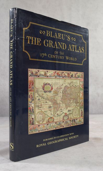
Auction 185, Lot 791
Subject: References
Goss, John
Blaeu's The Grand Atlas of the 17th Century World, 1997
Size: 11.4 x 14.5 inches (29 x 36.8 cm)
Estimate: $75 - $100
NO RESERVE
Sold for: $140
Closed on 11/17/2021
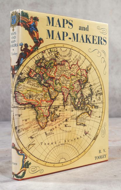
Auction 185, Lot 792
Subject: References, Mapmakers
Tooley, R. V.
Maps and Map-Makers, 1970
Size: 7.6 x 10.1 inches (19.3 x 25.7 cm)
Estimate: $30 - $50
NO RESERVE
Sold for: $41
Closed on 11/17/2021
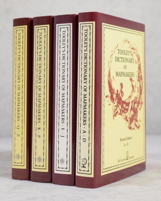
Auction 185, Lot 793
Subject: References, Mapmakers
Tooley, R. V.
[4 Volumes] Tooley's Dictionary of Mapmakers, 1999-2004
Size: 7.1 x 10.2 inches (18 x 25.9 cm)
Estimate: $500 - $650
Sold for: $475
Closed on 11/17/2021

Auction 185, Lot 794
Subject: References, America
Phillips, P. Lee
A List of Maps of America in the Library of Congress Preceded by a List of Works Relating to Cartography, 1901
Size: 7.4 x 10.8 inches (18.8 x 27.4 cm)
Estimate: $80 - $100
NO RESERVE
Sold for: $55
Closed on 11/17/2021
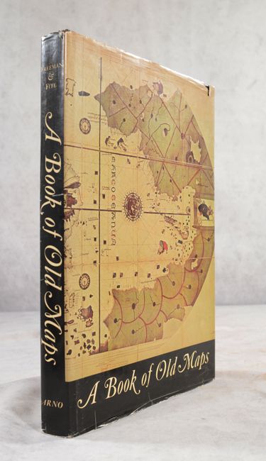
Auction 185, Lot 795
Subject: References, United States
A Book of Old Maps Delineating American History from the Earliest Days Down to the Close of the Revolutionary War, 1969
Size: 10 x 14.5 inches (25.4 x 36.8 cm)
Estimate: $120 - $150
Sold for: $90
Closed on 11/17/2021
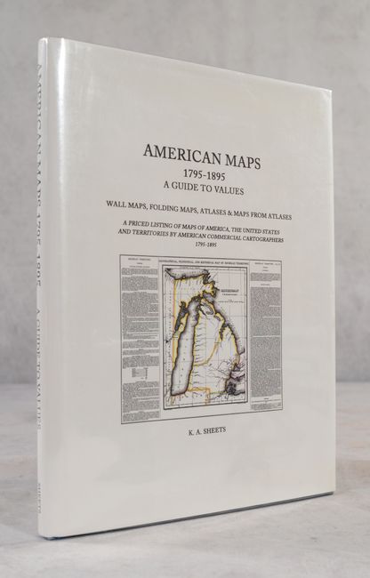
Auction 185, Lot 796
Subject: References, United States
American Maps 1795-1895 - A Guide to Values Wall Maps, Folding Maps, Atlases & Maps from Atlases..., 1994
Size: 8.7 x 11.4 inches (22.1 x 29 cm)
Estimate: $20 - $40
NO RESERVE
Sold for: $25
Closed on 11/17/2021
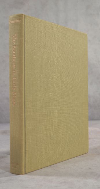
Auction 185, Lot 797
Subject: References, Southeast United States
Cumming, William P.
The Southeast in Early Maps with an Annotated Check List of Printed and Manuscript Regional and Local Maps of Southeastern North America During the Colonial Period, 1962
Size: 8.7 x 11.3 inches (22.1 x 28.7 cm)
Estimate: $60 - $80
NO RESERVE
Sold for: $60
Closed on 11/17/2021
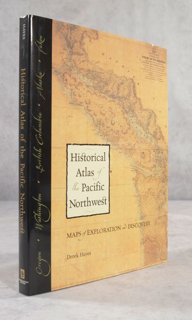
Auction 185, Lot 798
Subject: References, Pacific Northwest
Historical Atlas of the Pacific Northwest - Maps of Exploration and Discovery..., 1999
Size: 9.8 x 13 inches (24.9 x 33 cm)
Estimate: $25 - $45
NO RESERVE
Sold for: $41
Closed on 11/17/2021
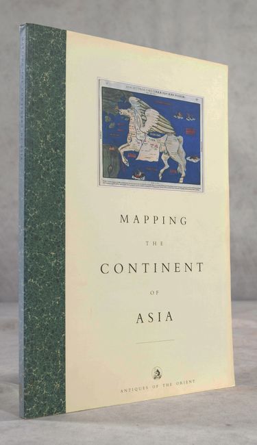
Auction 185, Lot 799
Subject: References, Asia
Mapping the Continent of Asia, 1994
Size: 8.3 x 11.8 inches (21.1 x 30 cm)
Estimate: $120 - $150
Sold for: $65
Closed on 11/17/2021
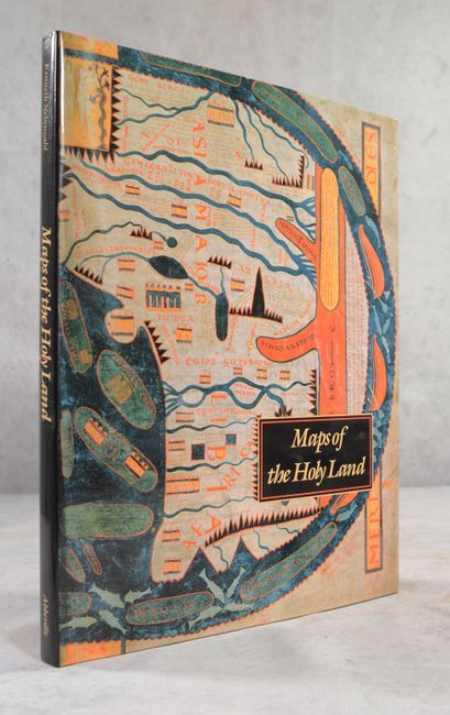
Auction 185, Lot 800
Subject: References, Holy Land
Nebenzahl, Kenneth
Maps of the Holy Land - Images of Terra Sancta Through Two Millenia, 1986
Size: 12.1 x 15.4 inches (30.7 x 39.1 cm)
Estimate: $90 - $110
NO RESERVE
Sold for: $65
Closed on 11/17/2021
58 lots
Page 1 of 2