Subject: Eastern United States & Canada
Period: 1780-90 (circa)
Publication:
Color: Hand Color
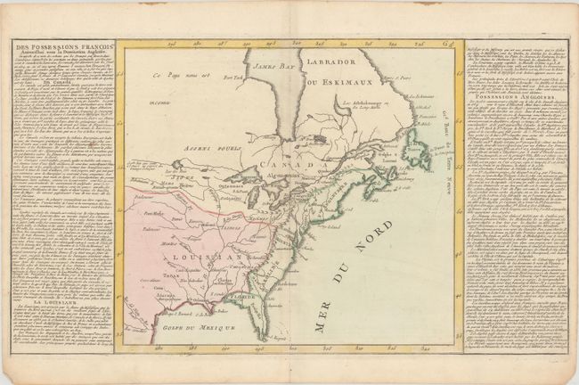
A. Des Possessions Francoises Aujourd'hui sous la Domination Angloises..., by Jean Baptiste Louis Clouet, circa 1780 (22.0 x 12.4"). This simple, yet interesting, map illustrates the French and British possessions in the eastern part of North America. The British colonies stretch from Florida to Newfoundland and are confined east of the Appalachian and Allegheny mountains. Louisiana takes in the entire region west of the mountains. Cenis appears, and Tecas is named. The most interesting feature of the map is a system of lakes and rivers stretching from Lake Superior toward the Pacific - forming the elusive Northwest Passage. The map is flanked by columns of French text that describe the colonial possessions, major settlements, and indigenous people. Condition: Contemporary color with very light soiling on a sheet with a bunch of grapes watermark.
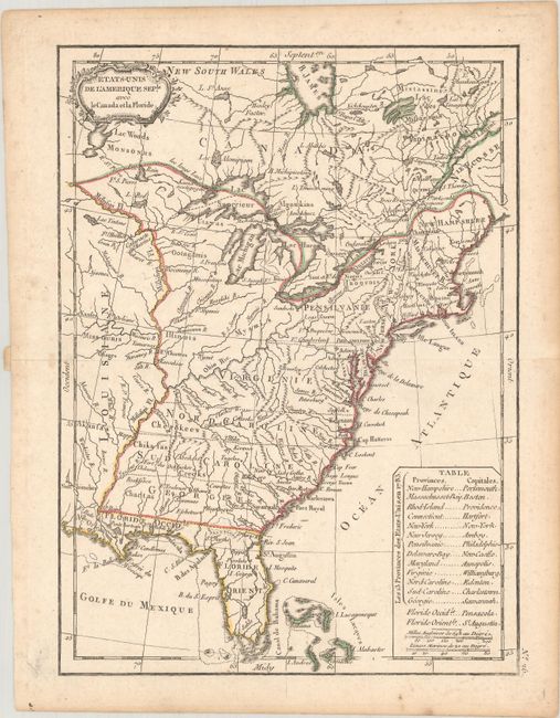
B. Etats-Unis de l'Amerique Seple. avec le Canada et la Floride, by Jean Lattre, circa 1790 (7.3 x 9.8"). This map focuses on the young United States. Virginia, North Carolina, South Carolina, and Georgia extend to the Mississippi River, and numerous forts and Indian villages are also located. A table in the Atlantic names the 13 states with their capitals. West and East Florida are part of the Spanish possession of Louisiane. The map features a rococo-style title cartouche. Condition: Contemporary outline color with very light soiling and a bit of toning along the edges of the sheet.
References:
Condition: B+
See description above.