Catalog Archive
Auction 185, Lot 136

"Carte Generale des Etats Unis de l'Amerique Septentrionale, Renfermant Aussi Quelques Provinces Angloises Adjacentes", Tardieu, Pierre Francois

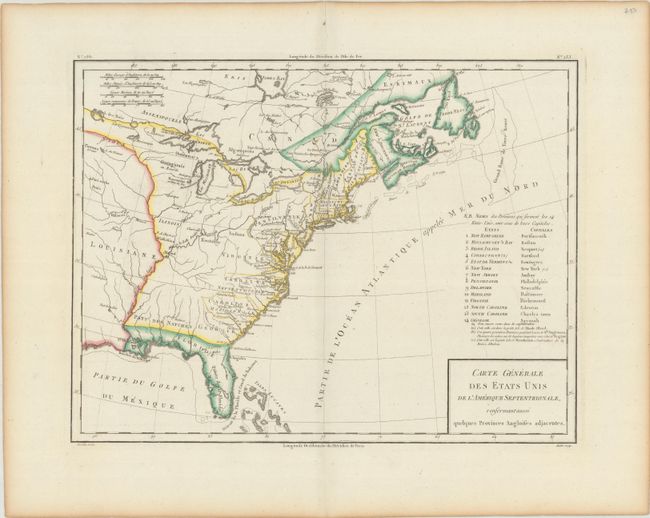
Subject: Eastern United States & Canada

Period: 1797 (circa)

Publication: Atlas Universel de Geographie Physique et Politique

Color: Hand Color

Size:
16.9 x 12.8 inches
42.9 x 32.5 cm
Download High Resolution Image
(or just click on image to launch the Zoom viewer)

Nice early map of the United States with fourteen states and their capitals named, and extending south to include the Isles Lucayes (Bahamas). The country's western boundary is shown on the Mississippi River, although many states' western boundaries are not depicted. A few forts are located in the western regions, but most detail is confined along the coast. Published by Chanlaire & Mentelle.

References: McCorkle #797.6.

Condition: A

A crisp impression on a bright sheet with light toning along the sheet edges.

Estimate: $240 - $300

Sold for: $120

Closed on 11/17/2021

Archived