Subject: United States
Period: 1880-82 (dated)
Publication:
Color:
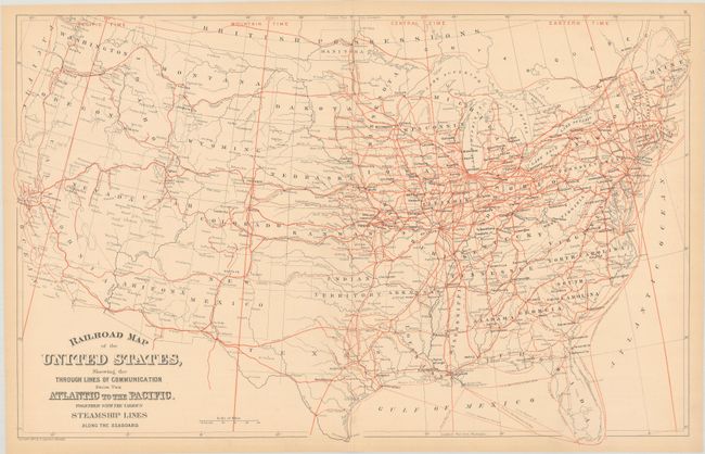
A. Railroad Map of the United States, Showing the Through Lines of Communication from the Atlantic to the Pacific. Together with the Various Steamship Lines Along the Seaboard, dated 1880, printed color (22.8 x 14.4"). A handsome map showing the country's rapidly expanding railroad network in the later portion of the 19th century. Locates both completed and proposed lines in bold red coloring along with major cities, forts, and mining communities. Steamship routes and time zones provide additional insight. Condition: Pleasant light toning with a 1" fold separation at top. (B+)
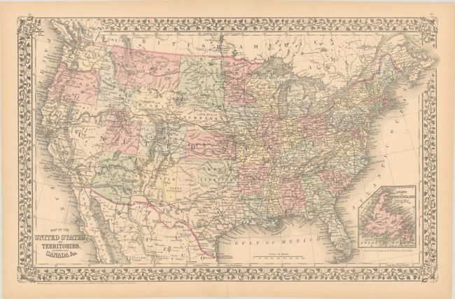
B. Map of the United States and Territories. Together with Canada &c., dated 1882, hand color (21.5 x 13.6"). An attractive map of the United States enclosed in a floral border. Dacotah has not yet split into North and South Dakota, and the recently established Yellowstone National Park is shown in Wyoming Territory. An extensive railroad network runs throughout the East, with a number of existing and proposed lines extending to the Pacific Ocean. Includes an inset of Newfoundland at bottom right. Condition: There is a hint of toning with a short centerfold separation confined to the bottom blank margin that has been closed on verso with archival tape. (A)
References:
Condition:
See description above.