Subject: Northeastern United States & Canada
Period: 1800 (published)
Publication: A Concise System of Modern Geography...
Color: Hand Color
Size:
15.1 x 11.6 inches
38.4 x 29.5 cm
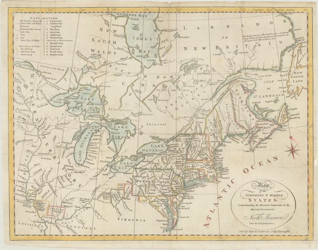
This is the rare Vint & Anderson edition of this map which originally appeared in Morse's American Geography (1789). The information-packed map describes the region from James Bay to Chesapeake Bay and the confluence of the Mississippi and Ohio Rivers, and from the Lake of the Woods to the Gulf of St. Lawrence. An explanation of the various symbols used in the map is displayed in the upper left corner. Several of the districts and states are shown with distorted borders, but the most interesting feature of the map are the numerous Bounty Land Grants shown in the western frontier including Genl Clarks Grant 1500 Acres, Donation Lands from the Commonwealth of Virginia, and Ohio Company in Ohio, and Wabash Company, New Jersey Company, and Illinois Company in Illinois. The Vint & Anderson imprint was added to the same plate that appeared in Scottish editions of Morse and Payne's respective geography books.
References: McCorkle #800.1; McCorkle (18th C. Geography Books) #438-5 (Vol. II).
Condition: B+
Issued folding, now flat, with archival repairs to a small binding tear at right and a short split along a fold at top. Minor soiling.