Filtered by Category:United States(Show All Categories)
Showing results for:Auction 146
Catalog Archive
161 lots
Page 1 of 4
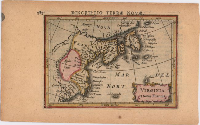
Auction 146, Lot 120
Subject: Colonial United States & Canada
Hondius/Bertius
Virginia et Nova Francia, 1618
Size: 5.4 x 3.8 inches (13.7 x 9.7 cm)
Estimate: $600 - $750
Sold for: $400
Closed on 9/4/2013
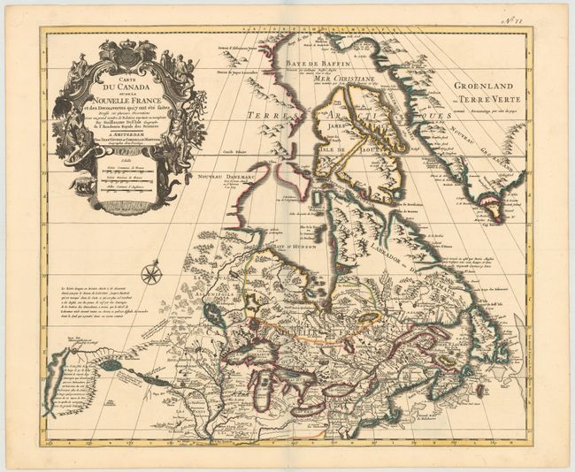
Auction 146, Lot 121
Subject: Colonial United States & Canada
Delisle/Covens & Mortier
Carte du Canada ou de la Nouvelle France et des Decouvertes quiy ont ete Faites..., 1730
Size: 22.6 x 19.3 inches (57.4 x 49 cm)
Estimate: $1,400 - $1,700
One of the most influential maps of Canada, the Great Lakes and Upper Midwest
Sold for: $1,300
Closed on 9/4/2013
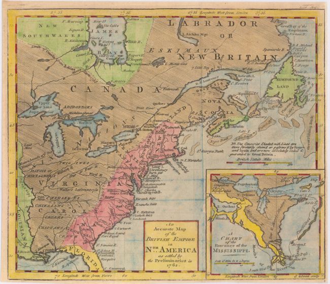
Auction 146, Lot 122
Subject: Colonial United States & Canada
Gibson, John
An Accurate Map of the British Empire in Nth. America as Settled by the Preliminaries in 1762, 1762
Size: 9.7 x 8.3 inches (24.6 x 21.1 cm)
Estimate: $300 - $400
Sold for: $220
Closed on 9/4/2013
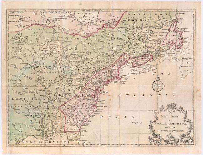
Auction 146, Lot 123
Subject: Colonial United States & Canada
Spilsbury, J.
A New Map of North America from the Latest Discoveries, 1763
Size: 14.75 x 10.9 inches (37.5 x 27.7 cm)
Estimate: $275 - $350
Unsold
Closed on 9/4/2013
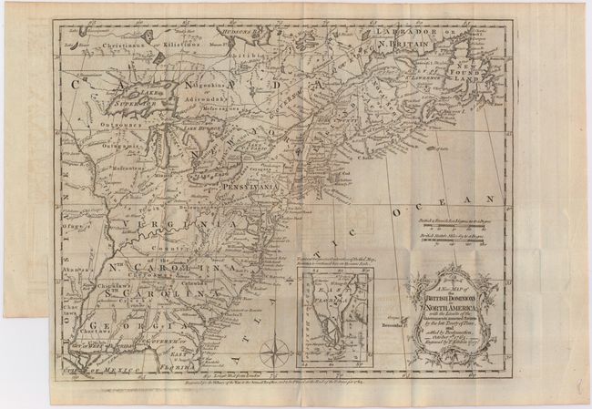
Auction 146, Lot 124
Subject: Colonial United States & Canada
Kitchin, Thomas
A New Map of the British Dominions in North America; with the Limits of the Governments Annexed thereto by the Late Treaty of Peace, and Settled by Proclamation, October 7th, 1763, 1763
Size: 12 x 9.5 inches (30.5 x 24.1 cm)
Estimate: $500 - $600
Sold for: $250
Closed on 9/4/2013
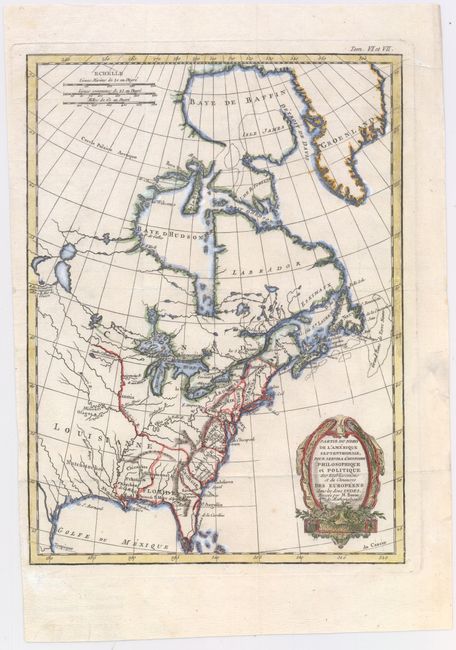
Auction 146, Lot 125
Subject: Colonial United States & Canada
Bonne, Rigobert
Partie du Nord de l'Amerique Septentrionale, pour Servir a l'Histoire Philosophique et Politique…, 1774
Size: 9.3 x 12.6 inches (23.6 x 32 cm)
Estimate: $240 - $300
Unsold
Closed on 9/4/2013
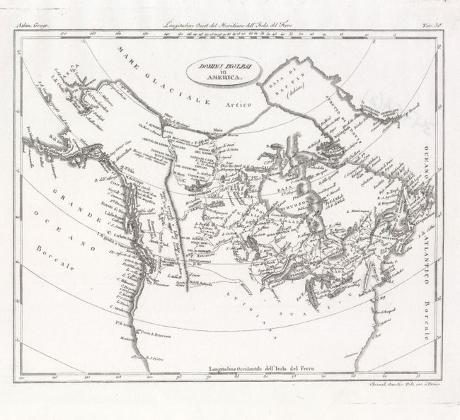
Auction 146, Lot 126
Subject: United States & Canada
Barbiellini, Carlo Antonio
Dominj Inglesi in America, 1807
Size: 9.7 x 7.9 inches (24.6 x 20.1 cm)
Estimate: $150 - $180
Sold for: $130
Closed on 9/4/2013
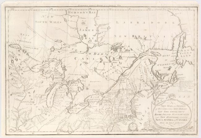
Auction 146, Lot 127
Subject: Eastern United States & Canada
Gordon, William
A New Map of the States of Pensylvania New Jersey New York Connecticut Rhode Island Massachusets and New Hampshire Including Nova Scotia and Canada..., 1789
Size: 16 x 10.6 inches (40.6 x 26.9 cm)
Estimate: $240 - $300
Unsold
Closed on 9/4/2013
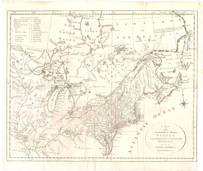
Auction 146, Lot 128
Subject: Eastern United States & Canada
Stockdale, John
A Map of the Northern & Middle States; Comprehending the Western Territory and the British Dominions in North America. From the Best Authorities, 1792
Size: 15.7 x 12.5 inches (39.9 x 31.8 cm)
Estimate: $650 - $800
Unsold
Closed on 9/4/2013
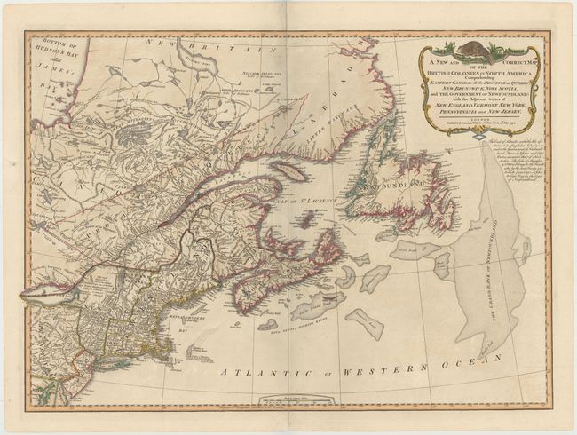
Auction 146, Lot 129
Subject: Eastern United States & Canada
Laurie & Whittle
A New and Correct Map of the British Colonies in North America Comprehending Eastern Canada with the Province of Quebec, New Brunswick, Nova Scotia, ... Newfoundland: with the Adjacent States of New England, Vermont, New York, Pennsylvania and New Jersey, 1794
Size: 25.8 x 18.5 inches (65.5 x 47 cm)
Estimate: $600 - $750
Unsold
Closed on 9/4/2013
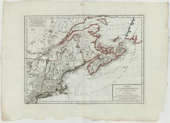
Auction 146, Lot 130
Subject: Eastern United States & Canada
Tardieu, Pierre Francois
Carte de la Partie Septentrionale des Etats Unis, comprenant le Canada, La Nouvelle Ecosse, New Hampshire, Massachuset's Bay, Rhode-Island, Connecticut, New-Yorck, Etat de Vermont avec partie de Pensilvanie et de New-Jersey, 1797
Size: 16.8 x 12.5 inches (42.7 x 31.8 cm)
Estimate: $250 - $325
Sold for: $180
Closed on 9/4/2013
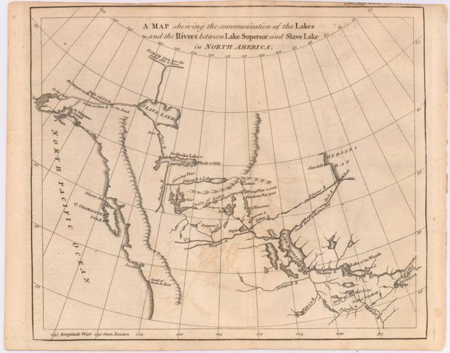
Auction 146, Lot 131
Subject: Western Canada & Alaska
Anon.
A Map Shewing the Communication of the Lakes and the Rivers Between Lake Superior and Slave Lake in North America, 1790
Size: 9.3 x 7.8 inches (23.6 x 19.8 cm)
Estimate: $275 - $350
Sold for: $150
Closed on 9/4/2013
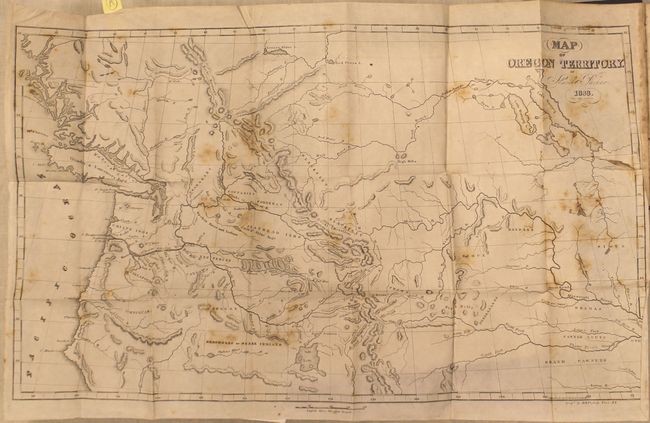
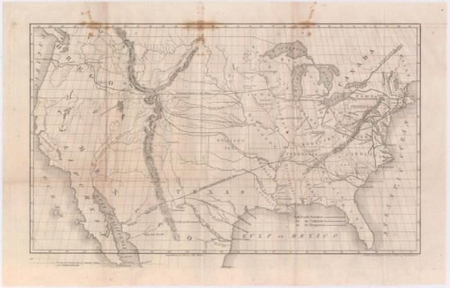
Auction 146, Lot 132
Subject: Western United States & Canada
Parker, Samuel (Rev.)
Journal of an Exploring Tour Beyond the Rocky Mountains … [with] Map of Oregon Territory, 1844
Size: 5 x 7.8 inches (12.7 x 19.8 cm)
Estimate: $700 - $850
Unsold
Closed on 9/4/2013
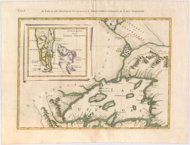
Auction 146, Lot 133
Subject: Great Lakes, Florida
Zatta, Antonio
Il Paese de Selvaggi Outauacesi e Kilistinesi Intorno al Lago Superiore, 1785
Size: 16.8 x 12.2 inches (42.7 x 31 cm)
Estimate: $400 - $475
Sold for: $300
Closed on 9/4/2013
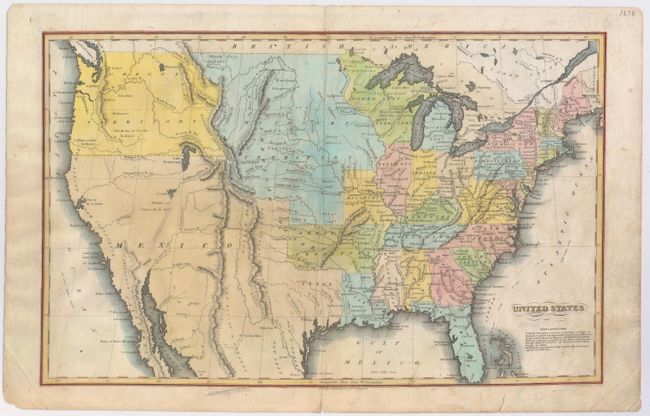
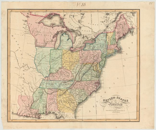
Auction 146, Lot 135
Subject: United States
Hammond, J.T.
United States, 1833
Size: 16.6 x 10.3 inches (42.2 x 26.2 cm)
Estimate: $90 - $120
Sold for: $110
Closed on 9/4/2013
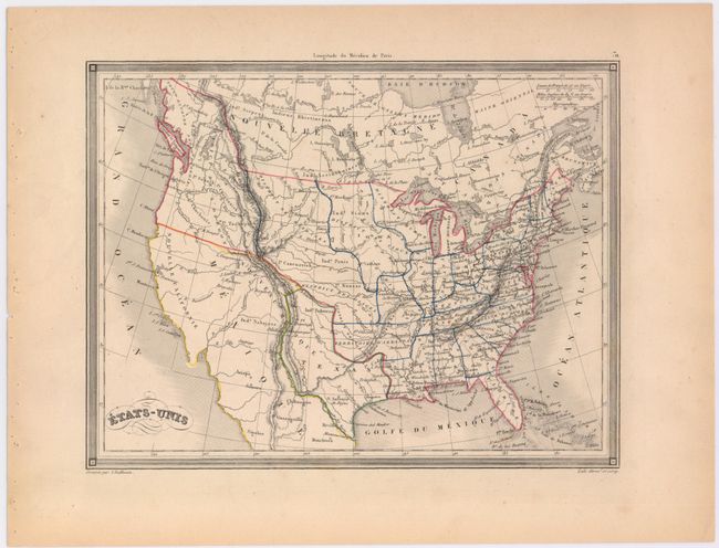
Auction 146, Lot 136
Subject: United States, Texas
Vuillemin, Alexander A.
Etats-Unis, 1843
Size: 10 x 7.5 inches (25.4 x 19.1 cm)
Estimate: $100 - $130
Sold for: $120
Closed on 9/4/2013
Auction 146, Lot 137
Subject: United States, Railroads
Throop, O. H.
[Untitled - Map of Proposed Routes of Western Railroads], 1848
Size: 16 x 9.5 inches (40.6 x 24.1 cm)
Estimate: $240 - $300
Sold for: $120
Closed on 9/4/2013
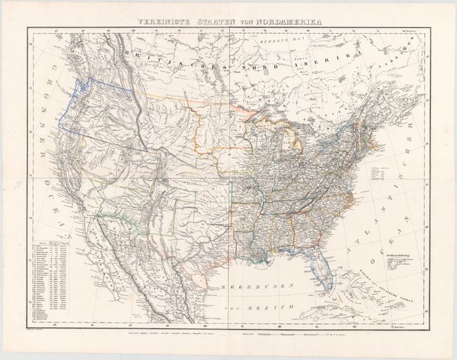
Auction 146, Lot 138
Subject: United States
Flemming, Carl
Vereinigte Staaten von Nordamerika, 1852
Size: 27 x 20.5 inches (68.6 x 52.1 cm)
Estimate: $300 - $400
Unsold
Closed on 9/4/2013
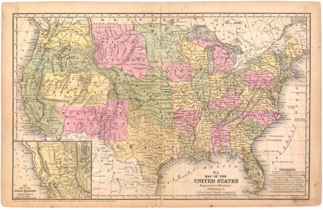
Auction 146, Lot 139
Subject: United States
Mitchell, Samuel Augustus
No. 5 Map of the United States Engraved to Illustrate Mitchell's School and Family Geography, 1852
Size: 16.7 x 10.5 inches (42.4 x 26.7 cm)
Estimate: $120 - $150
Sold for: $110
Closed on 9/4/2013
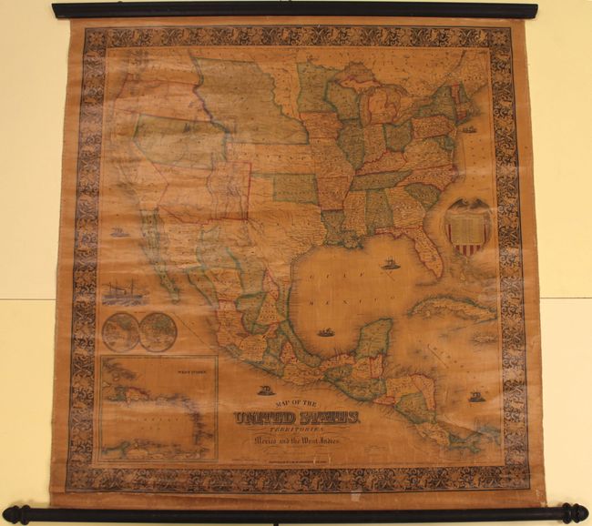
Auction 146, Lot 140
Subject: United States
Ensign, Bridgman & Fanning
Map of the United States, with Its Territories: Also Mexico and the West Indies, 1855
Size: 32.9 x 35 inches (83.6 x 88.9 cm)
Estimate: $1,700 - $2,000
Sold for: $1,500
Closed on 9/4/2013
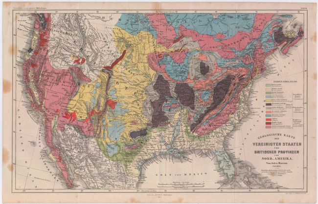
Auction 146, Lot 141
Subject: United States
Marcou, Jules
Geologische Karte der Vereinicten Staaten und Britischen Provinzen von Nord_Amerika, 1855
Size: 15 x 9.5 inches (38.1 x 24.1 cm)
Estimate: $350 - $450
Sold for: $200
Closed on 9/4/2013
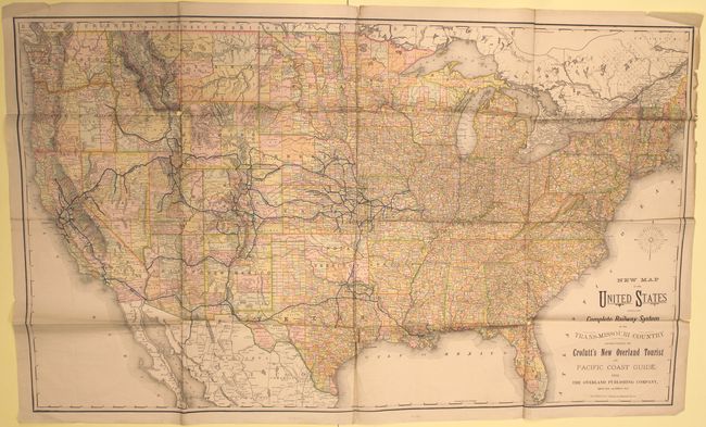
Auction 146, Lot 142
Subject: United States, Railroads
Crofutt, George A.
New Map of the United States Showing the Complete Railway System of the Trans-Missouri Country..., 1882
Size: 44.3 x 26.5 inches (112.5 x 67.3 cm)
Estimate: $140 - $170
Sold for: $100
Closed on 9/4/2013
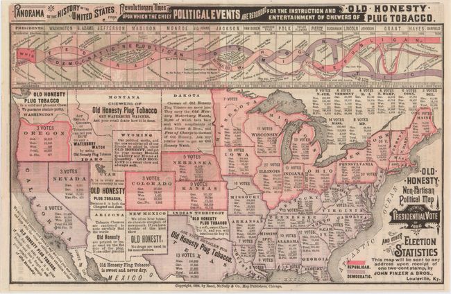
Auction 146, Lot 143
Subject: United States
Rand McNally & Co.
Old Honesty Non-Partisan Political Map Showing Presidential Vote of 1880 and Other Election Statistics, 1884
Size: 11.6 x 7.5 inches (29.5 x 19.1 cm)
Estimate: $350 - $450
Sold for: $300
Closed on 9/4/2013
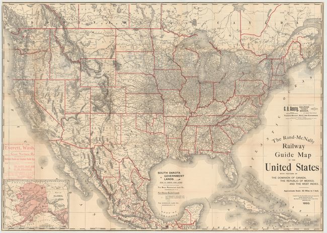
Auction 146, Lot 144
Subject: United States, Railroads
Rand McNally & Co.
The Rand-McNally Railway Guide Map of the United States with Portions of the Dominion of Canada, the Republic of Mexico, and the West Indies, 1893
Size: 42.5 x 30.5 inches (108 x 77.5 cm)
Estimate: $160 - $200
Unsold
Closed on 9/4/2013
Auction 146, Lot 145
Subject: United States
United States, 1896
Size: 21.8 x 15.3 inches (55.4 x 38.9 cm)
Estimate: $80 - $100
Sold for: $40
Closed on 9/4/2013
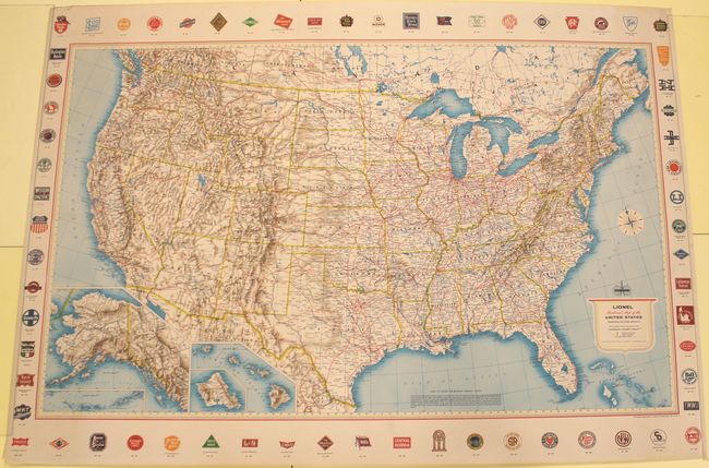
Auction 146, Lot 146
Subject: United States, Railroads
Rand McNally & Co.
Lionel Railroad Map of the United States, 1940
Size: 48 x 30.2 inches (121.9 x 76.7 cm)
Estimate: $140 - $170
Sold for: $100
Closed on 9/4/2013
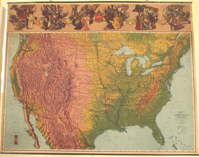
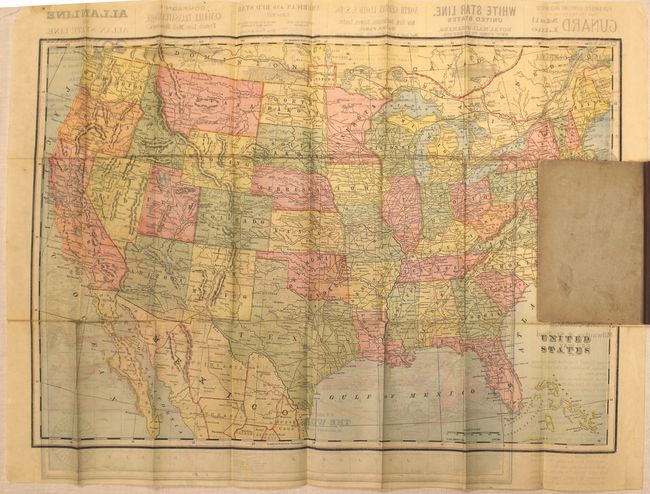
Auction 146, Lot 147
Subject: United States
Ohman's New Relief Map of the United States and Adjoining Portions of Canada and Mexico, 1945
Size: 35.2 x 28 inches (89.4 x 71.1 cm)
Estimate: $160 - $190
Map with Coca-Cola Advertisement
Unsold
Closed on 9/4/2013
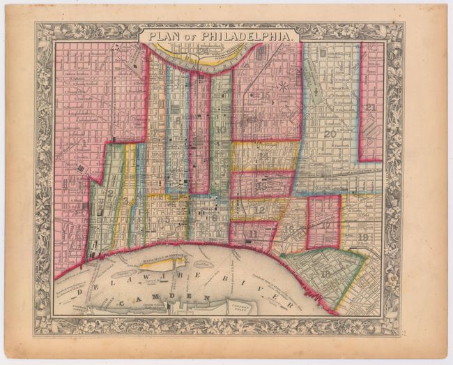
Auction 146, Lot 148
Subject: United States Cities
Mitchell, Samuel Augustus
[Lot of 4] Plan of Philadelphia [and] Plan of Baltimore [and] Plan of Cincinnati and Vicinity [and] St. Louis, 1860-74
Size: See Description
Estimate: $80 - $100
Sold for: $90
Closed on 9/4/2013
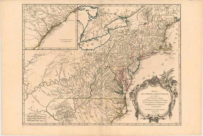
Auction 146, Lot 149
Subject: Colonial United States
Robert de Vaugondy, Didier
Partie de l'Amerique Septentrionale, qui Comprend le Cours de l'Ohio, la Nlle. Angleterre, la Nlle. York, le New Jersey, la Pensylvanie, le Maryland la Virginie, la Caroline, 1755
Size: 24.4 x 18.8 inches (62 x 47.8 cm)
Estimate: $900 - $1,100
Unsold
Closed on 9/4/2013
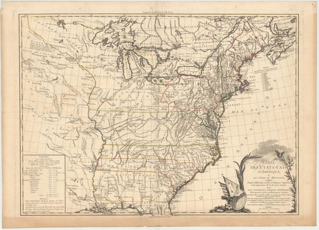
Auction 146, Lot 150
Subject: Eastern United States
Brion de la Tour, Louis
Carte des Etats-Unis d'Amerique et du Cours du Mississipi…, 1784
Size: 27.5 x 20 inches (69.9 x 50.8 cm)
Estimate: $3,000 - $3,750
One of the Earliest Maps of the New United States
Unsold
Closed on 9/4/2013
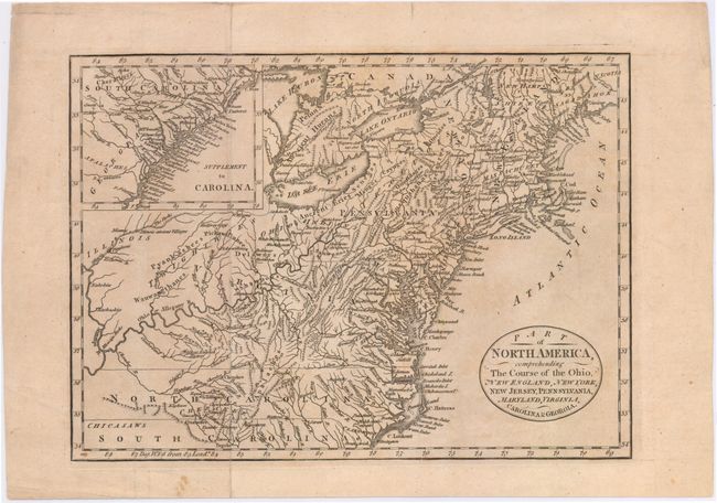
Auction 146, Lot 151
Subject: Eastern United States
Cary, John
Part of North America, Comprehending the Course of the Ohio, New England, New York, New Jersey, Pennsylvania, Maryland, Virginia, Carolina & Georgia, 1795
Size: 11.6 x 8.3 inches (29.5 x 21.1 cm)
Estimate: $350 - $450
Unsold
Closed on 9/4/2013
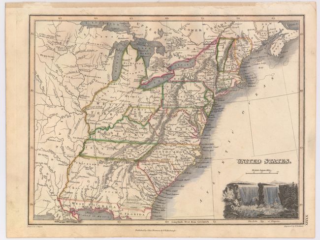
Auction 146, Lot 152
Subject: Eastern United States
Pinkerton, John
United States of America Northern Part, 1810
Size: 27.5 x 19.8 inches (69.9 x 50.3 cm)
Estimate: $250 - $325
Sold for: $150
Closed on 9/4/2013
Auction 146, Lot 153
Subject: Eastern United States
Lizars, William Home
United States of America, 1819
Size: 17.8 x 15.3 inches (45.2 x 38.9 cm)
Estimate: $250 - $325
Sold for: $300
Closed on 9/4/2013
Auction 146, Lot 154
Subject: Eastern United States
Wyld, James
United States, 1822
Size: 11.5 x 8.9 inches (29.2 x 22.6 cm)
Estimate: $400 - $500
Sold for: $300
Closed on 9/4/2013
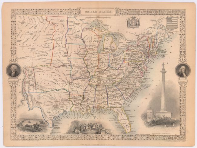
Auction 146, Lot 155
Subject: Eastern United States
Tallis, John
United States, 1851
Size: 13 x 9.5 inches (33 x 24.1 cm)
Estimate: $250 - $350
Sold for: $230
Closed on 9/4/2013
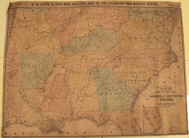
Auction 146, Lot 156
Subject: Eastern United States, Civil War
Lloyd, H. H.
Lloyd's New Military Map of the Border & Southern States, 1861
Size: 41 x 29.8 inches (104.1 x 75.7 cm)
Estimate: $500 - $650
Sold for: $375
Closed on 9/4/2013
Auction 146, Lot 157
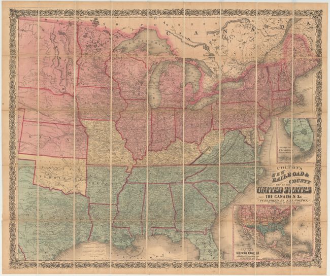
Subject: Eastern United States
Colton, Joseph Hutchins
Colton's New Railroad & County Map of the United States, 1862
Size: 39.5 x 33 inches (100.3 x 83.8 cm)
Estimate: $1,100 - $1,300
Rare Colton Civil War Map for a British Audience
Sold for: $700
Closed on 9/4/2013
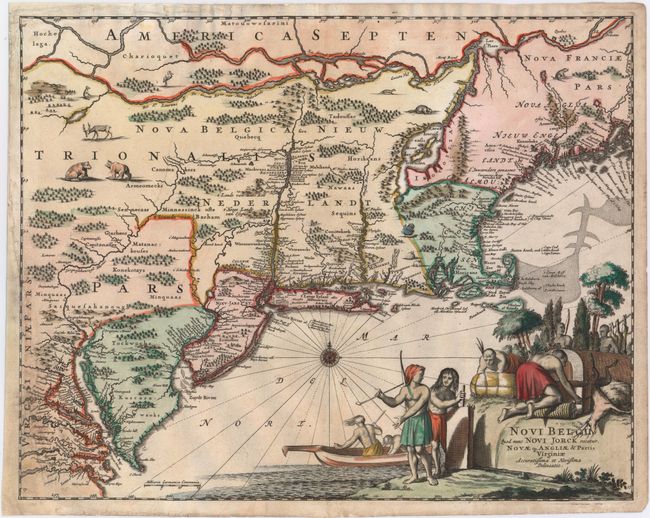
Auction 146, Lot 158
Subject: Colonial New England & Mid-Atlantic
Montanus, Arnoldus
Novi Belgii, quod nunc Novi Jorck Vocatur, Novae qz. Angliae & Partis Virginiae Accuratissima et Novissima Delineatio, 1671
Size: 14.6 x 11.5 inches (37.1 x 29.2 cm)
Estimate: $1,000 - $130
Sold for: $550
Closed on 9/4/2013
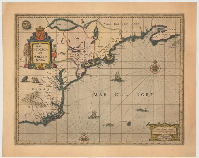
Auction 146, Lot 159
Subject: Colonial New England & Mid-Atlantic United States
Jansson/Valck & Schenk
Nova Belgica et Anglia Nova, 1694
Size: 19.5 x 15 inches (49.5 x 38.1 cm)
Estimate: $2,100 - $2,400
Jansson's Influential Map of the East Coast
Unsold
Closed on 9/4/2013
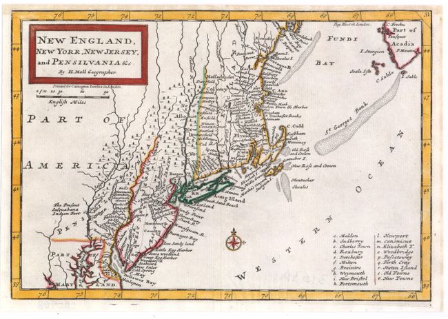
Auction 146, Lot 160
Subject: Colonial New England & Mid-Atlantic
Moll, Herman
New England, New York, New Jersey, and Pensilvania &c., 1708
Size: 10 x 7 inches (25.4 x 17.8 cm)
Estimate: $400 - $475
Sold for: $375
Closed on 9/4/2013
Auction 146, Lot 161
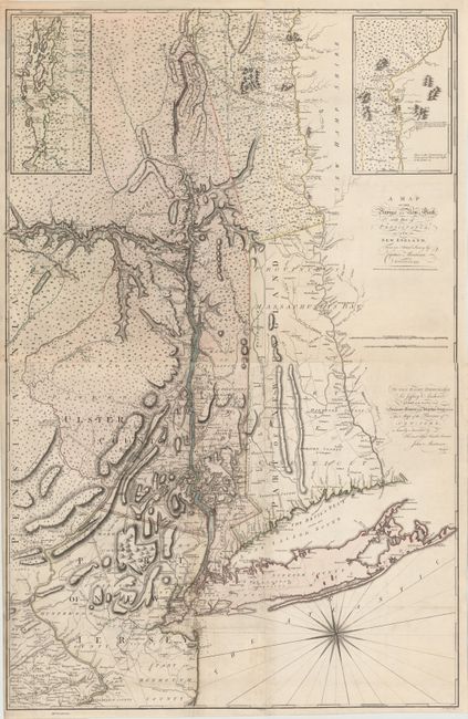
Subject: Colonial New England & Mid-Atlantic
Montresor, John
[On 2 Sheets] A Map of the Province of New York, with Part of Pensilvania, and New England..., 1775
Size: 36.2 x 28.5 inches (91.9 x 72.4 cm)
Estimate: $9,000 - $11,000
An Important Revolutionary War Period Map
Sold for: $5,500
Closed on 9/4/2013
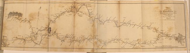
Auction 146, Lot 162
Subject: New England, Railroads
Report of the Board of Directors of Internal Improvements of the State of Massachusetts on the Practicability and Expediency of a Rail-Road from Boston to the Hudson River..., 1829
Size: 5.7 x 9.1 inches (14.5 x 23.1 cm)
Estimate: $800 - $1,000
Sold for: $500
Closed on 9/4/2013
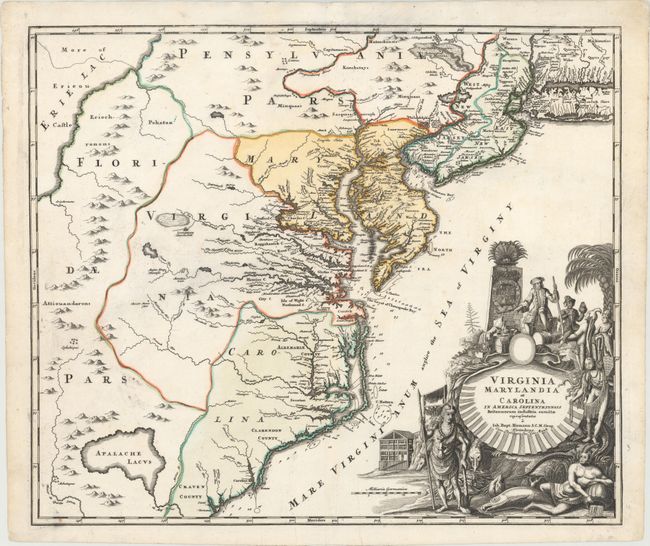
Auction 146, Lot 163
Subject: Colonial Mid-Atlantic
Homann, Johann Baptist
Virginia Marylandia et Carolina in America Septentrionali Britannorum Industria Excultae, 1730
Size: 22.8 x 19.2 inches (57.9 x 48.8 cm)
Estimate: $1,800 - $2,200
Sold for: $1,400
Closed on 9/4/2013
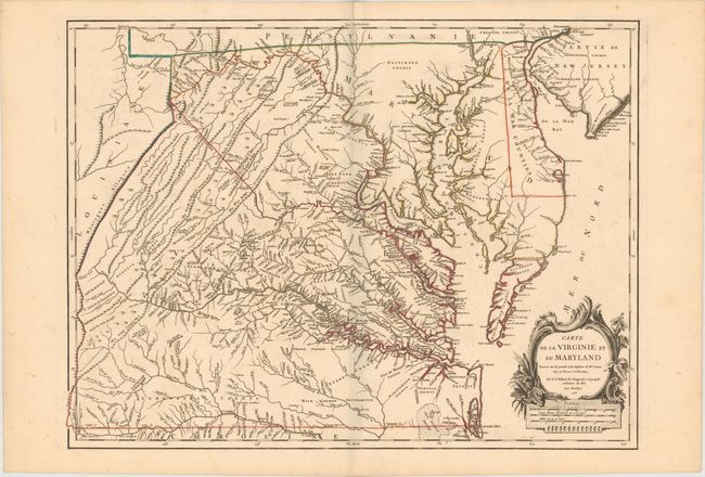
Auction 146, Lot 164
Subject: Colonial Mid-Atlantic United States, Virginia & Maryland
Robert de Vaugondy, Didier
Carte de la Virginie et du Maryland Dressee sur la Grande Carte Angloise de Mrs. Josue Fry et Pierre Jefferson, 1755
Size: 25.2 x 19.1 inches (64 x 48.5 cm)
Estimate: $3,250 - $4,000
An Essential Map of Virginia and Maryland
Sold for: $2,750
Closed on 9/4/2013
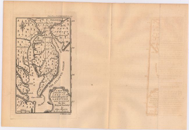
Auction 146, Lot 165
Subject: Colonial Mid-Atlantic United States
Mynde, James
A Map of That Part of America Where a Degree of Latitude Was Measured for the Royal Society by Cha: Mason & Jere: Dixon, 1769
Size: 3.9 x 6.6 inches (9.9 x 16.8 cm)
Estimate: $500 - $650
Rare First Issue of the Mason-Dixon Survey
Sold for: $850
Closed on 9/4/2013
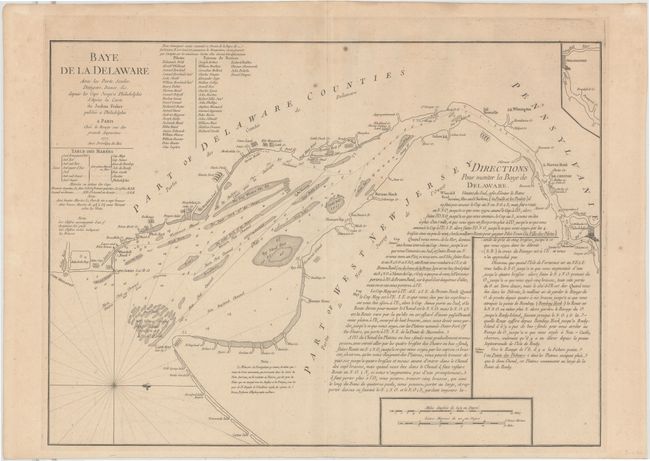
Auction 146, Lot 166
Subject: Colonial Mid-Atlantic, Delaware Bay
Le Rouge, George Louis
Baye de la Delaware avec les Ports, Sondes, Dangers, Bancs &c. depuis les Caps Jusqu'a Philadelphie…, 1777
Size: 25.8 x 19 inches (65.5 x 48.3 cm)
Estimate: $1,800 - $2,200
The Most Accurate Chart of Delaware Bay in the 18th Century
Unsold
Closed on 9/4/2013
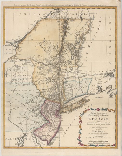
Auction 146, Lot 167
Subject: Colonial Mid-Atlantic
Homann Heirs
Mappa Geographica Provinciae novae Eboraci ab Anglis New-York …Nova Jersey…, 1778
Size: 22.4 x 27.8 inches (56.9 x 70.6 cm)
Estimate: $1,200 - $1,500
Unsold
Closed on 9/4/2013
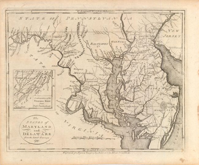
Auction 146, Lot 168
Subject: Maryland, Delaware
Payne, John
The States of Maryland and Delaware from the Latest Surveys, 1799
Size: 9.3 x 7.3 inches (23.6 x 18.5 cm)
Estimate: $180 - $230
Sold for: $210
Closed on 9/4/2013
Auction 146, Lot 169
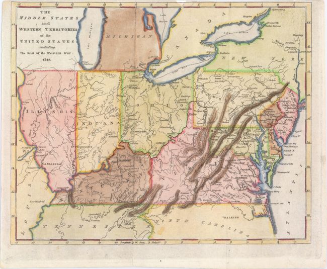
Subject: Mid-Atlantic & Central
Carey, Mathew
The Middle States and Western Territories of the United States Including the Seat of the Western War, 1812
Size: 9.6 x 7.8 inches (24.4 x 19.8 cm)
Estimate: $250 - $350
Sold for: $300
Closed on 9/4/2013
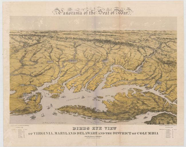
Auction 146, Lot 170
Subject: Mid-Atlantic, Civil War
Bachmann, John
Panorama of the Seat of War, Birds Eye View of Virginia, Maryland, Delaware, and the District of Columbia, 1861
Size: 27.8 x 18 inches (70.6 x 45.7 cm)
Estimate: $2,000 - $2,300
Sold for: $1,900
Closed on 9/4/2013
161 lots
Page 1 of 4