Catalog Archive
Auction 146, Lot 156

"Lloyd's New Military Map of the Border & Southern States", Lloyd, H. H.

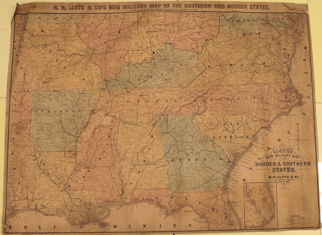
Subject: Eastern United States, Civil War

Period: 1861 (dated)

Publication:

Color: Hand Color

Size:
41 x 29.8 inches
104.1 x 75.7 cm
Download High Resolution Image
(or just click on image to launch the Zoom viewer)

This large format Civil War map of the southern United States covers the area from Pennsylvania to Florida and from Virginia to the Kansas Territory. Railroads, roads, canals and numerous towns and villages are depicted in good detail. Battle areas are highlighted in red dots and lines. Backed in heavy linen. The verso of the map shows the signature of "Dahlgren 1st Div."

References: Stephenson #12.5.

Condition: C+

The map is toned with several damp stains, small spots, and pencil notations in the image. There are small chips and tears along the sheet edges.

Estimate: $500 - $650

Sold for: $375

Closed on 9/4/2013

Archived