Catalog Archive
Auction 146, Lot 127

"A New Map of the States of Pensylvania New Jersey New York Connecticut Rhode Island Massachusets and New Hampshire Including Nova Scotia and Canada...", Gordon, William

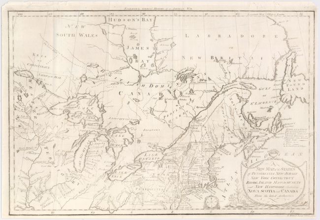
Subject: Eastern United States & Canada

Period: 1789 (published)

Publication: History of the American War

Color: Black & White

Size:
16 x 10.6 inches
40.6 x 26.9 cm
Download High Resolution Image
(or just click on image to launch the Zoom viewer)

An attractive and delicately engraved map showing the northeastern United States, the Great Lakes area, and much of eastern Canada. This map appeared in the first American edition of Gordon's renowned history of the American War. A key at the right side of the map provides symbols for boundaries, towns, forts, and Indian villages. Decorative rococo-style title cartouche and another smaller one containing a compass rose. An early American-produced map engraved by C. Tiebout in New York City.

References: McCorkle 789.9; Sellers and Van Ee 197; Kershaw II: 258.

Condition: B

Issued folding with light soiling and a couple of chips on the sheet's edge, away from image. The impression is slightly uneven and very light in a few areas.

Estimate: $240 - $300

Unsold

Closed on 9/4/2013

Archived