Catalog Archive
Auction 146, Lot 142

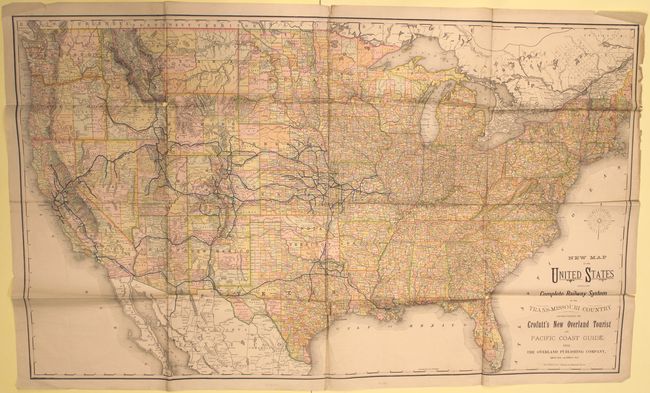
"New Map of the United States Showing the Complete Railway System of the Trans-Missouri Country...", Crofutt, George A.

Subject: United States, Railroads

Period: 1882 (dated)

Publication:

Color: Printed Color

Size:
44.3 x 26.5 inches
112.5 x 67.3 cm
Download High Resolution Image
(or just click on image to launch the Zoom viewer)

This large map of the United States shows the rail system from St. Louis to points west including Denver, Los Angeles and San Francisco. Printed on thin newspaper-like material, the detailed map shows county boundaries, cities and towns, rivers, as well as the railroads east of the Mississippi. Produced by Rand-McNally and published in Crofutt's tourist guide.

References:

Condition: B

Issued folding with a number of splits at fold intersections resulting in minor loss of image with a few edge chips and tears confined to the blank margins.

Estimate: $140 - $170

Sold for: $100

Closed on 9/4/2013

Archived