Subject: Colonial United States & Canada
Period: 1763 (dated)
Publication: London Magazine
Color: Hand Color
Size:
14.75 x 10.9 inches
37.5 x 27.7 cm
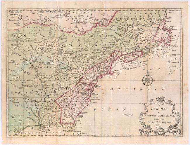
A fine map noting the colonial possessions in North America eastward from Texas to the Atlantic coast. It shows early settlements, forts, Indian villages and tribal territory. The colonies have boundaries extending past the map's western border. Various treaty and charter boundaries are shown. Earl Granville's Property stretches from the Atlantic west to beyond the Mississippi River. In Florida, a line from Fort St. George to St. Mark delineates the Limits Stipulated in 1738 and below, nearly to Cape Canaveral, are the Bounds of Carolina by Charter of 1665. The fishing banks off Canada are prominently outlined. The map is enhanced by a delicate title cartouche and fancy compass rose. This is the second state, published in the February 1763 edition of the London Magazine.
References: Jolly #222; McCorkle #761-3; Sellers & Van Ee #89.
Condition: B
Issued folding and now flattened on watermarked paper with a few small fold separations and spots in the image. A binding trim at bottom left has been replaced with old paper, and an associated 4" binding tear has been repaired on verso with old paper.