Subject: Colonial United States & Canada
Period: 1762 (dated)
Publication: Gentleman's Magazine
Color: Hand Color
Size:
9.7 x 8.3 inches
24.6 x 21.1 cm
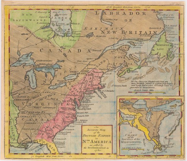
Covering from Labrador to Florida and west to the Mississippi, this important, historical map details the land settlement that ended the French & Indian War. The map graphically depicts "The Countries shaded with lines are those formerly claimed or possessed by France and Spain and are now absolutely ceded & guaranteed to Great Britain." This long and complex war resulted in Britain gaining New France, the eastern Mississippi basin and Florida. Spain gained New Orleans and retained its Caribbean islands. France also retained its Caribbean islands and Havana. The preliminary treaty illustrated by this map was ratified the following year in the Treaty of Paris. The colonies of Virginia and Carolina are now shown with their western boundaries to the Mississippi River. The Six Nations' boundary extends west to occupy the Great Lakes region. A large inset "Chart of the Entrance of the Mississippi" provides a detailed view of the delta region and the vicinity of New Orleans.
References: Jolly #GENT-165; McCorkle #762.1; Seller & Van Ee #92.
Condition: B+
Issued folding on watermarked paper with some hinge tape running along the right edge on verso. Trimmed close to neatline at bottom and right.