Subject: Colonial Mid-Atlantic
Period: 1778 (dated)
Publication:
Color: Hand Color
Size:
22.4 x 27.8 inches
56.9 x 70.6 cm
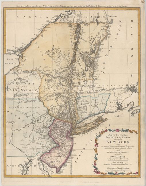
Handsome Revolutionary War period map of the region between Delaware Bay and Boston Harbor, north to include Montreal and west to the Finger Lakes district in New York. Based on the survey of the region by Claude Sauthier compiled between 1771 and 1774, the map provides excellent information including topographical detail, towns, forts, churches, roads, ferries, mills, and taverns. It shows Dartmouth College and the settlements along the northern part of the Connecticut River. The disputed lines of partition between New York and New Jersey are shown, as are boundaries of Pennsylvania with the Six Nations and other early boundaries. Printed on two sheets, joined as issued.
References: McCorkle #778.19; Sellers & Van Ee #1049.
Condition: B+
A fine impression on watermarked paper with attractive color, a couple of small manuscript notations, and minor soiling. A horizontal crease above title cartouche has been pressed, with professional repairs to a few short tears along the crease.