Filtered by Category:United States(Show All Categories)
Showing results for:Auction 108
Catalog Archive
122 lots
Page 1 of 3
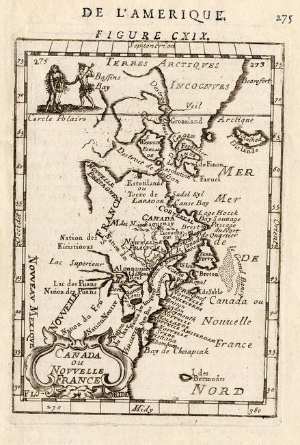
Auction 108, Lot 110
Subject: Colonial Canada and New England
Mallet, Alain Manesson
Canada ou Nouvelle France, 1683
Size: 4 x 5.5 inches (10.2 x 14 cm)
Estimate: $180 - $230
Sold for: $170
Closed on 9/29/2004
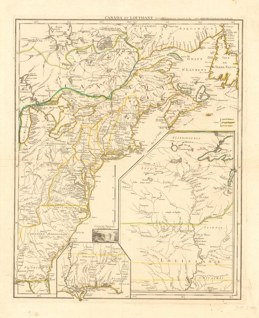
Auction 108, Lot 112
Subject: Colonial North America
Le Rouge, George Louis
Canada et Louisiane…, 1755
Size: 19.5 x 24 inches (49.5 x 61 cm)
Estimate: $2,200 - $2,500
Sold for: $2,300
Closed on 9/29/2004
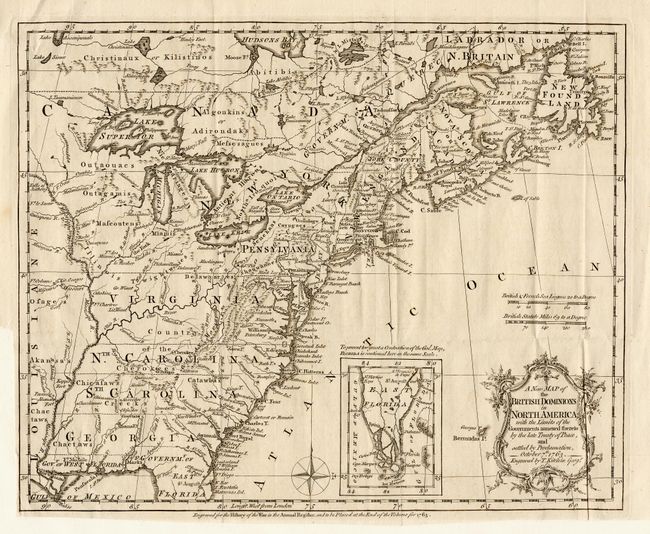
Auction 108, Lot 113
Subject: Colonial United States and Canada
Kitchin, Thomas
A New Map of the British Dominions in North America; with the Limits of the Governments Annexed thereto by the Late Treaty of Peace, and Settled by Proclamation, October 7th, 1763, 1763
Size: 11.7 x 9.5 inches (29.7 x 24.1 cm)
Estimate: $200 - $250
Sold for: $800
Closed on 9/29/2004
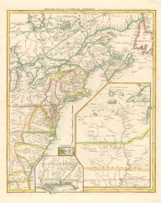
Auction 108, Lot 114
Subject: Colonial United States and Canada
Le Rouge, George Louis
Theatre de la Guerre en Amerique, 1777
Size: 19.8 x 24.3 inches (50.3 x 61.7 cm)
Estimate: $1,500 - $1,700
Sold for: $2,750
Closed on 9/29/2004
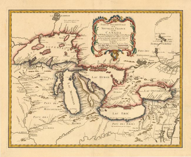
Auction 108, Lot 116
Subject: Colonial Great Lakes
Bellin/Homann Heirs
Partie Occidentale de la Nouvelle France ou du Canada, 1755
Size: 21.2 x 16.8 inches (53.8 x 42.7 cm)
Estimate: $1,600 - $1,800
Sold for: $1,700
Closed on 9/29/2004
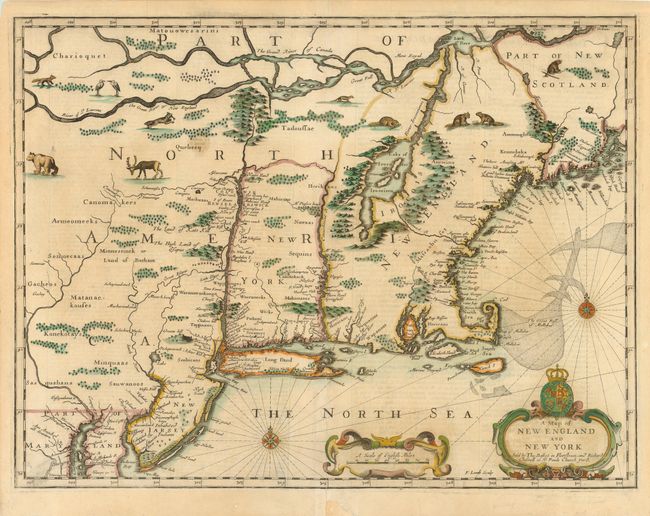
Auction 108, Lot 117
Subject: Colonial New England
Speed/Lamb
A Map of New England and New York, 1676
Size: 19.7 x 15 inches (50 x 38.1 cm)
Estimate: $5,500 - $6,500
Sold for: $8,000
Closed on 9/29/2004
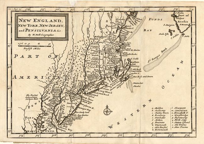
Auction 108, Lot 118
Subject: Colonial New England
Moll, Herman
New England, New York, New Jersey, and Pensilvania &c., 1708
Size: 10.2 x 7 inches (25.9 x 17.8 cm)
Estimate: $375 - $425
Sold for: $550
Closed on 9/29/2004
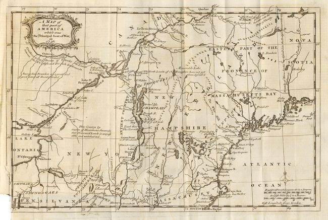
Auction 108, Lot 119
Subject: Colonial New England
Anon.
A Map of that part of America which was the Principal Seat of War in 1756, 1757
Size: 13 x 8.5 inches (33 x 21.6 cm)
Estimate: $400 - $500
Sold for: $400
Closed on 9/29/2004
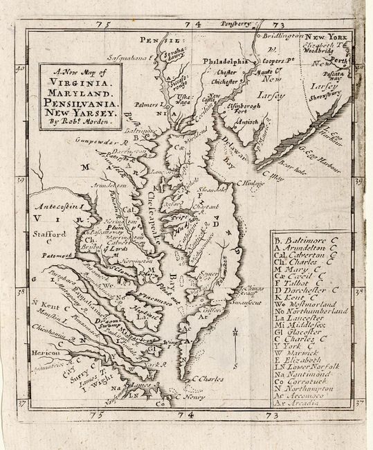
Auction 108, Lot 120
Subject: Colonial Mid Atlantic
Morden, Robert
A New Map of Virginia. Maryland. Pensilvania. New Yarsey, 1687
Size: 4.2 x 4.7 inches (10.7 x 11.9 cm)
Estimate: $300 - $350
Sold for: $300
Closed on 9/29/2004
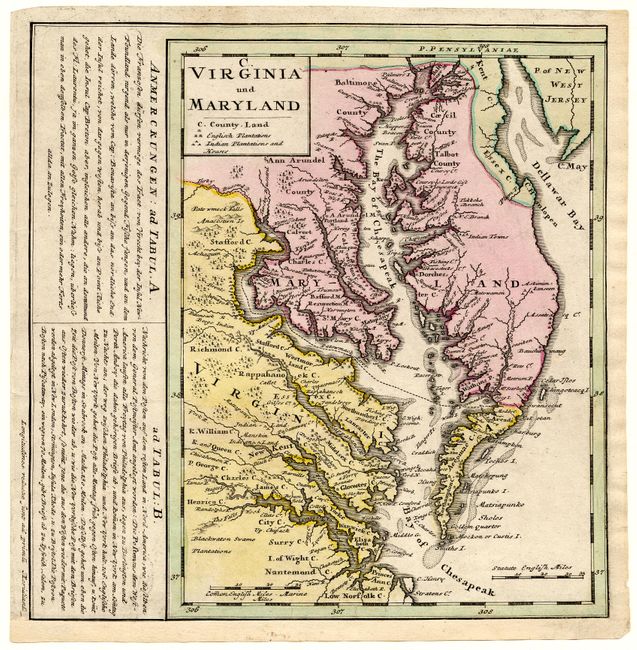
Auction 108, Lot 121
Subject: Colonial Mid Atlantic
Homann Heirs
C. Virginia und Maryland, 1765
Size: 7.8 x 10.2 inches (19.8 x 25.9 cm)
Estimate: $550 - $650
Unsold
Closed on 9/29/2004
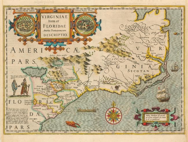
Auction 108, Lot 122
Subject: Colonial Southeast
Hondius, Jodocus
Virginiae Item et Floridae Americae Provinciarum, nova Descriptio, 1634
Size: 19 x 13.5 inches (48.3 x 34.3 cm)
Estimate: $3,000 - $3,500
Sold for: $2,300
Closed on 9/29/2004
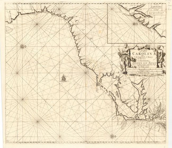
Auction 108, Lot 123
Subject: Colonial Southeast
Keulen, Johannes van
Pas Kaart Van de Kust van Carolina Tusschen C de Canaveral en C Henry…, 1702
Size: 22.8 x 20.5 inches (57.9 x 52.1 cm)
Estimate: $2,500 - $3,000
Sold for: $1,900
Closed on 9/29/2004
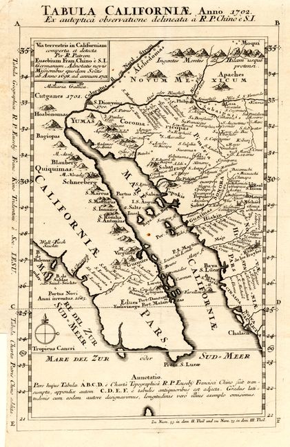
Auction 108, Lot 124
Subject: Colonial California and Mexico
Kino, Eusebio Francisco, SJ
Tabula Californiae Anno 1702 Ex autoptica observatione delineata a R.P. Chino e S.I., 1702
Size: 8.7 x 13.5 inches (22.1 x 34.3 cm)
Estimate: $2,000 - $2,500
Sold for: $1,900
Closed on 9/29/2004
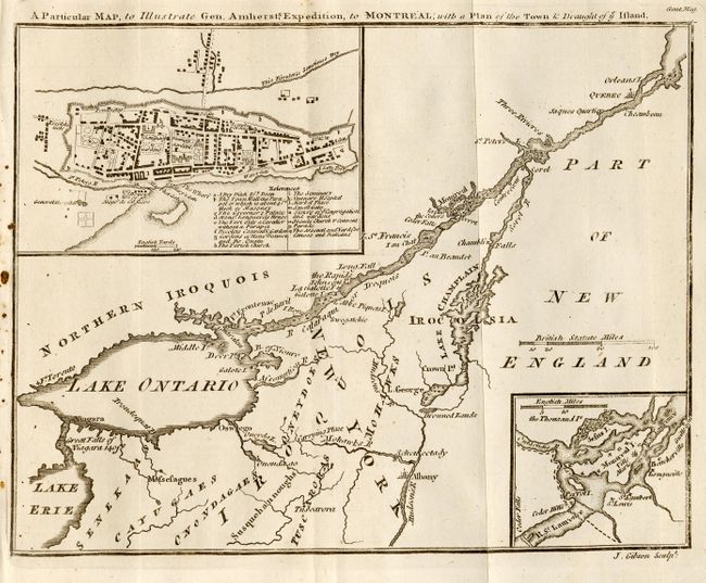
Auction 108, Lot 127
Subject: Canada
Gibson, John
A Particular Map, to Illustrate Gen. Amherst's Expedition, to Montreal; with a plan of the Town & Draught of ye Island, 1760
Size: 9 x 7 inches (22.9 x 17.8 cm)
Estimate: $180 - $200
Sold for: $150
Closed on 9/29/2004
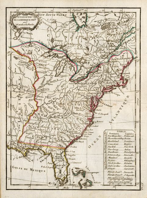
Auction 108, Lot 131
Subject: Canada and United States
Lattre, Jean
Etats-Unis de l'Amerique Seple. avec le Canada et la Floride, 1787
Size: 7.2 x 9.8 inches (18.3 x 24.9 cm)
Estimate: $200 - $240
Sold for: $170
Closed on 9/29/2004
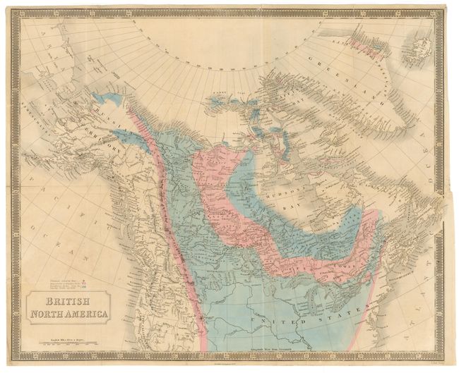
Auction 108, Lot 132
Subject: Canada and United States
Hall, Sidney
British North America, 1850
Size: 20.2 x 16.2 inches (51.3 x 41.1 cm)
Estimate: $250 - $300
Sold for: $190
Closed on 9/29/2004
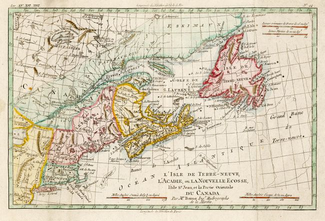
Auction 108, Lot 133
Subject: Canada & New England
Bonne, Rigobert
L'Isle de Terre-Neuve, L'Acadie, ou la Nouvelle Ecosse, l'Isle St Jean et la Partie Orientale du Canada, 1783
Size: 12.5 x 8.2 inches (31.8 x 20.8 cm)
Estimate: $250 - $300
Sold for: $230
Closed on 9/29/2004
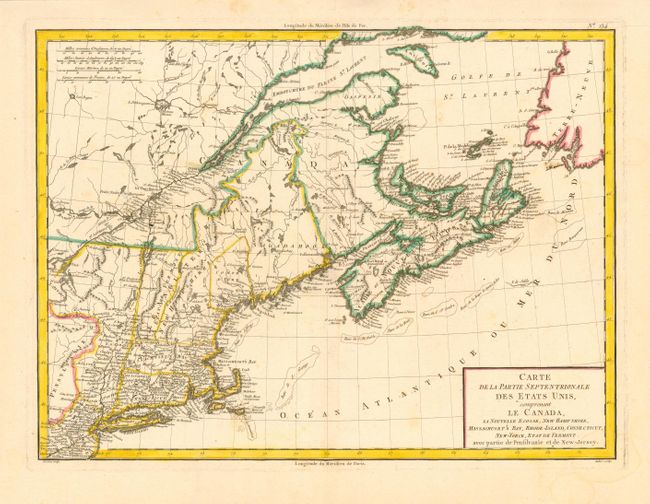
Auction 108, Lot 134
Subject: Canada & United States
Tardieu
Carte de la Partie Septentrionale des Etats Unis, comprenant le Canada, La Nouvelle Ecosse, New Hampshire, Massachuset's Bay, Rhode-Island, Connecticut, New-Yorck, Etat de Vermont avec partie de Pensilvanie et de New-Jersey, 1797
Size: 16.7 x 12.5 inches (42.4 x 31.8 cm)
Estimate: $300 - $350
Sold for: $300
Closed on 9/29/2004
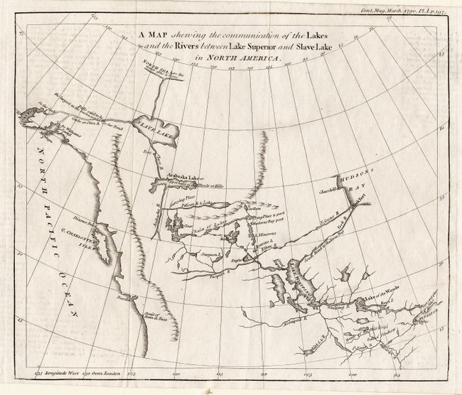
Auction 108, Lot 135
Subject: Canada and Alaska
Anon.
A Map Shewing the Communication of the Lakes and the Rivers between Lake Superior and Slave Lake in North America, 1790
Size: 9.2 x 8.7 inches (23.4 x 22.1 cm)
Estimate: $220 - $275
Sold for: $275
Closed on 9/29/2004

Auction 108, Lot 136
Subject: Western Canada and United States
Colton, G.W. & C.B.
Map of the Country from Lake Superior to the Pacific Ocean. From the latest Explorations and Surveys to accompany the Report of Edwin F. Johnson Chf. Engr. Northern Pacific R.R., 1867
Size: 45 x 21.8 inches (114.3 x 55.4 cm)
Estimate: $600 - $700
Sold for: $400
Closed on 9/29/2004
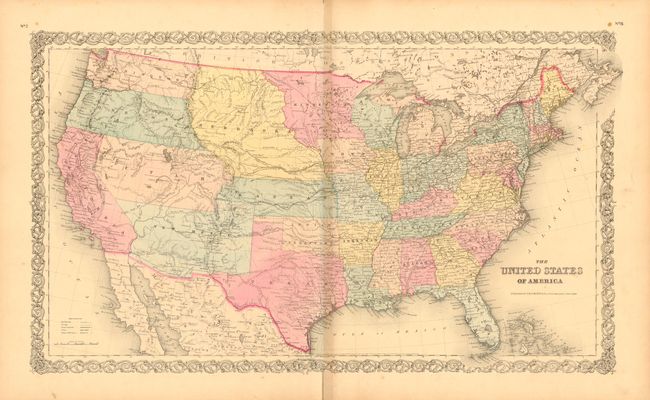
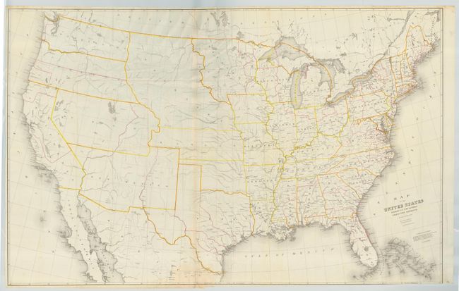
Auction 108, Lot 137
Subject: United States
Colton, Joseph Hutchins
The United States of America, 1855
Size: 26 x 15.2 inches (66 x 38.6 cm)
Estimate: $275 - $350
Sold for: $300
Closed on 9/29/2004
Auction 108, Lot 138
Subject: United States
Burr, David H.
Map of the United States Exhibiting the Several Collection Districts, 1856
Size: 48.5 x 38.5 inches (123.2 x 97.8 cm)
Estimate: $250 - $350
Sold for: $300
Closed on 9/29/2004
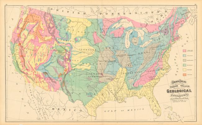
Auction 108, Lot 139
Subject: United States
Gray, O. W.
Gray's Atlas Map of the United States Showing the principal Geological Formations, 1874
Size: 26 x 16 inches (66 x 40.6 cm)
Estimate: $90 - $120
Sold for: $80
Closed on 9/29/2004
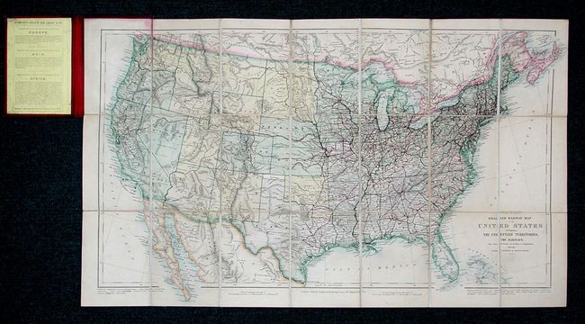
Auction 108, Lot 140
Subject: United States
Stanford, Edward
Stanford's Smaller Railway Map of the United States Distinguishing the Unsettled Territories; The Railways; The Cities and Towns According to Population; Also the State Capitals, & County Towns, 1875
Size: 28.5 x 16 inches (72.4 x 40.6 cm)
Estimate: $450 - $500
Unsold
Closed on 9/29/2004
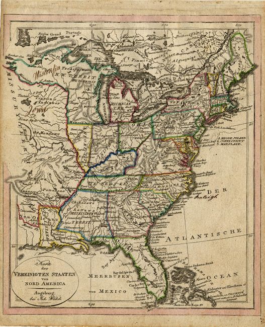
Auction 108, Lot 141
Subject: United States - Eastern
Walch, Johannes
Karte der Vereinigten Staaten von Nord America, 1820
Size: 8 x 9.2 inches (20.3 x 23.4 cm)
Estimate: $275 - $325
Sold for: $200
Closed on 9/29/2004
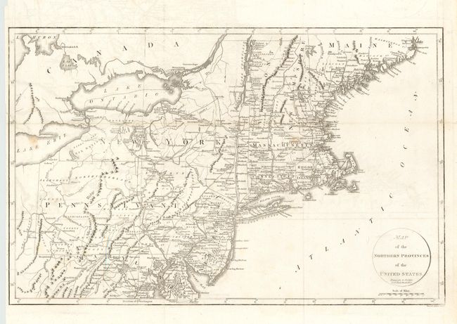
Auction 108, Lot 142
Subject: United States - Northeast
Russell, John C., Jr.
Map of the Northern Provinces of the United States, 1799
Size: 20 x 12.7 inches (50.8 x 32.3 cm)
Estimate: $180 - $220
Sold for: $190
Closed on 9/29/2004
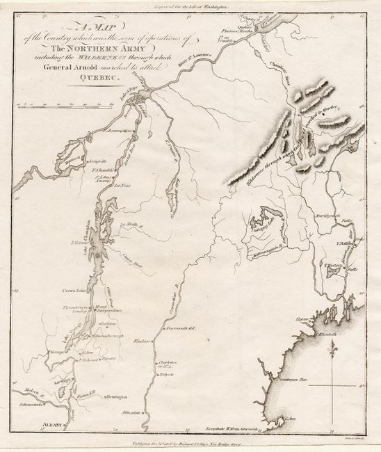
Auction 108, Lot 143
Subject: New England
Phillips, Richard (Sir)
A Map of the Country which was the scene of operations of The Northern Army; including the Wilderness through which General Arnold marched to attack Quebec, 1806
Size: 8.5 x 10 inches (21.6 x 25.4 cm)
Estimate: $100 - $140
Sold for: $120
Closed on 9/29/2004
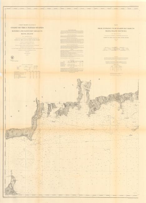
Auction 108, Lot 144
Subject: United States - Northeast
U.S. Coast Survey
[Lot of 3 - Nantucket and Martha's Vineyard], 1874
Size: 28.5 x 37.5 inches (72.4 x 95.3 cm)
Estimate: $450 - $500
Sold for: $475
Closed on 9/29/2004
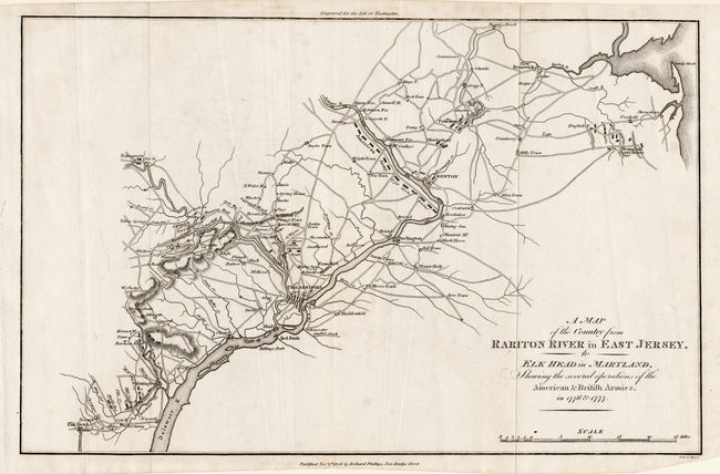
Auction 108, Lot 145
Subject: United States - Mid-Atlantic
Phillips, Richard (Sir)
A Map of the Country from Rariton River in East Jersey, to Elk Head in Maryland, Shewing the several operations of the American & British Armies, in 1776 & 1777, 1806
Size: 15.1 x 9.7 inches (38.4 x 24.6 cm)
Estimate: $120 - $140
Sold for: $90
Closed on 9/29/2004
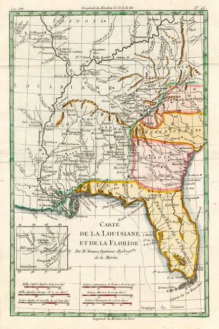
Auction 108, Lot 146
Subject: United States - Southern
Bonne, Rigobert
Carte de la Louisiane, et de la Floride, 1783
Size: 8.2 x 12.5 inches (20.8 x 31.8 cm)
Estimate: $275 - $375
Sold for: $170
Closed on 9/29/2004
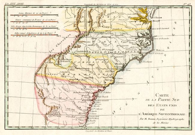
Auction 108, Lot 147
Subject: United States - Southeastern
Bonne, Rigobert
Carte de la Partie Sud des Etats Unis de l'Amerique Septentrionale, 1783
Size: 12.5 x 8.2 inches (31.8 x 20.8 cm)
Estimate: $150 - $200
Sold for: $120
Closed on 9/29/2004
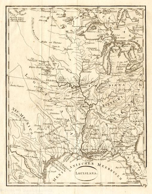
Auction 108, Lot 148
Subject: United States - Central
Ehrmann, Theodor Friedrich
Louisiana, 1804
Size: 6.6 x 8.5 inches (16.8 x 21.6 cm)
Estimate: $200 - $240
Sold for: $150
Closed on 9/29/2004
Auction 108, Lot 149
Subject: United States - Central
U.S. Government
[Indiana & Kentucky], 1833
Size: 20 x 17 inches (50.8 x 43.2 cm)
Estimate: $80 - $100
Sold for: $60
Closed on 9/29/2004
Auction 108, Lot 150
Subject: United States - Central
Lee, Robert E.
[Lot of 3 - Mississippi River], 1837
Size: See Description
Estimate: $200 - $300
Sold for: $180
Closed on 9/29/2004
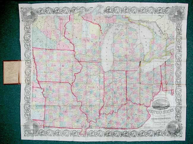
Auction 108, Lot 151
Subject: United States - Central
Colton, Joseph Hutchins
Colton's Railroad & Township Map of the Western States compiled from the United States Surveys, 1855
Size: 41 x 33.5 inches (104.1 x 85.1 cm)
Estimate: $700 - $800
Sold for: $500
Closed on 9/29/2004
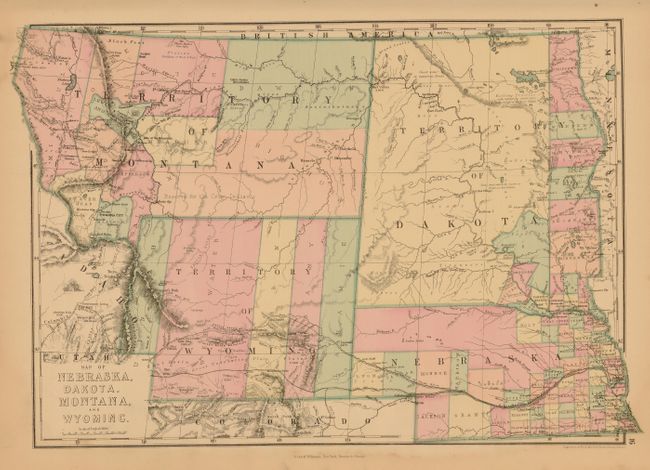
Auction 108, Lot 152
Subject: United States - Central
Williams, J. David
Map of Nebraska, Dakota, Montana, and Wyoming, 1877
Size: 18 x 12.2 inches (45.7 x 31 cm)
Estimate: $120 - $160
Sold for: $130
Closed on 9/29/2004
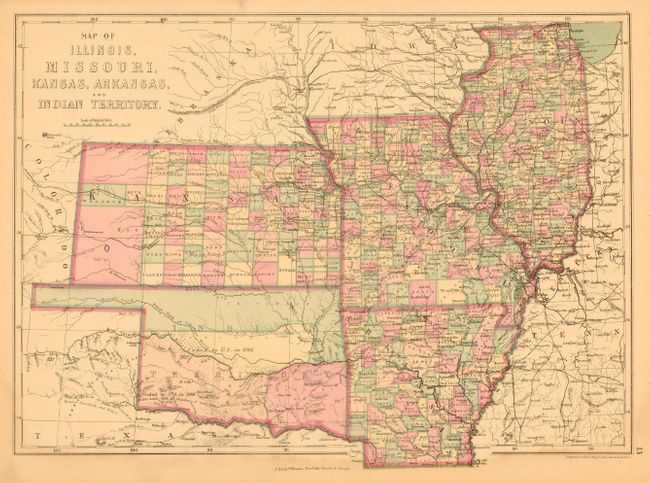
Auction 108, Lot 153
Subject: United States - Central
Williams, J. David
Map of Illinois, Missouri, Kansas, Arkansas, and Indian Territory, 1877
Size: 17 x 12.5 inches (43.2 x 31.8 cm)
Estimate: $120 - $160
Sold for: $90
Closed on 9/29/2004
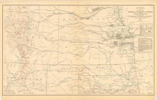
Auction 108, Lot 154
Subject: United States - Central
U.S. War Dept.
Map of the States of Kansas and Texas and Indian Territory, with Parts of the Territories of Colorado and New Mexico, 1895
Size: 27.5 x 16.5 inches (69.9 x 41.9 cm)
Estimate: $100 - $140
Sold for: $90
Closed on 9/29/2004
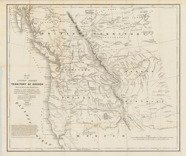
Auction 108, Lot 155
Subject: United States - Western
Abert/Hood
Map of the United States Territory of Oregon West of the Rocky Mountains…, 1838
Size: 20.5 x 17.5 inches (52.1 x 44.5 cm)
Estimate: $600 - $800
Sold for: $650
Closed on 9/29/2004
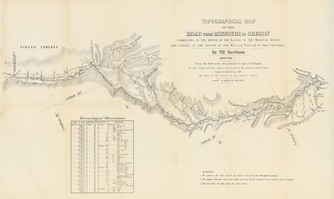
Auction 108, Lot 156
Subject: United States - Western
Fremont/Preuss
[Lot of 7] Topographical Map of the Road from Missouri to Oregon in Seven Sections, 1846
Size: 26 x 16 inches (66 x 40.6 cm)
Estimate: $1,500 - $2,500
Sold for: $3,000
Closed on 9/29/2004
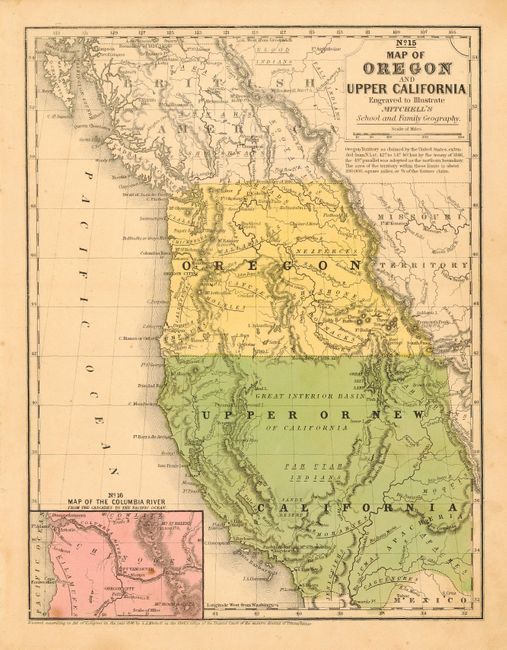
Auction 108, Lot 157
Subject: United States - Western
Mitchell, S. A.
Map of Oregon and Upper California, 1846
Size: 8 x 10.4 inches (20.3 x 26.4 cm)
Estimate: $200 - $250
Sold for: $500
Closed on 9/29/2004
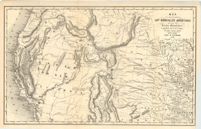
Auction 108, Lot 158
Subject: United States - Western
Colton, Joseph Hutchins
Map To Illustrate Capt. Bonneville's Adventure among the Rocky Mountains, 1849
Size: 18 x 11 inches (45.7 x 27.9 cm)
Estimate: $400 - $500
Sold for: $400
Closed on 9/29/2004
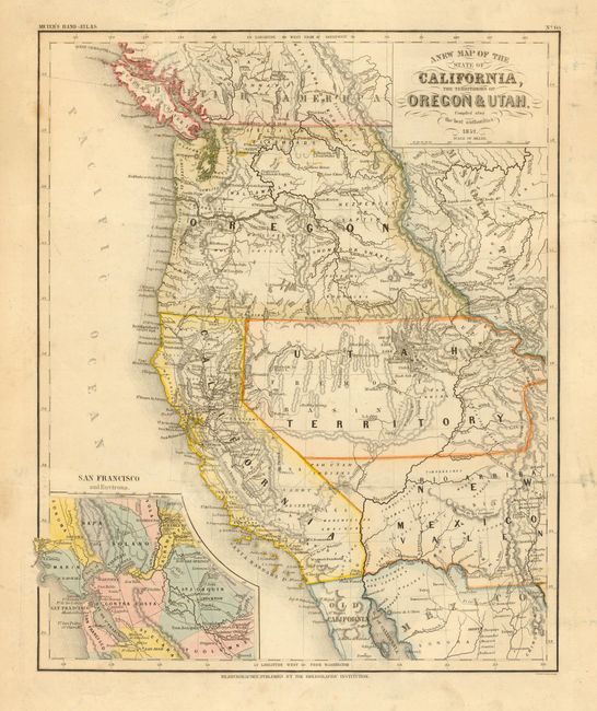
Auction 108, Lot 159
Subject: United States - Western
Meyer, Joseph
A New Map of the State of California, the Territories of Oregon & Utah, Compiled after the best authorities, 1852
Size: 12.5 x 15 inches (31.8 x 38.1 cm)
Estimate: $400 - $550
Sold for: $275
Closed on 9/29/2004
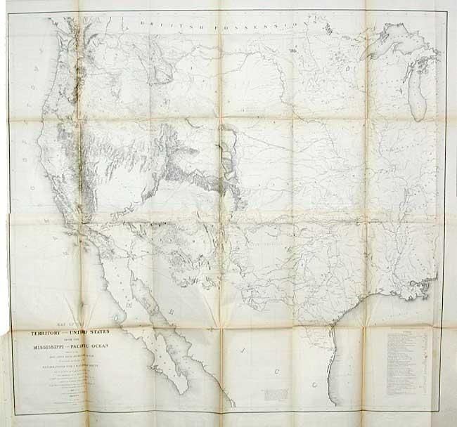
Auction 108, Lot 160
Subject: United States - Western
Warren, Lieut. G. K.
Map of the Territory of the United States from the Mississippi to the Pacific Ocean, 1854-7
Size: 46.7 x 42.2 inches (118.6 x 107.2 cm)
Estimate: $1,400 - $1,600
Sold for: $1,700
Closed on 9/29/2004
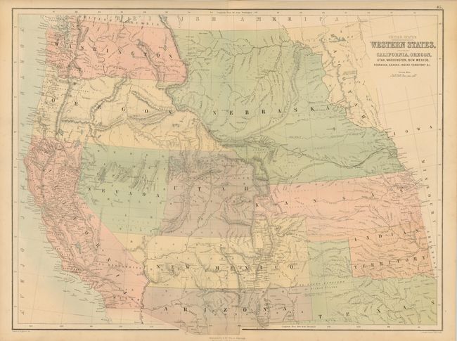
Auction 108, Lot 161
Subject: United States - Western
Black, Adam & Charles
United States Western States, including California, Oregon, Utah Washington, New Mexico, Nebraska, Kansas, Indian Territory &c., 1862
Size: 22.2 x 16.2 inches (56.4 x 41.1 cm)
Estimate: $250 - $300
Sold for: $325
Closed on 9/29/2004
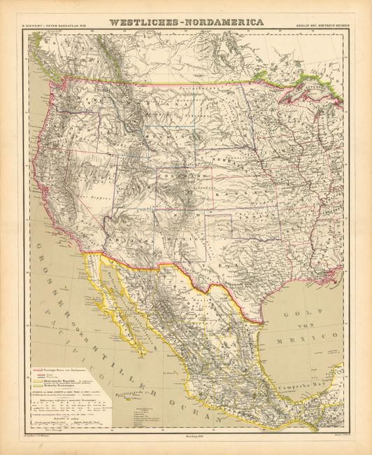
Auction 108, Lot 162
Subject: United States - Western
Kiepert, Heinrich C.
Westliches-Nordamerica, 1869
Size: 16.8 x 20.8 inches (42.7 x 52.8 cm)
Estimate: $150 - $200
Sold for: $110
Closed on 9/29/2004
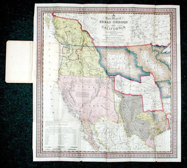
Auction 108, Lot 163
Subject: United States - Western
Mitchell, S. A.
A New Map of Texas Oregon and California with the Regions adjoining. Compiled from the most recent authorities, 1925
Size: 17.7 x 19 inches (45 x 48.3 cm)
Estimate: $300 - $350
Sold for: $375
Closed on 9/29/2004
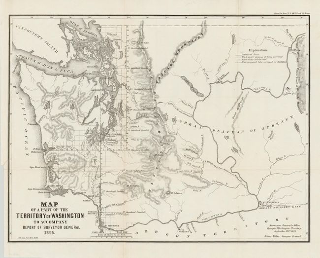
Auction 108, Lot 164
Subject: United States - Northwestern
General Land Office
[Lot of 2] Map of a Part of the Territory of Washington [with] Map of Oregon Territory West of the Cascade Mountain, 1855
Size: See Description
Estimate: $350 - $450
Sold for: $325
Closed on 9/29/2004
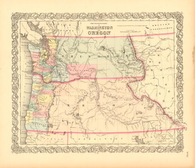
Auction 108, Lot 165
Subject: United States - Northwestern
Colton, Joseph Hutchins
The Territories of Washington and Oregon, 1856
Size: 16 x 12.7 inches (40.6 x 32.3 cm)
Estimate: $250 - $325
Sold for: $190
Closed on 9/29/2004
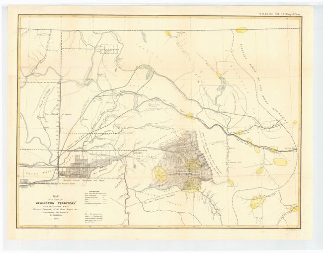
Auction 108, Lot 166
Subject: United States - Northwestern
U.S. State Surveys
Map of a Part of Washington Territory East of Cascade Mtns. Showing Topography of the Mines Region &c. to accompany the Report of E. Giddings, 1862
Size: 23 x 17.2 inches (58.4 x 43.7 cm)
Estimate: $200 - $240
Sold for: $250
Closed on 9/29/2004
122 lots
Page 1 of 3