Catalog Archive
Auction 108, Lot 150

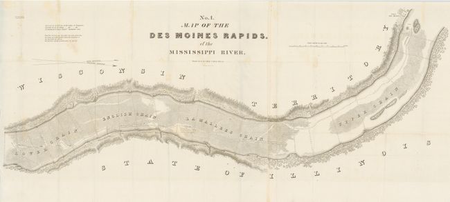
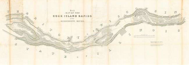
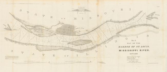
"[Lot of 3 - Mississippi River]", Lee, Robert E.

Subject: United States - Central

Period: 1837 (dated)

Publication: Ex Senate Doc. 139, 25th Cong., 2nd Session

Color: Black & White

Size:
See Description
Download High Resolution Image
(or just click on image to launch the Zoom viewer)

This set of three matched maps by the young Lt. Robert E. Lee are fine examples of his cartographic skills at this early point in his military career. Charts include: No. 1 - Map of the Des Moines Rapids of the Mississippi River (49.5 x 22.5"); No. 2 - Map of the Rock Island Rapids of the Mississippi River (66 x 24"); and No. 3 - Map of the Harbor of St. Louis, Mississippi River (43 x 17"). Rarely offered together, they cover the river in minute detail.

References: Keopp #316.

Condition: A

Maps No. 1 & 3 are very good to fine. Map No. 2 has toning along one fold and a fold split. All are tissue backed.

Estimate: $200 - $300

Sold for: $180

Closed on 9/29/2004

Archived