Catalog Archive
Auction 108, Lot 164

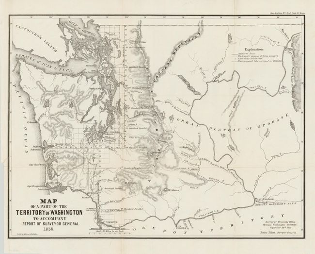
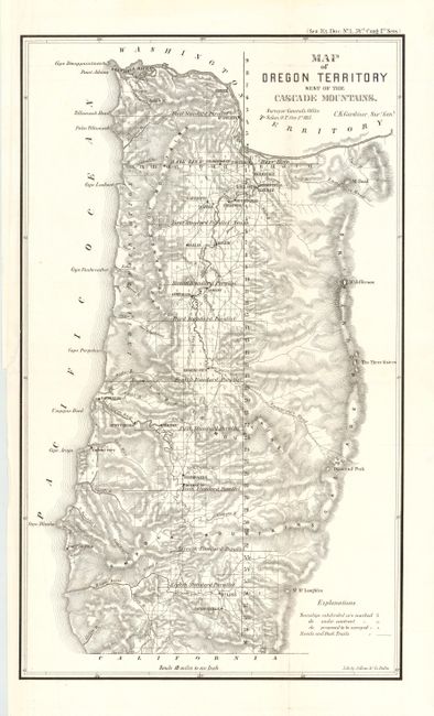
"[Lot of 2] Map of a Part of the Territory of Washington [with] Map of Oregon Territory West of the Cascade Mountain", General Land Office

Subject: United States - Northwestern

Period: 1855 (dated)

Publication: Senate Ex. Doc. No. 1, 34th. Cong., 1st

Color: Black & White

Size:
See Description
Download High Resolution Image
(or just click on image to launch the Zoom viewer)

Fine pair of maps by the Surveyor General that detail the Northwest coastal region. The first (19.2 x 14.5") is by James Tilton from the Olympia office. This is an early and very historical map showing limited survey progress just 28 months after the territory was created. Modest detail west of the Cascades, but only major rivers shown to the east. Locates several forts (Steilacom, Nisqually, Walla Walla, & Townsend) and Seattle is labeled Statle. An infrequently offered Washington map on a scale of 1"=18 miles. The second (10.5 x 18") is by C.K. Gardiner from the Salem office. This map also shows the progress of surveys.

References:

Condition: A

Both maps have a short marginal tear from binding trim just into border, closed on verso.

Estimate: $350 - $450

Sold for: $325

Closed on 9/29/2004

Archived