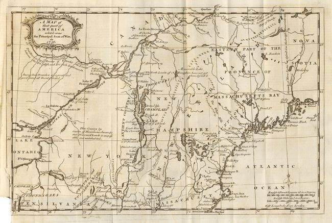
Subject: Colonial New England
Period: 1757 (published)
Publication: Gentleman's Magazine
Color: Black & White
Size:
13 x 8.5 inches
33 x 21.6 cm
This map covers the northeastern part of the United States focusing on the areas that were the Principal Seat of the French and Indian War. A great deal of the conflict was focused around the upper Hudson and Lake Champlain, and the Mohawk River to Lake Ontario. Several forts involved in the war are located, including William Henry, Frontenac, Edward, and Frederick. All these details and topographical information were important to the contemporary reader following the war from across the Atlantic. Plus a map titled "Plan of the Forts Ontario and Oswego, with Part of the River Onondago and Lake Ontario" (7" x 2") in the text on page 79. Still bound in the original February, 1757 magazine.
References: Jolly GENT-102; Sellers & van Ee #78; McCorkle 757.4.
Condition: B
Good impression. Folding as issued with binding trim into bottom border. Trace of offsetting, else very good.