Catalog Archive
Auction 108, Lot 157

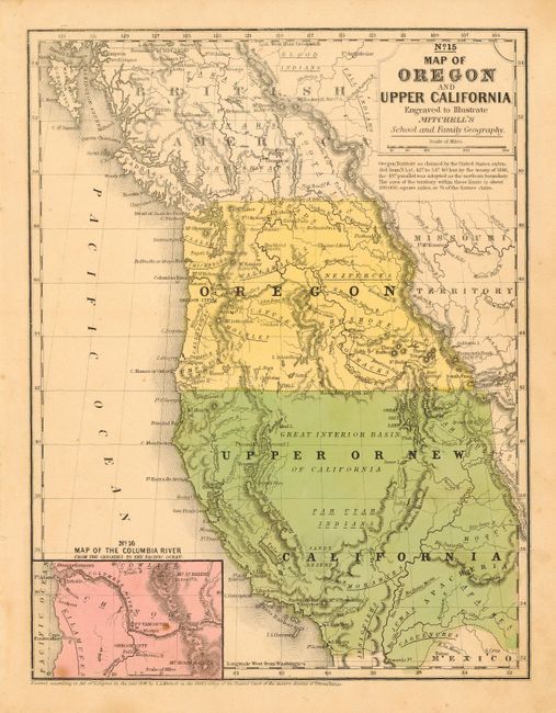
"Map of Oregon and Upper California", Mitchell, S. A.
Subject: United States - Western

Period: 1846 (dated)

Publication: Mitchell's School and Family Geography

Color: Hand Color

Size:
8 x 10.4 inches
20.3 x 26.4 cm
Download High Resolution Image
(or just click on image to launch the Zoom viewer)

The smaller school atlas version of this famous map based largely on Fremont's map of 1845. Inset "Map of the Columbia River from the Cascades to the Pacific Ocean". Upper California extends eastward to the Rio Grande and Oregon Territory extends to the Continental Divide. Shows the Oregon Route in good detail as it winds from the Sweetwater River through South Pass to Oregon City.

References: Wheat (TMW) #518.

Condition: A

Original color. A couple spots in inset map, still very good. Tear in upper left, stopping short of the border.

Estimate: $200 - $250

Sold for: $500

Closed on 9/29/2004

Archived