Subject: United States
Period: 1856 (published)
Publication:
Color: Hand Color
Size:
48.5 x 38.5 inches
123.2 x 97.8 cm
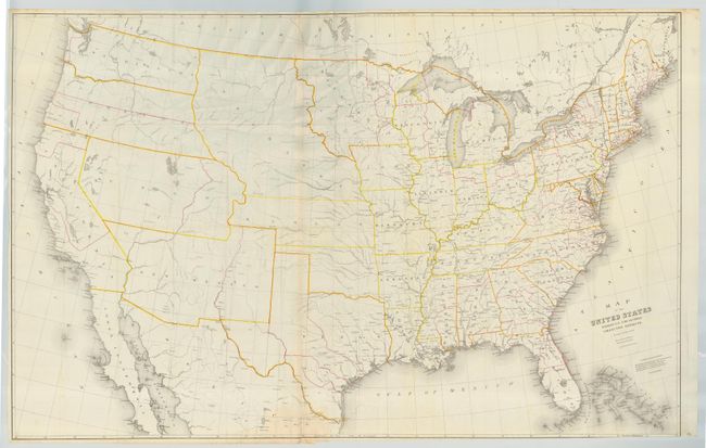
A relatively scarce and most interesting map with red lines indicating the district boundaries and yellow lines distinguishing the states and territories. Arizona and New Mexico are shown as one territory, Nebraska includes the present states of the Dakotas and Wyoming, West Virginia has not separated from Virginia, Utah spans from California to Kansas, and Washington and Oregon extend to the Continental Divide. Indian Territory is unnamed. Burr was 'Geographer and Draftsman to the Senate' between 1855-59.
References:
Condition: A
Folding, as issued. Bottom right corner close trimmed just into outer neatline, as issued. A little soiling at bottom center, still very good.