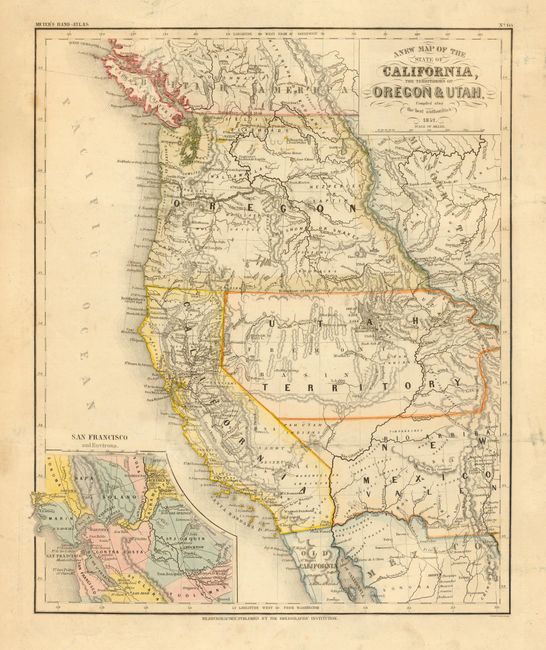
Subject: United States - Western
Period: 1852 (dated)
Publication: Meyer's Handatlas
Color: Hand Color
Size:
12.5 x 15 inches
31.8 x 38.1 cm
A great map of the state of California and the large western territories based on the important Mitchell series. The map is filled with interesting information, the exploration routes of Lewis and Clark, Fremont, Kearney, and Cooke, and the Spanish and Oregon Trails. Oregon Territory, with Oregon City as its capital, has its eastern boundary in the Rocky Mountains adjoining Missouri Territory. Utah Territory extends to Old Park and Long's Peak in present-day Colorado. New Mexico Territory encompasses parts of present-day Colorado and Arizona and displays a pre-Gadsden Purchase border along the Gila River. Only a few counties are delineated in California and the capital is at San Jose. A large inset shows San Francisco and Environs, which includes much of the Gold Region.
References:
Condition: B
Bit of minor soil and light creasing. Minor tears in blank margins, repaired with archival tape.