Subject: United States, Presidential Election
Period: 1960 (dated)
Publication:
Color: Printed Color
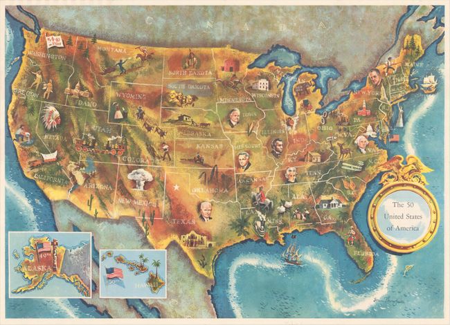
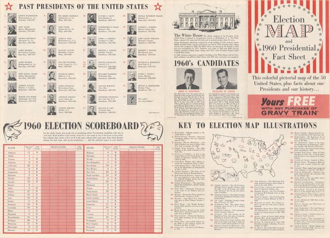
A. The 50 United States of America, by Lorin Thompson (24.9 x 17.9"). This colorful map of the United States was published by the General Foods Corporation. The map has an unusual coloring style with symbols of American history including past presidents, Native Americans, important buildings (White House, Statue of Liberty, Alamo), agriculture, industry, and more. Includes inset maps of Hawaii and Alaska with small American flags noting they were the final two states added to the Union. The verso shows a list of past presidents, pictures of the two candidates (Kennedy and Nixon), a 1960 election scoreboard, and a key to the 54 illustrations on the map on recto. Self-folding with cover title "Election Map and 1960 Presidential Fact Sheet...Yours Free with Any Purchase of Gravy Train." Condition: A clean and colorful example.
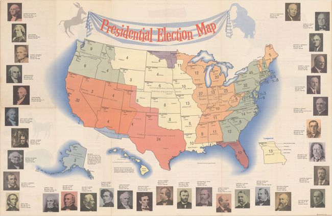
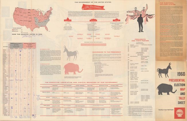
B. 1960 Presidential Election Map and Tally Sheet, by Rand McNally & Co. (31.0 x 20.0"). This simple map of the United States shows the number of electoral votes for each state along with its capital, population, and founding date. States are also color-coded to show its territorial acquisition by the United States. Surrounding the map are portraits of the previous 33 presidents, while a donkey and elephant hold up the drape-style title cartouche. The verso contains a tally sheet (with final results!), a small map of how the country voted in 1956, and related text describing the government of the United States. Condition: Clean and colorful. Manuscript notations on verso do not impact map.
References:
Condition: A
Issued folding. See description for details.