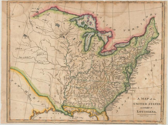
Subject: Eastern United States
Period: 1812 (circa)
Publication:
Color: Hand Color
Size:
10.6 x 8.3 inches
26.9 x 21.1 cm
A detailed map of the nascent United States that extends to include the recently acquired Louisiana Territory. Depicts the new state of Ohio with a large Northwestern Territory occupying all lands to its north and west. Mississippi Territory includes present-day Alabama, and the state of Louisiana has yet to appear (established in 1812). Only river systems are noted in the frontier region, with numerous spurious islands still shown in Lake Superior. Engraved by Kneass.
References:
Condition: B
Issued folding with scattered foxing and dampstains at top. Trimmed to inside the neatline at top with a number of fold separations that have been closed on verso with archival tape. There is a binding trim at lower right with a 1" binding tear and tiny chip that have also been archivally repaired on verso.