Subject: Eastern United States & Canada
Period: 1792-97 (circa)
Publication:
Color:
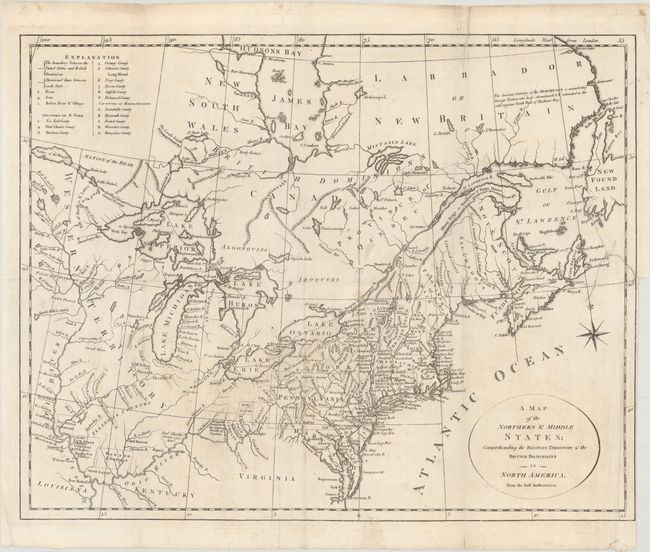
A. A Map of the Northern & Middle States; Comprehending the Western Territory & the British Dominions in North America. From the Best Authorities, by John Stockdale, circa 1792, black & white (15.1 x 12.0"). This uncommon and information-packed map describes the region from James Bay to Chesapeake Bay and the confluence of the Mississippi and Ohio Rivers, and from the Lake of the Woods to the Gulf of St. Lawrence. An explanation of the various symbols used in the map is displayed in the upper left corner. Several of the districts and states are shown with distorted borders, but the most interesting feature of the map are the numerous Bounty Land Grants shown in the western frontier including Genl Clarks, Donation Lands from the Commonwealth of Virginia, and Ohio Company in Ohio, and Wabash Company, New Jersey Company, and Illinois Company in Illinois. This version lacks any publisher's imprint below the map image, but is most similar to the version in Morse's Geography. References: cf. McCorkle #792.1; cf. Kershaw #388. Condition: Issued folding on watermarked paper with a few small spots and abrasions. There is a binding tear that extends 6" into the map image that is closed on verso with archival tape. (B)
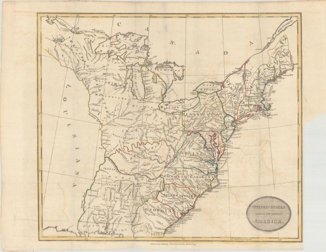
B. United States of America, by Cruttwell/Kearsley, dated 1797, hand color (15.6 x 13.5"). An attractive early map of the United States extending from East and West Florida up to Lake of the Woods and the lands of the Eastern Sioux in the northeast. Most of the states' boundaries are oddly distorted, while Tennassee is named but undefined. West of the Mississippi is Louisiana and is completely devoid of detail. A huge Western Territory occupies everything west of Pennsylvania and north of Kentucky, and the area between Georgia and the Mississippi River is unnamed and filled with the names of various Indian tribes. Engraved by Samuel Neele and published by Kearsley for Rev. Clement Cruttwell's New Universal Gazetter. References: McCorkle #799-10; Phillips (A) #692-7. Condition: Issued folding on watermarked paper with light offsetting and a binding trim at lower right. (B+)
References:
Condition:
See description above.