Subject: Colonial Eastern United States
Period: 1757 (dated)
Publication: Histoire Generale des Voyages
Color: Black & White
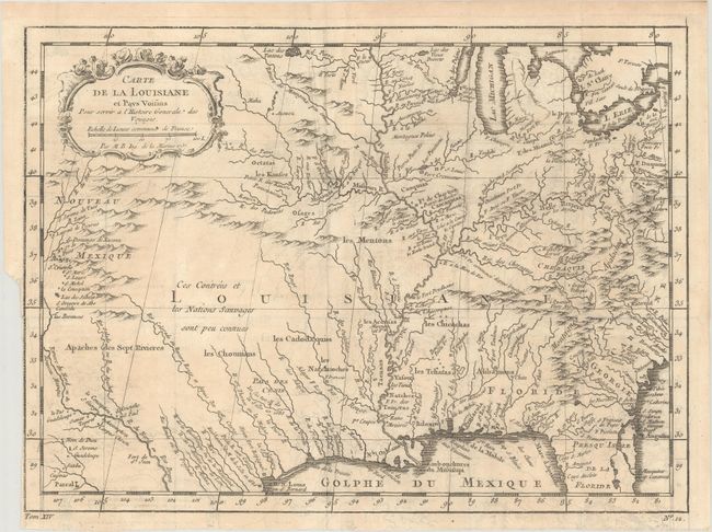
A. Carte de la Louisiane et Pays Voisins pour Servir a l'Histoire Generale des Voyages (11.9 x 8.7"). Superb small map based on Delisle's map of the French colony of Louisiana. This finely engraved and detailed map of French Louisiana extends from the Great Lakes to the Gulf of Mexico and from Nouveau Mexique to Florida (not showing the tip of Florida). Many Indian place names, forts, and early European settlements are shown. Nouveau Mexique in the far west includes Santa Fe and names the S. Jerome de Taos. The decorative title cartouche includes the distance scale. Reference: cf. Sellers & Van Ee #18.
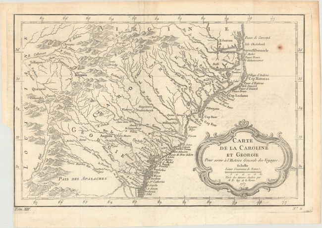
B. Carte de la Caroline et Georgie… (11.2 x 7.4"). This delicately engraved map covers the colonies of Carolina and Georgia from Albemarle Sound to the Alatamaha River. It probably owes its origin to the 1752 map of the region by Emanuel Bowen. There are numerous English settlements along the coast, and Indian villages are located throughout, including a number west of the Appalachian Mountains. There is more detail in the area west of the Blue Ridge than in many other maps of the period. It shows a rudimentary course of the Tennessee River in the northwestern section of the map. A decorative rococo-style title cartouche incorporates the distance scale. References: Cumming (SE) #311; Sellers & Van Ee #1384.
References:
Condition: B+
Issued folding on watermarked paper with binding trims at lower left. There is light offsetting, some minor creasing (first map), and one small rust spot (second map).