Subject: Eastern United States
Period: 1828 (dated)
Publication: Reise durch Nord Amerika
Color: Black & White
Size:
20.5 x 16.2 inches
52.1 x 41.1 cm
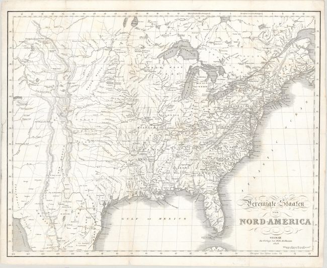
This is an uncommon German edition of John Melish's important map of the eastern United States with some changes in nomenclature and cartography. The map extends as far west as the Rocky Mountains and a portion of the Great Basin. It provides a detailed view of the region based on information from the expeditions of Lewis & Clark and Pike. The vast Missouri Territory from Melish's map is not identified, but the Great American Desert is located south of the Black Hills and east of Santa Fe. Arkansas Territory is named south of the new state of Missouri. Today's Minnesota, Wisconsin, and Upper Peninsula of Michigan are here a part of North West Territory. In Texas there are a few place names including Ft. Matagorda, but Galveston is poorly located. There are several updates to the river systems in the West: the Red River of California now appears as R. Clorado (Colorado River); the Columbia River is now named and its tributaries are depicted in greater detail; and Timpanogos L. is now identified at the westernmost edge of the map. Despite this being a German map, most of the place names are in English. Published in Carl Bernhard's Reise durch Nord Amerika.
References: Phillips (Maps) p. 885.
Condition: B+
Issued folding with several short fold separations that have been archivally repaired on verso. There is faint scattered foxing and minor offsetting.