Subject: Colonial Eastern United States & Canada
Period: 1776 (dated)
Publication:
Color: Hand Color
Size:
17.1 x 11.8 inches
43.4 x 30 cm
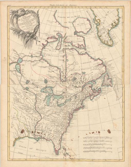
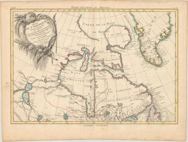
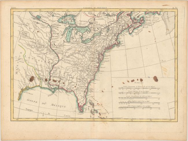
This is the second state of this finely engraved pair of Revolutionary War maps covering the eastern parts of North America. The top sheet contains the decorative title cartouche, and covers eastern Canada and Greenland from the bottom of Hudson Bay, northward beyond the Arctic Circle to about 70 deg. N. Latitude. It includes an interesting depiction of a passage between Lake Winnipeg and Hudson Bay alluding to a possible passage to the Pacific. The southern map covers French Louisiane and the British Colonies with their western boundary on the Mississippi River. Nice detail, particularly of the French forts and Indian villages. This state has been updated with the title Theatre de la Guerre en Amerique above the map.
References: Kershaw #474; McCorkle #771.2.
Condition:
Nice impressions on watermarked sheets with contemporary color and minor toning. The northern sheet is in "B+" condition with very light soiling. The southern sheet is in "B" condition with some old manuscript ink splotches. The first image is a composite image - the map is in two separate sheets.