Subject: Eastern United States
Period: 1788 (circa)
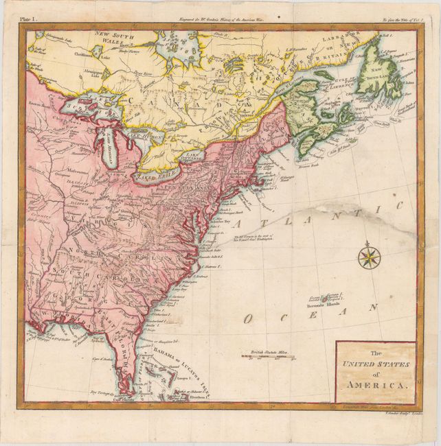
Publication: The History of Rise, Progress and Establishment of the…United States
Color: Hand Color
Size:
11.8 x 11.3 inches
30 x 28.7 cm
This early map shows the United States only five years after the Treaty of Paris. Georgia, South Carolina, North Carolina and Virginia extend to the Mississippi River but the engraved borders end at the Appalachian Mountains, leaving some room for interpretation. Florida is divided into East and West, and Maine is noted as being a part of Massachusetts Bay. A few spurious islands still appear in Lake Superior. Published in William Gordon's The History of Rise, Progress and Establishment of the Independence of the United States.
References: Howes #G-256.
Condition: B
Issued folding with a 6.5" edge tear at right that has been closed on verso with archival tape. A few small chips in unengraved areas of the image adjacent to the tear have been closed with old paper. A binding trim at lower right has been replaced with old paper.