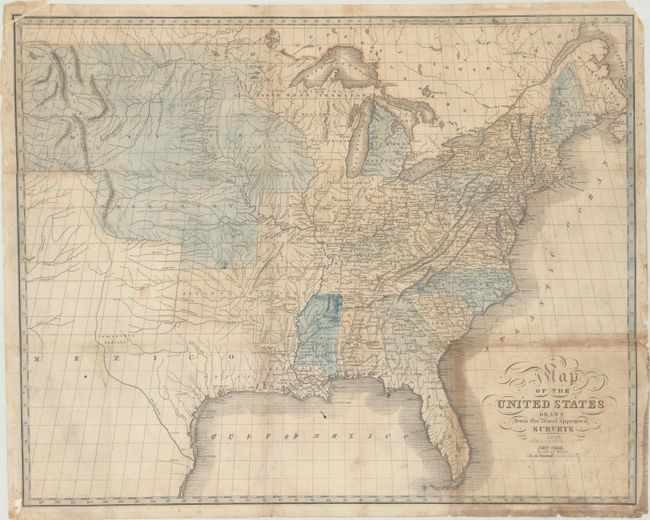
Subject: United States
Period: 1826 (dated)
Publication:
Color: Hand Color
Size:
20.4 x 16.3 inches
51.8 x 41.4 cm
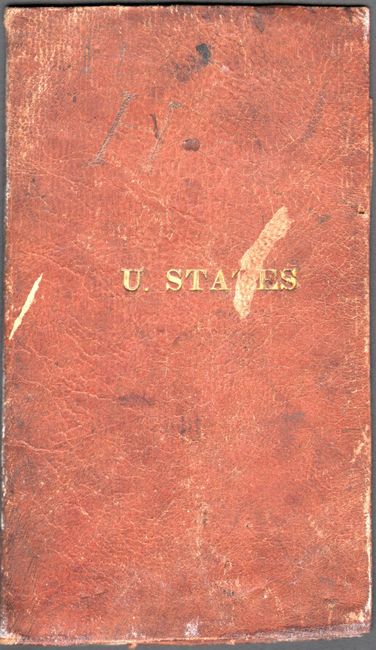
This scarce folding map was published by I. Starr & Company in New York. It appears to be identical to the one published by Solomon Schoyer and engraved by G.W. Merchant in the same year, but lacks the United States emblem in the lower left corner. Cartographically, the map extends to the Rocky Mountains with the huge Missouri Territory taking in the entire west. The new state of Missouri is also depicted without its "boot." The large Arkansas Territory incorporates present-day Oklahoma, and North West Territory includes both Wisconsin and eastern Minnesota. Texas is named and part of Mexico. Folds into brown leather covers with gilt tile on the front cover (3.5 x 6").
References:
Condition: B
Issued folding and now flattened with numerous fold separations that have mostly been repaired on verso with archival materials. There is some soiling, minor dampstains, and the top left corner of the image has been reattached on recto. There is light toning around the title and a few pencil notations. Covers are moderately worn and stained.