Subject: Colonial Eastern United States & Canada
Period: 1780 (dated)
Publication: Political Magazine
Color: Black & White
Size:
15.1 x 10.8 inches
38.4 x 27.4 cm
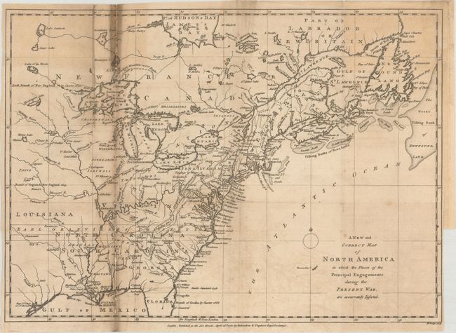
According to Jolly, this is an early state of the map which shows the British view of their colonies during the American Revolution. Based on the cartography of Thomas Jefferys, the map covers from James Bay to the Gulf of Mexico and provides many details about the frontier wilderness, including numerous early forts, Indian villages and tribal territories. The mythical islands in Lake Superior are a hold-over from earlier French cartographers. Earl Granville's Property in North Carolina is shown extending beyond the Mississippi River. Published by Richardson & Urquhart.
References: Jolly #POL-5; Phillips (Maps) p. 590.
Condition: B
Issued folding with light offsetting and heavy soiling along the left fold. Several fold separations along the left fold have been repaired on verso with old paper, with minor loss of image. There is a binding trim at lower right.