Catalog Archive
Auction 175, Lot 127

"D' Engelze Volkplanting in Virginie door Iohan Smith Bezogt en Verder Uytgeset", Aa, Pieter van der

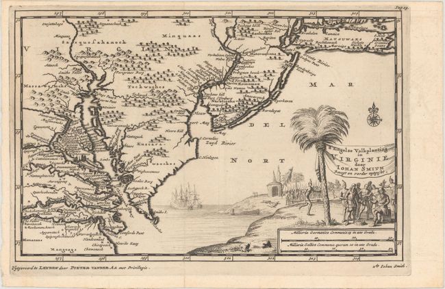
Subject: Colonial Mid-Atlantic United States

Period: 1706 (circa)

Publication:

Color: Black & White

Size:
9.2 x 5.9 inches
23.4 x 15 cm
Download High Resolution Image
(or just click on image to launch the Zoom viewer)

A well-engraved map of the Mid-Atlantic extending from Long Island to Cape Henry, with Breakelen (Brooklyn) named on Long Island. The map was derived from Capt. John Smith's map of 1612, the first to depict Chesapeake Bay and its tributaries with any accuracy. It is filled with primarily native names, but with a few Dutch and English ones scattered around. The decorative cartouche shows Smith being brought before Powhatan for judgment, showing English ships off the coast.

References:

Condition: A+

A fine example, issued folding.

Estimate: $600 - $750

Sold for: $500

Closed on 11/13/2019

Archived