Subject: Colonial Eastern United States & Canada
Period: 1757 (dated)
Publication:
Color: Hand Color
Size:
27.1 x 19.1 inches
68.8 x 48.5 cm
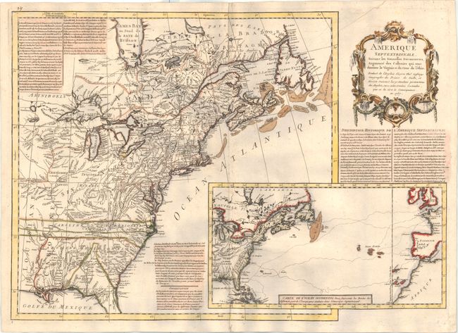
This rare, separately published map was issued during the French and Indian War. The routes from Spain and France to the Americas are drawn in an inset map at lower right. The western borders of the Carolinas are shown extending past the Mississippi River and Pennsylvania has an odd western border. While the map is attributed to Thomas Jefferys by McCorkle, it appears to be the French rebuttal to Jefferys' pro-English map of 1755, North America From the French of Mr. D'Anville Improved with the Back Settlements of Virginia and Course of Ohio Illustrated with Geographical and Historical Remarks. The map has text at the upper left describing the claims of the French and English, the history of the region, and the French Jesuits and martyrs who evangelized the Six Native Nations. The title cartouche mentions the 'pretensions' of the English in the region, and misspells Jefferys name as 'Gefferys.' A most unusual map with no records of sale.
References: McCorkle #757.3; Sellers & Van Ee #73.
Condition: B+
A crisp impression printed on very thick, sturdy paper with light soiling. In excellent shape for a separately published map.