Catalog Archive
Auction 175, Lot 108

"Map of the National Highways Terminating at San Diego, California - Strip Maps from El Paso, Texas, to San Diego Shown on Reverse Side...",

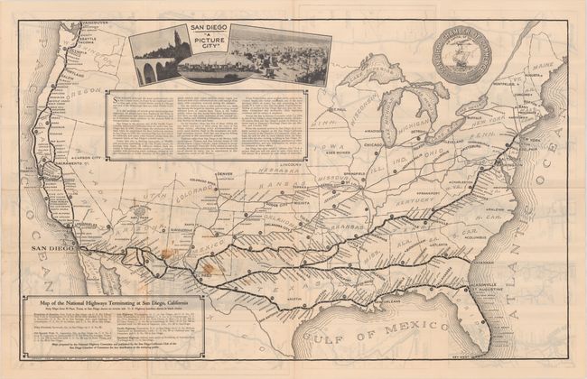
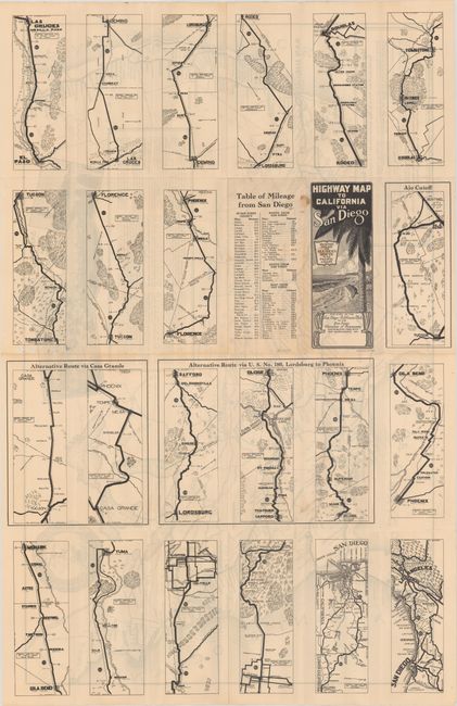
Subject: United States; San Diego, California

Period: 1929 (dated)

Publication:

Color: Black & White

Size:
31.9 x 19.9 inches
81 x 50.5 cm
Download High Resolution Image
(or just click on image to launch the Zoom viewer)

This road map of the United States was prepared by the National Highway Committee and published by the San Diego Chamber of Commerce. It prominently depicts several transcontinental highways from Chicago and several east coast cities terminating in San Diego. Promotional text in the middle of the map touts the benefits of the "Picture City" and that "once seen, it will always be a treasure in your album of memories." The verso contains auto strip maps detailing three different ways to get from El Paso to San Diego. Self folding with pictorial paper wrappers. Drawn and engraved by Sunset Engraving Co.

References:

Condition: B+

Issued folding on a bright sheet with some minor staining near New Mexico and a few small holes along the top border.

Estimate: $100 - $130

Sold for: $130

Closed on 11/13/2019

Archived