Subject: Colonial Eastern United States
Period: 1770 (circa)
Publication: Atlas Moderne
Color: Hand Color
Size:
17.1 x 11.6 inches
43.4 x 29.5 cm
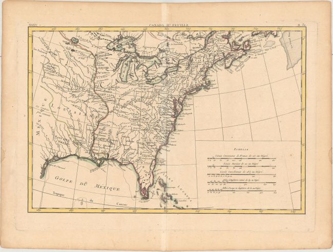
Counter to the title above the image, this map covers the eastern portion of North America west to Texas and the Great Plains. French Louisiane is sandwiched between Mexique and the Mississippi River and the British Colonies take in all the region east of the Mississippi. Texas is labeled Pays des Cenis and the southern portion of Florida is depicted as a series of islands. Many early place names, forts and Indian villages are identified. Notations to the west describe that these "savage nations" are subject to change and that the regions are not well known. There is an early mention of les Kansez in the area of Kansas City. This is the bottom sheet of a two part map. It has its own borders and stands completely on its own.
References: McCorkle #771.2.
Condition: B+
On watermarked paper with a few faint spots and light toning along the sheet edges.