Filtered by Category:United States(Show All Categories)
Showing results for:Auction 140
Catalog Archive
228 lots
Page 1 of 5
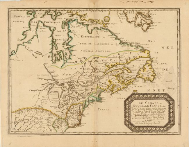
Auction 140, Lot 109
Subject: Colonial United States and Canada - Great Lakes
Sanson, Nicolas
Le Canada, ou Nouvelle France, &c., 1656
Size: 21.5 x 15.8 inches (54.6 x 40.1 cm)
Estimate: $4,750 - $6,000
Keystone Map for Great Lakes Collections
Sold for: $3,000
Closed on 5/23/2012
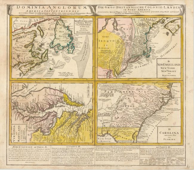
Auction 140, Lot 110
Subject: Colonial United States and Canada
Homann Heirs
Dominia Anglorum in America Septentrionali, 1740
Size: 21.5 x 19.8 inches (54.6 x 50.3 cm)
Estimate: $600 - $800
Unsold
Closed on 5/23/2012
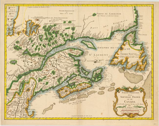
Auction 140, Lot 111
Subject: Colonial New England and Canada
Bellin, Jacques Nicolas
Partie Orientale de la Nouvelle France ou du Canada, 1755
Size: 21.3 x 17 inches (54.1 x 43.2 cm)
Estimate: $900 - $1,000
Foundation map of Eastern Canada
Sold for: $650
Closed on 5/23/2012
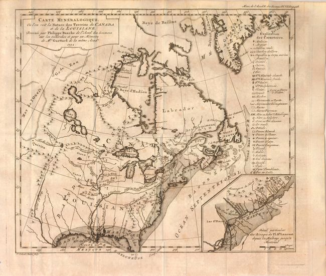
Auction 140, Lot 112
Subject: Colonial United States and Canada, Switzerland and Geology
Guettard, Jean Etienne
Carte Mineralogique, ou l'on voit la Nature des Terreins de Canada et de la Louisiane, Dressee par Philippe Buache…1752 [and] Carte Mineralogique de la Suisse par Philippe Buache pour servir aux recherches et pour un Memoire de Mr. Guettard en 1572, 1761
Size: 12 x 10.5 inches (30.5 x 26.7 cm)
Estimate: $1,300 - $1,800
Unsold
Closed on 5/23/2012
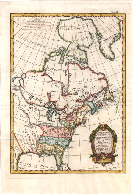
Auction 140, Lot 113
Subject: Colonial United States and Canada
Bonne, Rigobert
Partie du Nord de l'Amerique Septentrionale, pour Servir a l'Histoire Philosophique et Politique…, 1774
Size: 9.3 x 12.6 inches (23.6 x 32 cm)
Estimate: $200 - $240
Sold for: $350
Closed on 5/23/2012
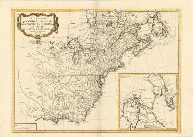
Auction 140, Lot 114
Subject: Colonial United States and Canada
D'Anville/Santini
Carte Generale du Canada, de la Louisiane, de la Floride, de la Caroline, de la Virginie, de la Nouvelle Angleterre etc. par le Sr. d'Anville, 1776
Size: 25.8 x 18.8 inches (65.5 x 47.8 cm)
Estimate: $800 - $950
Unsold
Closed on 5/23/2012
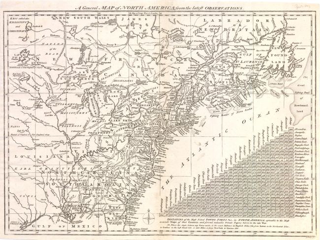
Auction 140, Lot 115
Subject: Colonial United States and Canada
Lodge, John
A General Map of North America from the Latest Observations, 1778
Size: 15 x 10.8 inches (38.1 x 27.4 cm)
Estimate: $650 - $750
Sold for: $325
Closed on 5/23/2012
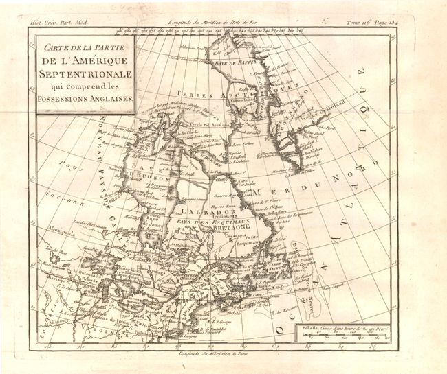
Auction 140, Lot 116
Subject: Colonial United States & Canada
Brion de la Tour, Louis
Carte de la Partie de l'Amerique Septentrionale qui Comprend les Possessions Anglaises, 1782
Size: 10 x 8.8 inches (25.4 x 22.4 cm)
Estimate: $150 - $200
Unsold
Closed on 5/23/2012
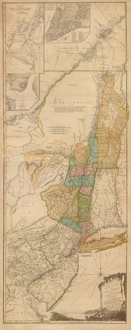
Auction 140, Lot 117
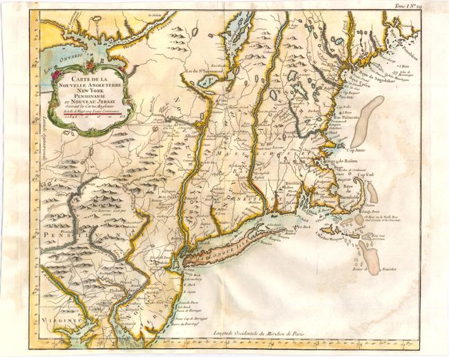
Subject: Colonial Northeast and Quebec
Sayer & Bennett
The Provinces of New York, and New Jersey; with Part of Pensilvania, and the Province of Quebec. Drawn by Major Holland…, 1776
Size: 20.5 x 53 inches (52.1 x 134.6 cm)
Estimate: $5,500 - $6,500
Thomas Jefferys' Important Revolutionary War Period Map
Unsold
Closed on 5/23/2012
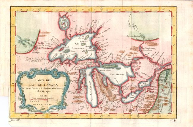
Auction 140, Lot 118
Subject: Canada and Great Lakes
Bellin, Jacques Nicolas
Carte des Lacs du Canada…, 1757
Size: 11.4 x 7.6 inches (29 x 19.3 cm)
Estimate: $400 - $475
Sold for: $300
Closed on 5/23/2012
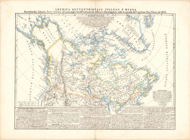
Auction 140, Lot 119
Subject: Canada & Northern United States
Marzolla, Benedetto
America Settentrionale Inglese E Russa…, 1854
Size: 23.5 x 18 inches (59.7 x 45.7 cm)
Estimate: $275 - $350
Unsold
Closed on 5/23/2012
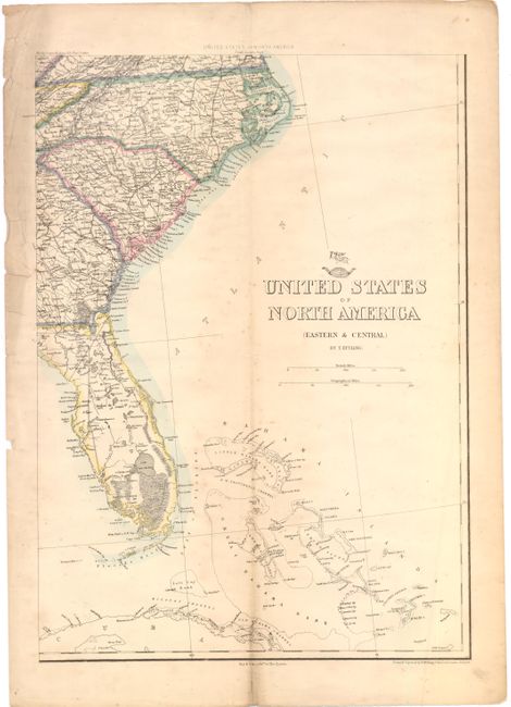
Auction 140, Lot 120
Subject: Canada & United States
Ettling, Theodor
[Lot of 2] [On 4 Sheets] United States of North America [and] Upper Canada, 1855-80
Size: See Description
Estimate: $190 - $230
Unsold
Closed on 5/23/2012
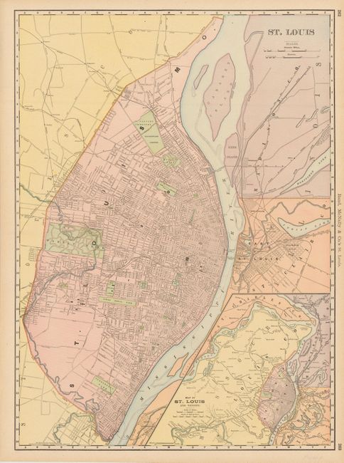
Auction 140, Lot 121
Subject: United States and Canadian Cities
[Lot of 7] St. Louis [and] Montreal [and] Toledo [and] Milwaukee [and] Cincinnati [and] Louisville [and] Colton's City of Baltimore, 1855-98
Size: See Description
Estimate: $250 - $325
Unsold
Closed on 5/23/2012
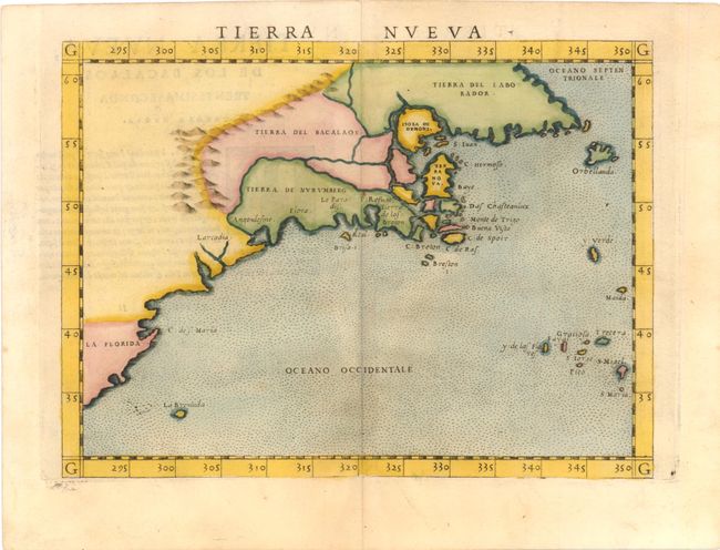
Auction 140, Lot 122
Subject: Eastern United States & Canada
Ruscelli, Girolamo
Tierra Nueva, 1561
Size: 9.5 x 7.1 inches (24.1 x 18 cm)
Estimate: $1,200 - $1,500
Sold for: $1,000
Closed on 5/23/2012
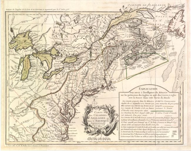
Auction 140, Lot 123
Subject: Eastern Canada & United States
Poilly, N.J.B.
Carte des Colonies Anglaises dans l'Amerique Septentrionale Terminee par la Re. Ohio, 1756
Size: 18.3 x 14.5 inches (46.5 x 36.8 cm)
Estimate: $2,500 - $3,500
An Important French Map Illustrating the Theater of the French and Indian War
Sold for: $1,800
Closed on 5/23/2012
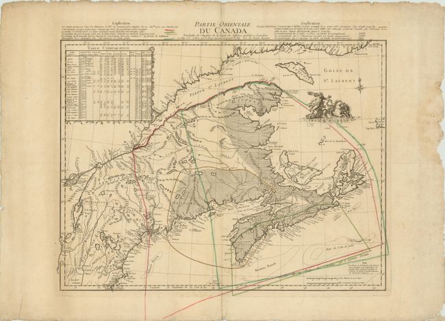
Auction 140, Lot 124
Subject: Eastern Canada & United States
Le Rouge, George Louis
Partie Orientale du Canada Traduitte de l'Anglois de la Carte de Jefferys …, 1762
Size: 23.5 x 19.5 inches (59.7 x 49.5 cm)
Estimate: $1,000 - $1,300
Unsold
Closed on 5/23/2012
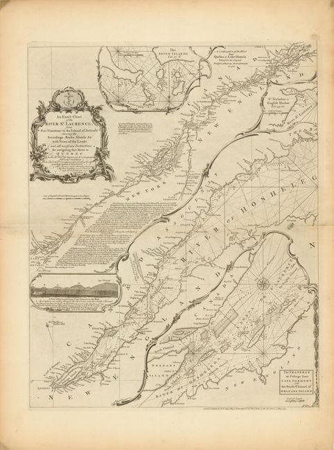
Auction 140, Lot 125
Subject: Eastern Colonial United States & Canada
Jefferys/Sayer & Bennett
[On 2 Sheets] An Exact Chart of the River St. Laurence, from Fort Frontenac to the Island of Anticosti Shewing the Soundings, Rocks, Shoals, &c. with Views of the Lands and All Necessary Instructions for Navigating that River to Quebec, 1775
Size: 18.8 x 23.5 inches (47.8 x 59.7 cm)
Estimate: $900 - $1,100
Sold for: $650
Closed on 5/23/2012
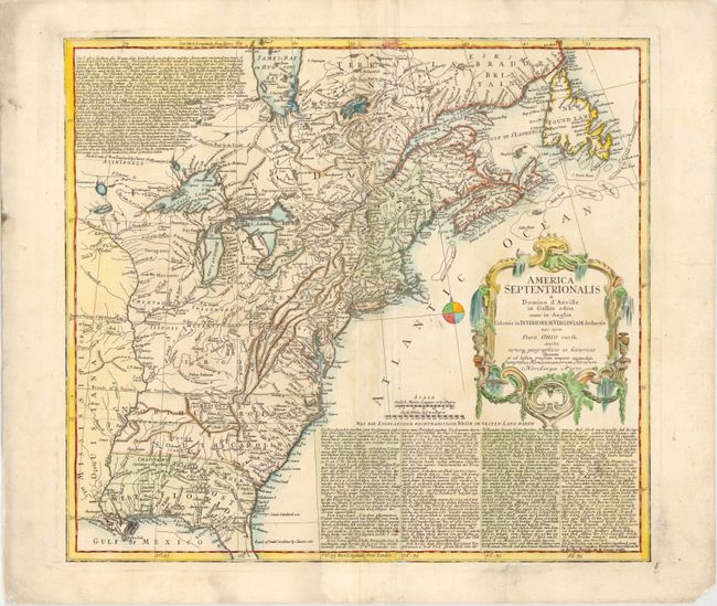
Auction 140, Lot 126
Subject: Eastern Colonial United States & Canada
Homann Heirs
America Septentrionalis a Domino d'Anville in Galliis Edita nunc in Anglia Coloniis in Interiorem Virginiam Deductis nec non Fluvii Ohio Cursu…, 1777
Size: 20 x 18 inches (50.8 x 45.7 cm)
Estimate: $700 - $900
Sold for: $500
Closed on 5/23/2012
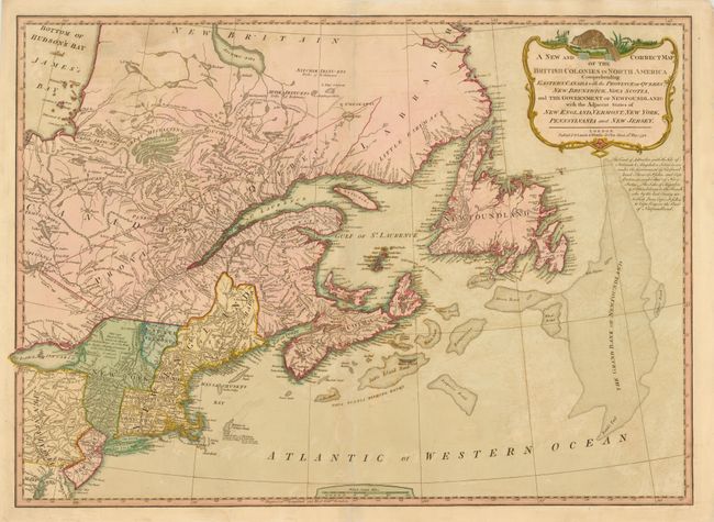
Auction 140, Lot 127
Subject: Eastern Canada & United States
Laurie & Whittle
A New and Correct Map of the British Colonies in North America Comprehending Eastern Canada with the Province of Quebec, New Brunswick, Nova Scotia, ... Newfoundland: with the Adjacent States of New England, Vermont, New York, Pennsylvania and New Jersey, 1794
Size: 25.8 x 18.5 inches (65.5 x 47 cm)
Estimate: $600 - $750
Sold for: $450
Closed on 5/23/2012
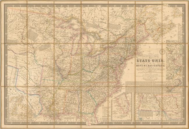
Auction 140, Lot 128
Subject: Eastern Canada & United States
Brue, Adrien Hubert
Nouvelle Carte des Etats-Unis, des Haut et Bas-Canada, de la Nouvle. Ecosse, du Nouvau.-Brunswick, de Terre-Neuve &c., 1839
Size: 37 x 24.8 inches (94 x 63 cm)
Estimate: $500 - $650
Sold for: $375
Closed on 5/23/2012
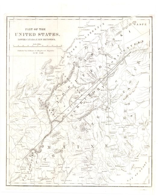
Auction 140, Lot 129
Subject: Eastern Canada & United States
Part of the United States, Lower Canada & New Brunswick, 1840
Size: 10.5 x 12.3 inches (26.7 x 31.2 cm)
Estimate: $80 - $100
Sold for: $120
Closed on 5/23/2012
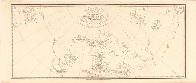
Auction 140, Lot 130
Subject: Northern Canada & United States
Parry, William Edward (Adm. Sir)
General Chart Shewing the Track of H. M. Ships Fury and Hecla, on a Voyage for the Discovery of a North West Passage, AD. 1821-22-23, 1824
Size: 23.5 x 10 inches (59.7 x 25.4 cm)
Estimate: $375 - $450
Unsold
Closed on 5/23/2012
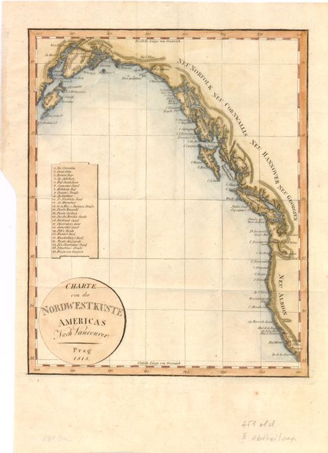
Auction 140, Lot 131
Subject: Western Canada & United States
Anon.
Charte von der Nordwestkuste Americas nach Vancouver, 1818
Size: 8 x 9.8 inches (20.3 x 24.9 cm)
Estimate: $190 - $230
Sold for: $140
Closed on 5/23/2012
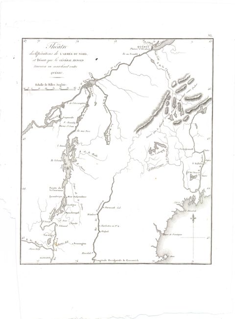
Auction 140, Lot 132
Subject: New England and Canada
Marshall, John
Theatre des Operations de l'Armee du Nord, et Desert que le General Arnold Traversa en Marchant Contre Quebec, 1807
Size: 8.5 x 10 inches (21.6 x 25.4 cm)
Estimate: $150 - $200
Sold for: $110
Closed on 5/23/2012
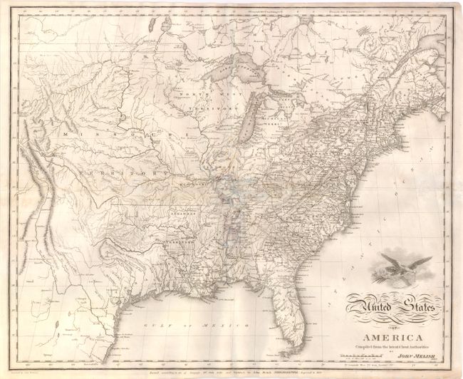
Auction 140, Lot 133
Subject: United States
Melish, John
United States of America Compiled from the Latest & Best Authorities, 1822
Size: 19.5 x 16 inches (49.5 x 40.6 cm)
Estimate: $500 - $600
Unsold
Closed on 5/23/2012
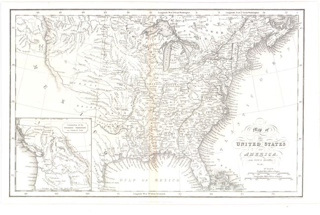
Auction 140, Lot 134
Subject: United States
Hinton, Simpkin & Marshall
Map of the United States of America and Nova Scotia, &c.&c., 1832
Size: 15.6 x 9.8 inches (39.6 x 24.9 cm)
Estimate: $200 - $250
Unsold
Closed on 5/23/2012
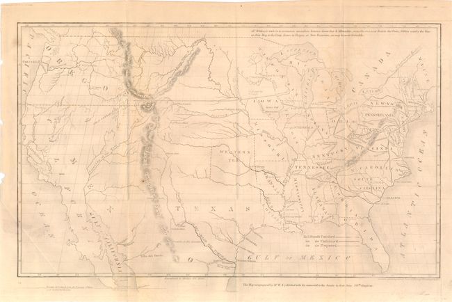
Auction 140, Lot 135
Subject: United States
Whitney, Asa
[Map of Proposed Routes of Western Railroads], 1848
Size: 15.5 x 9.6 inches (39.4 x 24.4 cm)
Estimate: $200 - $300
Sold for: $250
Closed on 5/23/2012
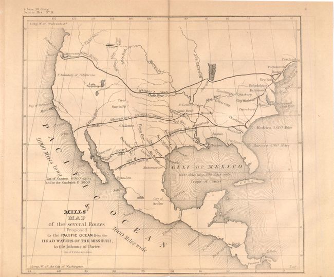
Auction 140, Lot 136
Subject: United States
U.S. Government
Mills' Map of the Several Routes Proposed to the Pacific Ocean from the Head Waters of the Missouri, to the Isthmus of Darien, 1848
Size: 9 x 8.3 inches (22.9 x 21.1 cm)
Estimate: $120 - $150
Sold for: $75
Closed on 5/23/2012
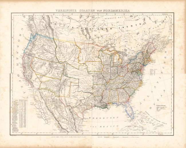
Auction 140, Lot 137
Subject: United States
Flemming, Carl
Vereinigte Staaten von Nordamerika, 1854
Size: 27 x 20.5 inches (68.6 x 52.1 cm)
Estimate: $300 - $400
Sold for: $220
Closed on 5/23/2012
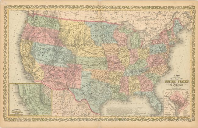
Auction 140, Lot 138
Subject: United States
Desilver, Charles
A New Map of the United States of America by J.H. Young, 1857
Size: 26.3 x 16 inches (66.8 x 40.6 cm)
Estimate: $300 - $400
Desilver's United States
Sold for: $220
Closed on 5/23/2012
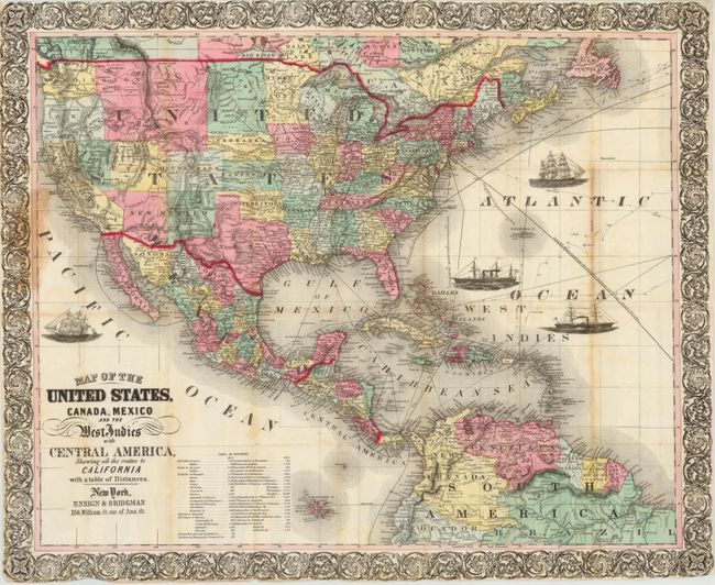
Auction 140, Lot 139
Subject: United States
Map of the United States, Canada, Mexico and the West Indies with Central America…, 1863
Size: 27 x 22 inches (68.6 x 55.9 cm)
Estimate: $800 - $1,000
Unsold
Closed on 5/23/2012
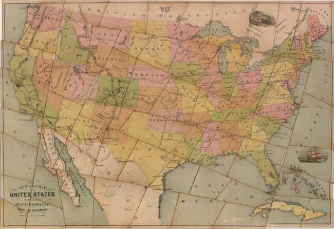
Auction 140, Lot 140
Subject: United States
Milton Bradley Co.
[Puzzle] Outline Map of the United States, 1881
Size: 22.5 x 15.5 inches (57.2 x 39.4 cm)
Estimate: $325 - $400
Sold for: $240
Closed on 5/23/2012
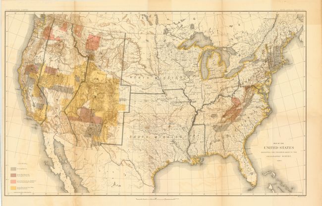
Auction 140, Lot 141
Subject: United States
Powell, John Wesley
Map of the United States Showing Areas Surveyed on a Scale Suitable for the Purposes of the U.S. Geological Survey…, 1883
Size: 28 x 17.5 inches (71.1 x 44.5 cm)
Estimate: $130 - $160
Sold for: $100
Closed on 5/23/2012
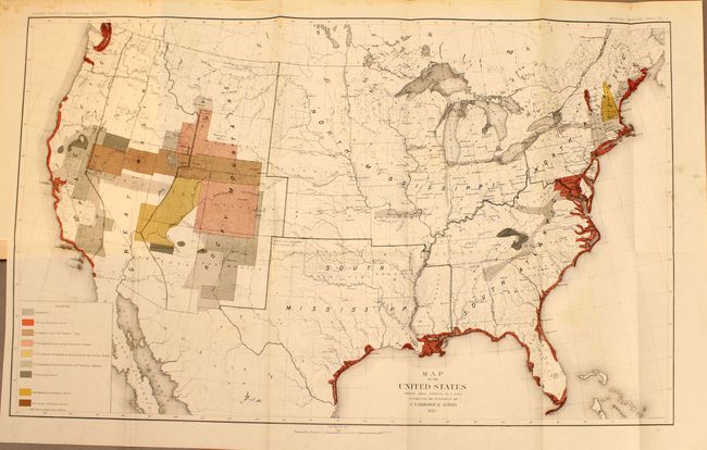
Auction 140, Lot 142
Subject: United States
U.S. Geological Survey (USGS)
[Lot of 2] Map of the United States Exhibiting the Present Status of Knowledge Relating to the Areal Distribution of Geologic Groups [and] Map of the United States Exhibiting the Progress Made in the Geographic Survey, 1884
Size: 28 x 18 inches (71.1 x 45.7 cm)
Estimate: $325 - $400
Unsold
Closed on 5/23/2012
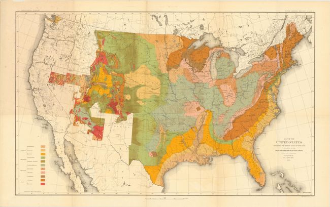
Auction 140, Lot 143
Subject: United States
U.S. Geological Survey (USGS)
[Lot of 4 - USGS Maps], 1884-97
Size: 28 x 17.5 inches (71.1 x 44.5 cm)
Estimate: $140 - $180
Sold for: $50
Closed on 5/23/2012
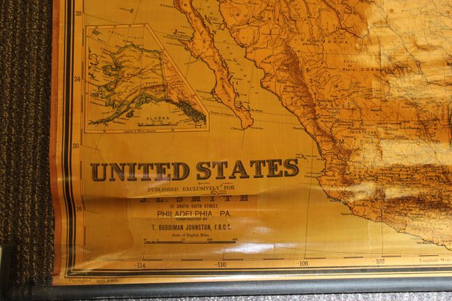
Auction 140, Lot 144
Subject: United States
Johnston, T. Ruddiman
United States, 1885
Size: 38 x 45 inches (96.5 x 114.3 cm)
Estimate: $150 - $200
Sold for: $75
Closed on 5/23/2012
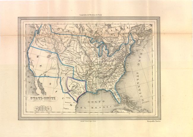
Auction 140, Lot 145
Subject: United States and Texas
Stati-Uniti, 1850
Size: 12 x 8.8 inches (30.5 x 22.4 cm)
Estimate: $200 - $250
Sold for: $150
Closed on 5/23/2012
Auction 140, Lot 146
Subject: Eastern United States
Smith, Charles
United States, 1820
Size: 14 x 11 inches (35.6 x 27.9 cm)
Estimate: $275 - $350
Sold for: $275
Closed on 5/23/2012
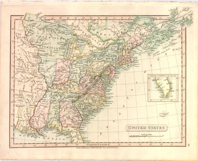
Auction 140, Lot 147
Subject: Eastern United States
Bromme, Traugott
Post- und Reise-Karte der Vereinigten Staaten von Nord-Amerika, 1837
Size: 21.8 x 18 inches (55.4 x 45.7 cm)
Estimate: $600 - $750
Unsold
Closed on 5/23/2012
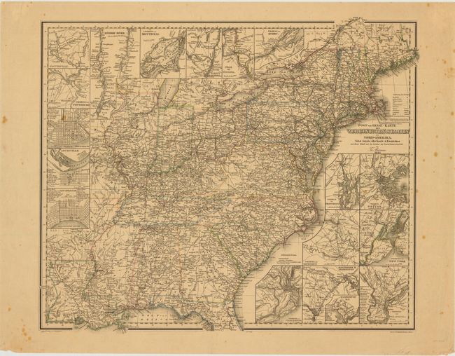
Auction 140, Lot 148
Subject: Eastern United States
Thomas, Cowperthwait & Co.
United States, 1854
Size: 12.6 x 15.8 inches (32 x 40.1 cm)
Estimate: $140 - $170
Sold for: $50
Closed on 5/23/2012
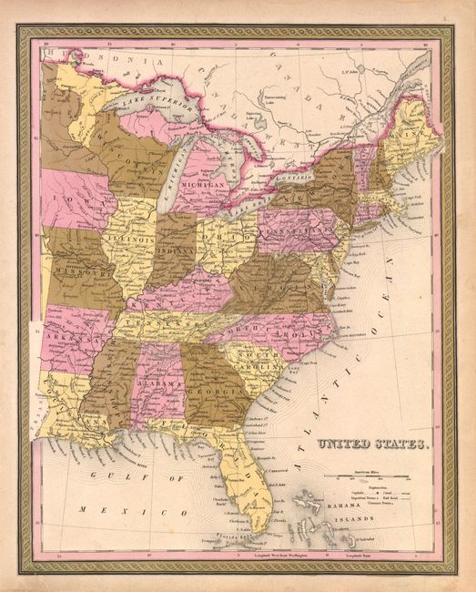
Auction 140, Lot 149
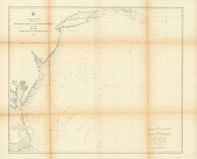
Subject: Eastern United States
U.S. Coast Survey
Atlantic Coast of the United States (in four sheets) Sheet No. II Nantucket to Cape Hatteras, 1863
Size: 27 x 23 inches (68.6 x 58.4 cm)
Estimate: $70 - $100
Unsold
Closed on 5/23/2012
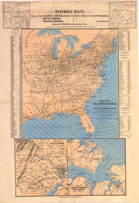
Auction 140, Lot 150
Subject: Eastern United States, Civil War
Prang, Louis
Distance Maps. Map of the Atlantic States, Showing 50 Mile Distances from Washington. Map of the Battle Ground [at Manassas], Showing 5 Mile Distances from Washington. Map of Fortress Monroe, Showing 1 Mile Distances from the Fortress., 1861
Size: 12.5 x 21.8 inches (31.8 x 55.4 cm)
Estimate: $400 - $500
Rare Civil War Distance Map
Sold for: $1,600
Closed on 5/23/2012
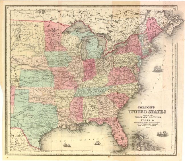
Auction 140, Lot 151
Subject: Eastern United States, Civil War
Colton, Joseph Hutchins
Colton's United States Shewing the Military Stations, Forts &c., 1862
Size: 16.3 x 14.5 inches (41.4 x 36.8 cm)
Estimate: $200 - $300
Sold for: $150
Closed on 5/23/2012
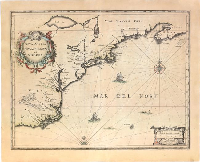
Auction 140, Lot 152
Subject: Colonial New England and Mid-Atlantic
Jansson, Jan
Nova Anglia Novum Belgium et Virginia, 1636
Size: 20 x 15.3 inches (50.8 x 38.9 cm)
Estimate: $1,700 - $2,000
Jansson's Influential Map of the East Coast
Sold for: $1,300
Closed on 5/23/2012
Auction 140, Lot 153
Subject: Colonial New England and Mid-Atlantic
Bellin, Jacques Nicolas
Carte de la Nouvelle Angleterre New York Pensilvanie et Nouveau Jersay Suivant les Cartes Angloises, 1764
Size: 14.5 x 12.6 inches (36.8 x 32 cm)
Estimate: $600 - $800
Unsold
Closed on 5/23/2012
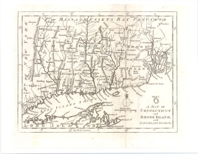
Auction 140, Lot 154
Subject: Colonial New England
Anon.
A Map of Connecticut and Rhode Island, with Long Island Sound, &c., 1776
Size: 9 x 6.8 inches (22.9 x 17.3 cm)
Estimate: $190 - $240
Sold for: $140
Closed on 5/23/2012
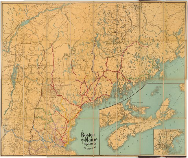
Auction 140, Lot 155
Subject: New England
Boston and Maine Railroad and Connections, 1900
Size: 45 x 37.5 inches (114.3 x 95.3 cm)
Estimate: $275 - $350
Unsold
Closed on 5/23/2012
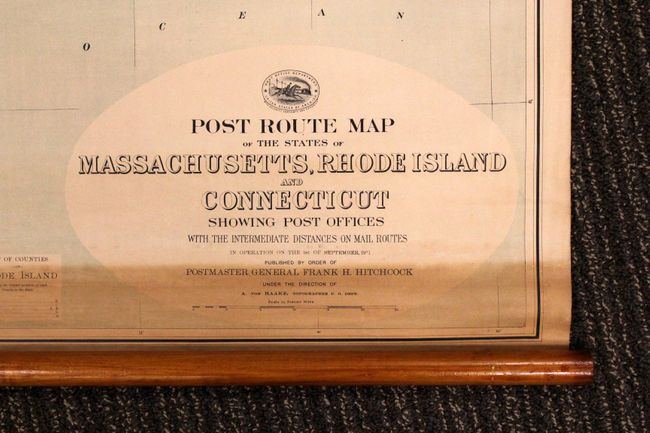
Auction 140, Lot 156
Subject: New England - United States
[Lot of 2] Post Route Map of the States of Massachusetts, Rhode Island and Connecticut… [and] Connecticut Post Offices and Postmarks, 1911-77
Size: See Description
Estimate: $180 - $220
Unsold
Closed on 5/23/2012
Auction 140, Lot 157
Subject: Colonial Mid-Atlantic
Hondius/Blaeu
Nova Virginiae Tabula, 1642
Size: 19 x 15 inches (48.3 x 38.1 cm)
Estimate: $2,750 - $3,500
One of the Most Important 17th Century Maps of the Chesapeake Bay
Sold for: $2,000
Closed on 5/23/2012
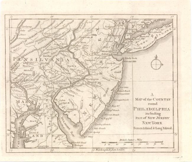
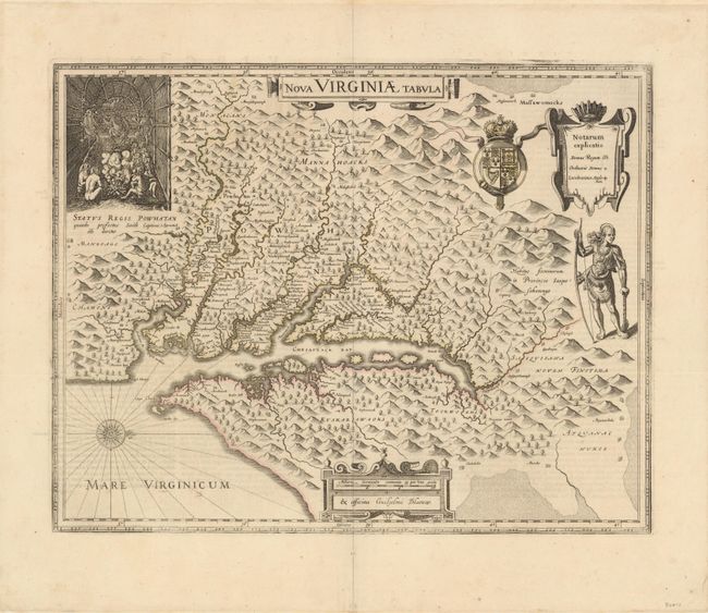
Auction 140, Lot 158
Subject: Colonial Mid-Atlantic
Anon.
A Map of the Country round Philadelphia Including Part of New Jersey New York Staten Island & Long Island, 1776
Size: 8.5 x 7 inches (21.6 x 17.8 cm)
Estimate: $180 - $220
Sold for: $120
Closed on 5/23/2012
228 lots
Page 1 of 5