Subject: New England
Period: 1900 (circa)
Publication:
Color: Printed Color
Size:
45 x 37.5 inches
114.3 x 95.3 cm
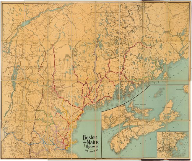
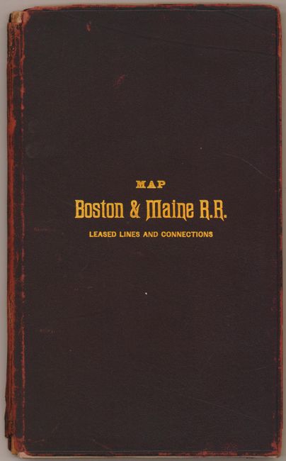
This uncommon pocket map details the railroad lines in Northern New England, covering the area from Boston north to Canada. The numerous lines and leased lines of the B&M Railroad are highlighted in color overprinting. At lower right are insets of New Brunswick, Nova Scotia and Prince Edward Island and one of downtown Boston. There is no advertising on the map or covers, suggesting that it was used by either company officials or station agents. The map is dissected and backed with original linen and folds into attractive brown leather covers entitled "Map Boston & Maine R.R. Leased Lines and Connections." Produced by the Rand Avery Supply Company.
References:
Condition: B+
The map is in very good condition with a few minor spots and abrasions. A few of the folds have archival tape on verso for reinforcement. Covers show some wear with the leather partially detached from the boards, and the spine has a few chips at top and bottom.