Subject: Colonial United States and Canada, Switzerland and Geology
Period: 1761 (published)
Publication:
Color: Black & White
Size:
12 x 10.5 inches
30.5 x 26.7 cm
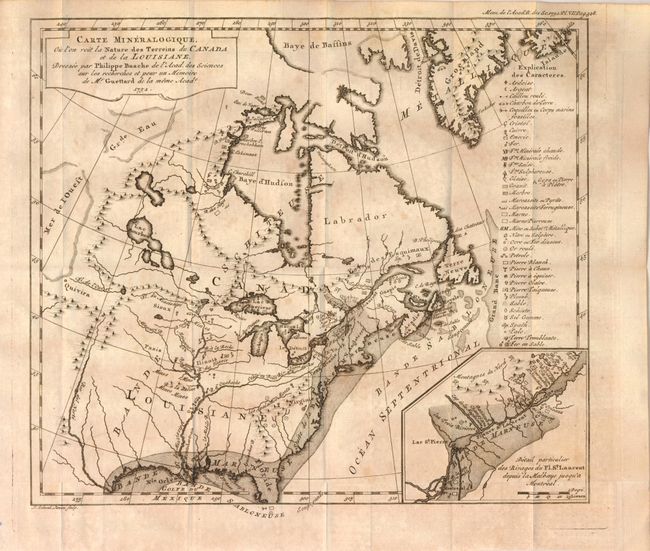
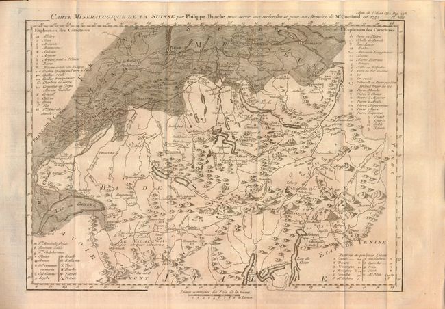
These two rare maps are still bound in the original Premiere Suite des Memoires de Mathematique et de Physique… Tome Second by Jean Ttienne Guettard. The first map represents Guettard's efforts to create the first geological map of North America. Drawn by Philippe Buache, the map has an ambitious legend identifying an amazing 39 different geological formations and types. The map also has interest for its inclusion of the cartographic curiosity Mer de l'Ouest (Sea of the West) that is shown as occupying part of western Canada. This imaginary feature appeared in a series of Buache's maps of North America and its derivatives, each showing the sea shrinking in size and prominence as continuing exploration failed to prove its existence. The inset map at lower right notes eight places containing fossils. The second map is Carte Mineralogique de la Suisse par Philippe Buache pour servir aux recherches et pour un Memoire de Mr. Guettard en 1572, (13 x 9.5"), uncolored. This map, also drawn by Buache, is the first geological map of Switzerland. It extends from Geneva in the southwest to Constance in the northeast. It identifies even more categories of geological formations than the map of North America, over fifty by our count.
The book (4" x 6.5'") also has four engraved plates depicting fossils including a fish and the tooth of a Mastodon. This volume is the 1761 Amsterdam reprint by Jean Etienne Guettard, J. Schreuder and Pierre Mortier. The first edition was published from Paris in 1756. Volume 2 (of 3) pp. 176 to 595. Hardbound in vellum covers. This rare volume is complete with all plates and both maps as issued. It represents a pioneering effort in early geology.
References: 1) Marcou No. 24
Condition: B+
Both maps have light, scattered foxing and mild toning. The covers have slight shelf wear and light scraping to lower front board. The hinges are sound and the binding is tight. The text and plates are lightly foxed and there is a library bookplate on the front pastedown and a library stamp on the first title page.