Subject: Colonial New England and Canada
Period: 1755 (dated)
Publication:
Color: Hand Color
Size:
21.3 x 17 inches
54.1 x 43.2 cm
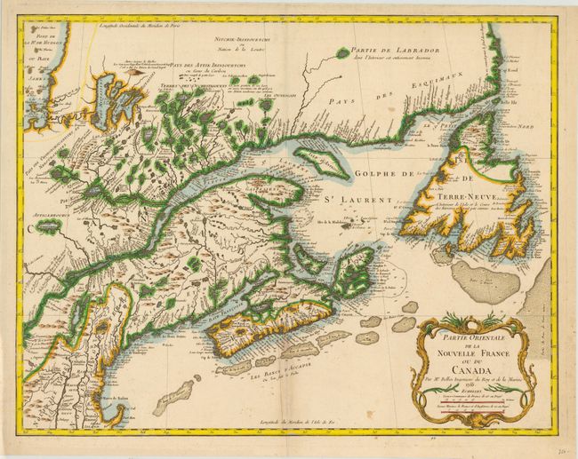
This is the final state of Bellin's definitive map of eastern Canada and New England showing the mouth of the St. Lawrence, the length of the river, the Maritime provinces and French claims in the region. There are some very interesting details of the coastal towns, showing Havre de Baston for Boston Harbor, up the coast to Portsmouth in New Hampshire, Wells, York and Cape Elizabeth in Maine. There is considerable information shown on the extent of French exploration in the region. In this state, Bellin updated the plate with changes to the Saint Lawrence River, Lake Ontario and Cape Code. A large decorative cartouche incorporates two distance scales.
References: Kershaw #689; McCorkle #745.1, Sellers and Van Ee #273.
Condition: B+
Watermarked paper with a couple of minor spots, few miniscule worm holes at top right, and a light damp stain with a couple of tiny tears along centerfold at bottom. Remnants of paper tape on verso.