Subject: Eastern United States & Canada
Period: 1561 (circa)
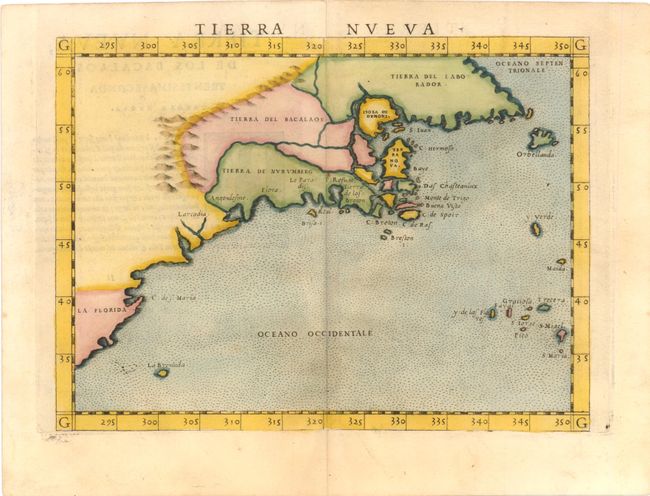
Publication: La Geografia di Claudio Tolomeo Allessadrino…
Color: Hand Color
Size:
9.5 x 7.1 inches
24.1 x 18 cm
This important early map devoted to the East Coast of North America is based on Giacomo Gastaldi's map of 1548, which combined data from the Verrazano and Cartier voyages. The cartography is unchanged, with the exception of the depiction of the Hudson and St. Lawrence Rivers (unnamed), which are shown connected upriver, a notion he borrowed from Ramusio. Engraved on copper by Giulio and Livio Sanuto in the unmistakable Italian style. This is the first state, with Italian text on verso, published in 1561 and 1564.
References: Burden #30; Kershaw #18a; McCorkle #561.2.
Condition: A
Watermarked paper with a few faint spots in ocean and marginal soiling.