Subject: Eastern United States
Period: 1863 (dated)
Publication:
Color: Black & White
Size:
27 x 23 inches
68.6 x 58.4 cm
The Office of Coast Survey is the oldest U.S. scientific organization, dating from 1807 when Congress directed that a "survey of the coast" be carried out. By 1836, it was called the U.S. Coast Survey and in 1878, the name was changed to the U.S. Coast and Geodetic Survey. Today the Office of Coast Survey is a division of the National Oceanic and Atmospheric Administration NOAA.
The survey teams, composed of civilians as well as Army and Naval officers, charted the nation's waterways and produced a wide array of reports, survey charts, hydrographic studies of tides and currents, astronomical studies and observations, and coastal pilots. These charts are an important record of the changing nature of the nation's coastlines. In additional to coastal charts, the U.S. Coast and Geodetic Survey produced land sketches, Civil War battle maps, and the early aeronautical charts.
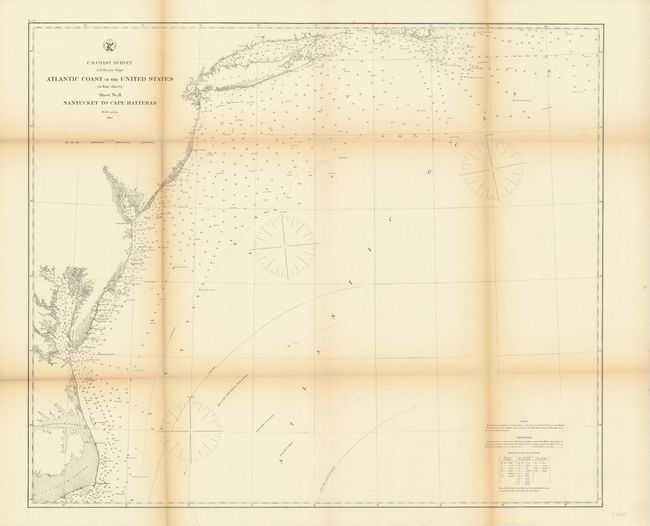
This is a map of the Atlantic coast from North Carolina to Massachusetts showing Nantucket Island, Martha's Vineyard, Long Island, Delaware Bay, most of the Chesapeake Bay, and Cape Hatteras off of Pamlico Sound. There is detailed information on soundings, locations of lighthouses and the Gulf Stream. This is sheet two from a four sheet set.
References:
Condition: B
There is some toning along the folds with two fold separations extending slightly into the image and a few small splits at fold intersections.