Subject: Eastern United States, Civil War
Period: 1861 (dated)
Publication:
Color: Printed Color
Size:
12.5 x 21.8 inches
31.8 x 55.4 cm
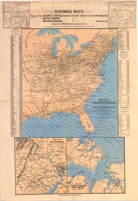
This rare Civil War broadside includes 5 maps and statistical information from the 1860 census. This sheet was designed to illustrate the theater of the war that was engulfing the nation and to highlight the recent major battlefields. The largest map, Map of the Atlantic States, Showing 50 Mile Distances from Washington, is centered on Washington DC and shows 50 mile distances in concentric circles from the capital. Existing and proposed railroads are noted, along with forts. The smaller maps at top and bottom include Map of the Battle Ground [at Manassas], Showing 5 Mile Distances from Washington, Map of Fortress Monroe, Showing 1 Mile Distances from the Fortress, Position of Forces at Bull Run and Fortress Monroe. This is one of Prang’s earliest war maps, issued just months after the start of the war. It was distributed by J. Haven, Prang’s agent in New England.
Louis Prang, a lithographer in Boston, became well-known for his Civil War maps. Prang used a clever marketing program to promote his maps. They were distributed at newsstands or as a premium for newspaper subscribers and accompanied by red and blue colored pencils with which the user could plot the progress of the armies. Due to their ephemeral nature, these maps are quite rare today especially in good condition. There are no listings of this map being for sale in the last 30 years.
References: Stephenson #15; Rumsey #5440.000.
Condition: B
There are two tiny holes in the map image and a number of edge tears, mostly at top that have been closed on verso with archival tape. The map is lightly toned, has an extraneous crease that does not distract, and a few small stains.