Subject: United States
Period: 1854 (circa)
Publication:
Color: Hand Color
Size:
27 x 20.5 inches
68.6 x 52.1 cm
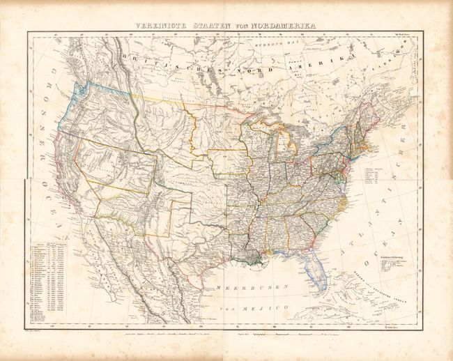
This large, detailed map of the United States extends to include part of Canada and Mexico, although information is focused on the United States. The map provided an excellent view of the American West with five large territories encompassing almost the entire west, shown to be mostly the domain of numerous Indian nations. Minosotah Territory takes in the Dakotas with Missouri Territory stretching to the Rocky Mountains. Indian Territory encompasses present day Oklahoma, Kansas and Nebraska. West of the Rockies are the state of California and the territories of New Mexico, Utah and Oregon, which encompasses present-day Washington, Idaho and Oregon. The border with Mexico is shown along the Gila River, pre Gadsden Purchase. The map depicts towns, missions, forts, railroads, and canals, and includes a list of the highest mountain peaks. A table lists the states and territories, with populations in 1840, number of counties, and size. Lithography by Handtke. Printed on four sheets joined.
References:
Condition: B
Wide margins with light, scattered foxing and toning in far blank margins.