Subject: Eastern Canada & United States
Period: 1840 (published)
Publication: Blackwoods Magazine
Color: Black & White
Size:
10.5 x 12.3 inches
26.7 x 31.2 cm
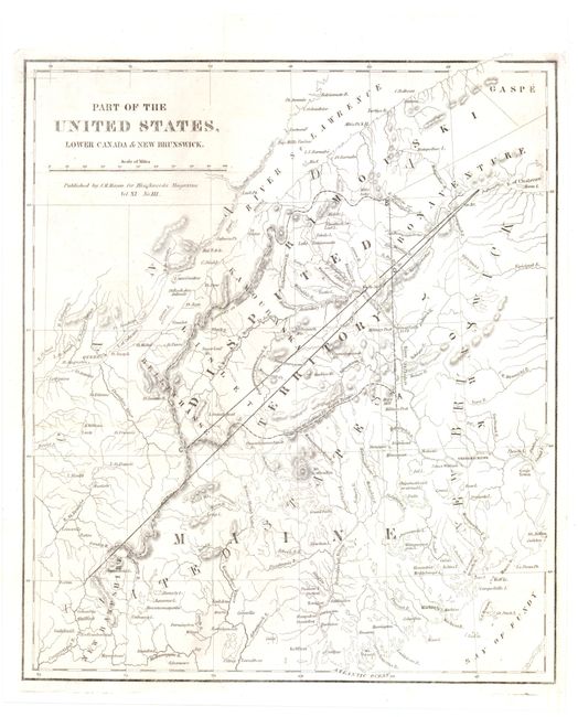
This interesting map focuses on the Maine boundary dispute between the United States and Great Britain. The dispute was settled during the Aroostook War, a nonviolent confrontation that ended in 1842 with the Webster-Ashburton Treaty of Washington. The map depicts the topography of the land with the "Disputed Territory" well delineated. Adapted from an 1832 map by the Society for the Diffusion of Useful Knowledge, North America Sheet II Lower Canada and New Brunswick with Part of New York, Vermont and Maine. Published by J. M. Mason for Blackwoods Magazine.
References:
Condition: B+
Issued folding, now pressed, with faint offsetting and some minute worm holes only visible when held to light. There is an archivally repaired fold separation in top blank margin.