Subject: United States
Period: 1822 (dated)
Publication: Traveller's Directory through the United States
Color: Black & White
Size:
19.5 x 16 inches
49.5 x 40.6 cm
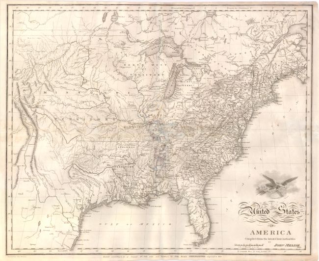
This map of the United States extends west to the Rocky Mountains and provides a detailed view of the Missouri River based on information from the expeditions of Lewis & Clark, Pike, Humboldt and others. A notation at the western edge of the map shows where "Clarks Canoes stop 3000 miles from the Mississippi." The Missouri Territory takes in the entire northern plains region from the Mississippi to the Rocky Mountains. The new state of Missouri is presented with preliminary boundaries and Arkansas is at its largest extent. Today's Minnesota and Wisconsin are here a part of North West Territory. In Texas there are a few place names including Ft. Matagorda, but Galveston is poorly located. There is good detail throughout including towns and villages, Indian place names, roads and trails, forts and watershed. Above the script title is a vignette of an eagle carrying a shield emblazoned with the stars and stripes. The genesis for this map, which was engraved by Samuel Harrison, is Melish's 1812 pocket map. First issued in 1818, the map is dated under the title 1820, with a note that it has been Improved to 1822.
References: Wheat (TMW) #327.
Condition: C+
Uncolored as issued with a printer's crease from Ohio to Florida. Issued folding, now flattened with archival repairs and some small abrasions along folds. Stains along the folds have been lightened with pastel.