Filtered by Category:United States(Show All Categories)
Showing results for:Auction 138
Catalog Archive
236 lots
Page 1 of 5
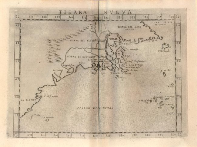
Auction 138, Lot 132
Subject: United States and Canada
Ruscelli, Girolamo
Tierra Nueva, 1574
Size: 9.5 x 7 inches (24.1 x 17.8 cm)
Estimate: $1,000 - $1,300
Sold for: $750
Closed on 12/7/2011
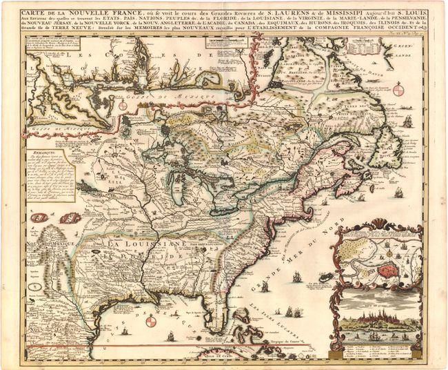
Auction 138, Lot 133
Subject: Colonial United States and Canada
Chatelain, Henry Abraham
Carte de la Nouvelle France, ou se voit le cours des Grandes Rivieres de S. Laurens & de Mississipi Aujour d'hui S. Louis, Aux Environs des-quelles se trouvent les Etats, Pais, Nations, Peuples &c., 1719
Size: 19 x 16.5 inches (48.3 x 41.9 cm)
Estimate: $2,500 - $3,250
Sold for: $1,900
Closed on 12/7/2011
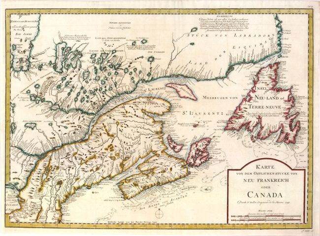
Auction 138, Lot 134
Subject: Colonial United States & Canada
Bellin, Jacques Nicolas
Karte von dem Ostlichen-Stucke von Neu Frankreich oder Canada, 1744
Size: 21.8 x 15.8 inches (55.4 x 40.1 cm)
Estimate: $400 - $500
Unsold
Closed on 12/7/2011
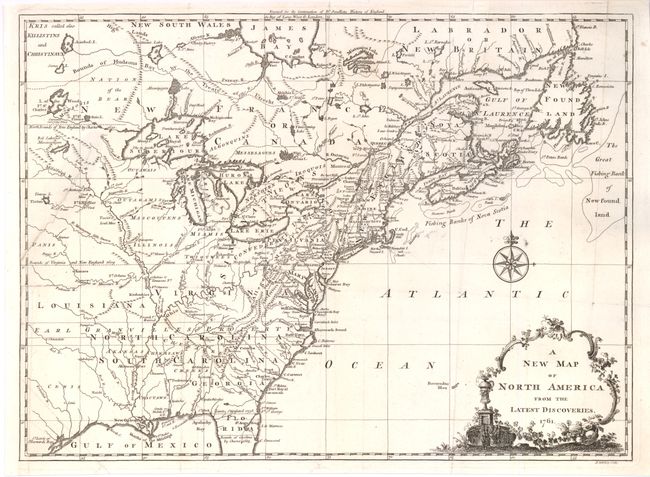
Auction 138, Lot 135
Subject: Colonial United States and Canada
Spilsbury, J.
A New Map of North America from the Latest Discoveries, 1761
Size: 14.75 x 10.9 inches (37.5 x 27.7 cm)
Estimate: $275 - $350
Sold for: $300
Closed on 12/7/2011
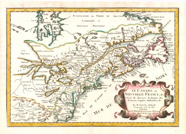
Auction 138, Lot 136
Subject: Colonial United States and Canada - Great Lakes
Sanson/Mariette
Le Canada, ou Nouvelle France, &c. Tiree de Diverses Relations des Francois, Anglois, Hollandois, &c., 1662
Size: 12.3 x 8.3 inches (31.2 x 21.1 cm)
Estimate: $850 - $950
Small Version of a Keystone Map for Great Lakes Collections
Sold for: $600
Closed on 12/7/2011
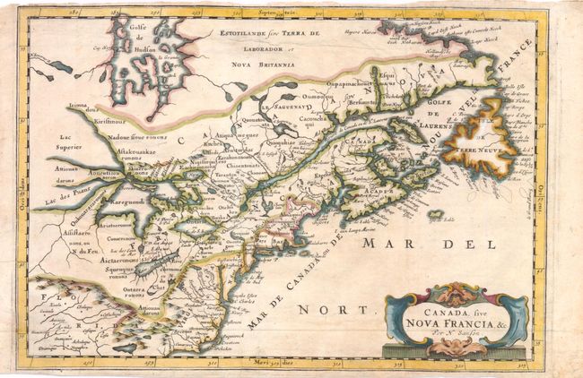
Auction 138, Lot 137
Subject: Colonial United States and Canada - Great Lakes
Sanson, Nicolas
Canada, sive Nova Francia, &c., 1679
Size: 12 x 8.3 inches (30.5 x 21.1 cm)
Estimate: $500 - $650
Small Version of a Keystone Map for Great Lakes Collections
Sold for: $425
Closed on 12/7/2011
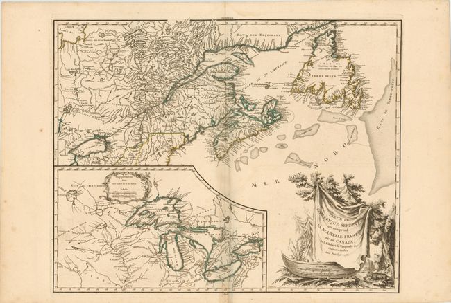
Auction 138, Lot 138
Subject: Colonial United States and Canada - Great Lakes
Robert de Vaugondy
Partie de l'Amerique Septent? qui comprend la Nouvelle France ou le Canada, 1755
Size: 23.5 x 18.8 inches (59.7 x 47.8 cm)
Estimate: $600 - $700
Sold for: $450
Closed on 12/7/2011
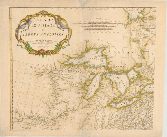
Auction 138, Lot 139
Subject: Colonial Great Lakes
Anville, Jean Baptiste Bourguignon d'
Canada Louisiane et Terres Angloises, 1755
Size: 22.3 x 18.8 inches (56.6 x 47.8 cm)
Estimate: $900 - $1,100
Sold for: $475
Closed on 12/7/2011
Auction 138, Lot 140
Subject: Colonial Northeast and Quebec
Sayer & Bennett
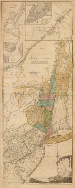
The Provinces of New York, and New Jersey; with Part of Pensilvania, and the Province of Quebec. Drawn by Major Holland…, 1776
Size: 20.5 x 53 inches (52.1 x 134.6 cm)
Estimate: $5,500 - $6,500
Thomas Jefferys' Important Revolutionary War Period Map
Unsold
Closed on 12/7/2011
Auction 138, Lot 141
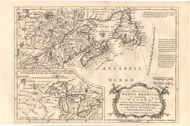
Subject: Canada & United States
Barrow, John (Sir)
Part of North America; Containing Canada, the North Parts of New England and New York; with Nova Scotia and Newfound Land, 1759
Size: 11.5 x 8 inches (29.2 x 20.3 cm)
Estimate: $200 - $300
Sold for: $120
Closed on 12/7/2011
Auction 138, Lot 142
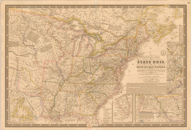
Subject: Canada & United States
Brue, Adrien Hubert
Nouvelle Carte des Etats-Unis, du Haut et Bas-Canada, de la Nouvle. Ecosse, du Nouvau. Brunswick, de Terre-Neuve &c., 1832
Size: 36.8 x 24.8 inches (93.5 x 63 cm)
Estimate: $500 - $600
Sold for: $325
Closed on 12/7/2011
Auction 138, Lot 143
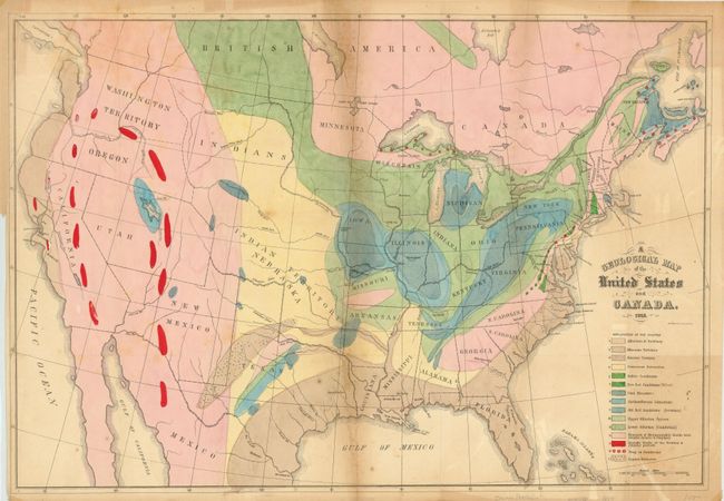
Subject: Canada & United States
Hitchcock, Edward
A Geological Map of the United States and Canada, 1853
Size: 24.3 x 16.5 inches (61.7 x 41.9 cm)
Estimate: $400 - $500
Sold for: $475
Closed on 12/7/2011
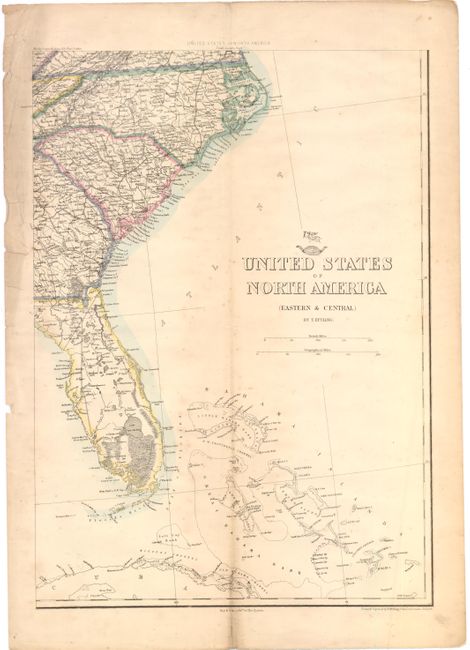
Auction 138, Lot 144
Subject: Canada & United States
Ettling, Theodor
[Lot of 2] [On 4 Sheets] United States of North America [and] Upper Canada, 1855-80
Size: See Description
Estimate: $220 - $300
Unsold
Closed on 12/7/2011
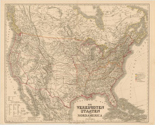
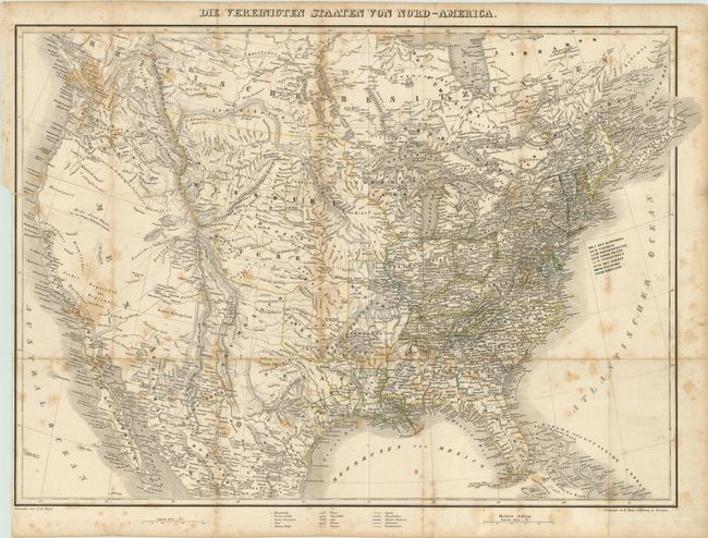
Auction 138, Lot 145
Subject: Canada & United States
Kiepert, Heinrich C.
Die Vereinigten Staaten von Nord America nebst Canada, 1858
Size: 25.3 x 20.8 inches (64.3 x 52.8 cm)
Estimate: $200 - $240
Sold for: $120
Closed on 12/7/2011
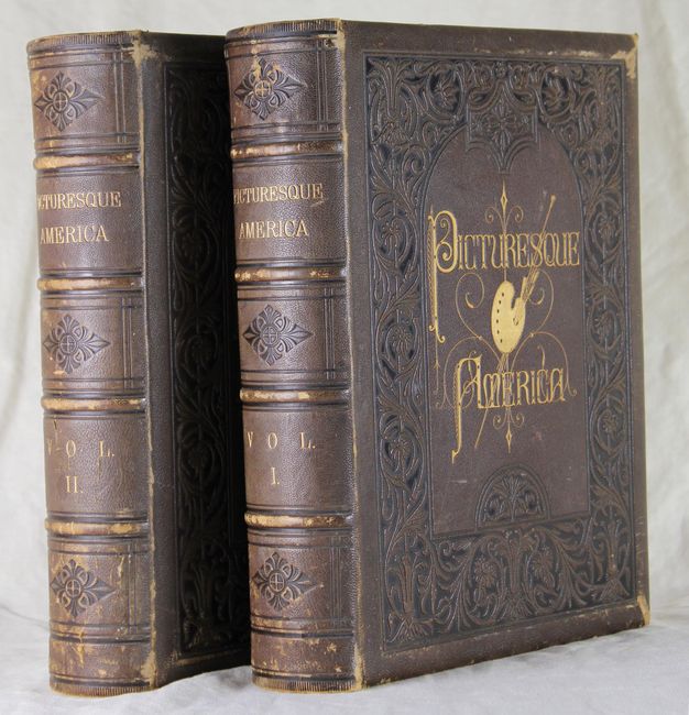
Auction 138, Lot 146
Subject: Canada & United States
Bryant, William C.
[2 Volumes] Picturesque America; or, the Land we Live in…, 1872-74
Size: 10.5 x 13 inches (26.7 x 33 cm)
Estimate: $400 - $500
Sold for: $375
Closed on 12/7/2011
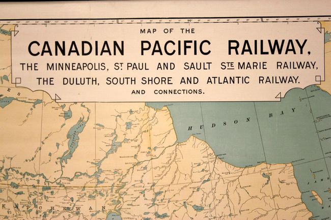
Auction 138, Lot 147
Subject: Canada & United States, Railroads
Poole Bros.
Map of the Canadian Pacific Railway…, 1902
Size: 58 x 32 inches (147.3 x 81.3 cm)
Estimate: $300 - $400
Sold for: $200
Closed on 12/7/2011
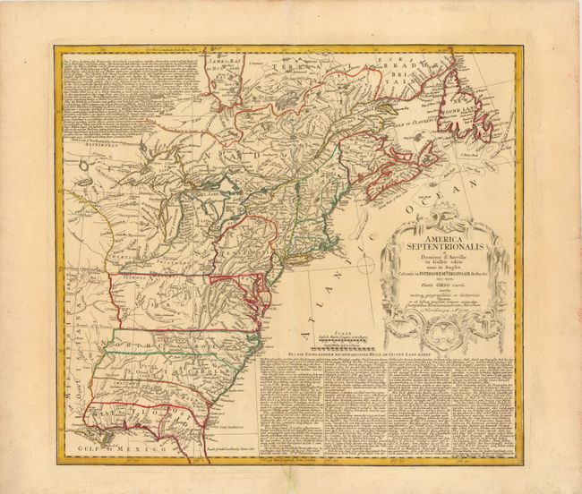
Auction 138, Lot 148
Subject: Eastern Colonial United States & Canada
Homann Heirs
America Septentrionalis a Domino d'Anville in Galliis Edita nunc in Anglia Coloniis in Interiorem Virginiam Deductis nec non Fluvii Ohio Cursu…, 1777
Size: 20 x 18 inches (50.8 x 45.7 cm)
Estimate: $750 - $900
Unsold
Closed on 12/7/2011
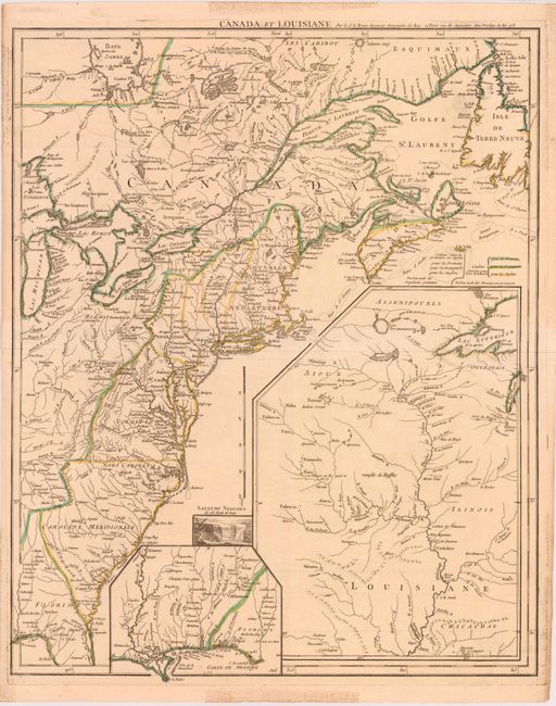
Auction 138, Lot 149
Subject: Eastern Colonial United States and Canada
Le Rouge, George Louis
Canada et Louisiane, 1755
Size: 19.8 x 24.3 inches (50.3 x 61.7 cm)
Estimate: $2,200 - $3,000
Unsold
Closed on 12/7/2011
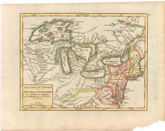
Auction 138, Lot 150
Subject: Eastern Canada & United States - Great Lakes
Robert de Vaugondy, Didier
Les Lacs du Canada et Nouvelle Angleterre, 1749
Size: 8.5 x 6.5 inches (21.6 x 16.5 cm)
Estimate: $275 - $350
Sold for: $240
Closed on 12/7/2011
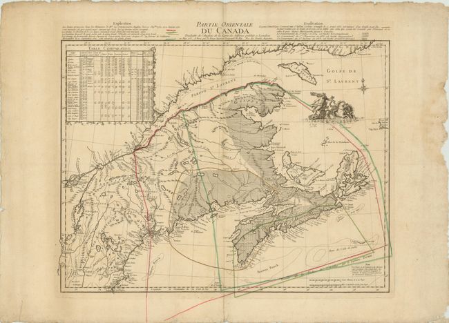
Auction 138, Lot 151
Subject: Eastern Canada & United States
Le Rouge, George Louis
Partie Orientale du Canada Traduitte de l'Anglois de la Carte de Jefferys …, 1762
Size: 23.5 x 19.5 inches (59.7 x 49.5 cm)
Estimate: $1,000 - $1,300
Unsold
Closed on 12/7/2011
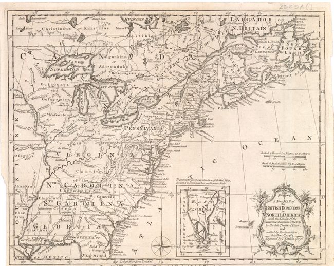
Auction 138, Lot 152
Subject: Eastern Colonial United States and Canada
Kitchin, Thomas
A New Map of the British Dominions in North America; with the Limits of the Governments Annexed thereto by the Late Treaty of Peace, and Settled by Proclamation, October 7th, 1763, 1763
Size: 12 x 9.8 inches (30.5 x 24.9 cm)
Estimate: $375 - $450
Sold for: $225
Closed on 12/7/2011
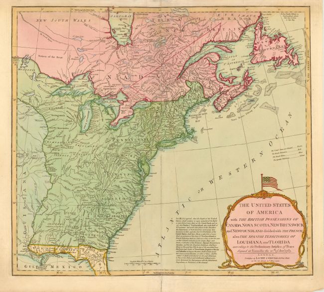
Auction 138, Lot 153
Subject: Eastern Canada & United States
Laurie & Whittle
The United States of America with the British Possessions of Canada, Nova Scotia, New Brunswick and Newfoundland Divided with the French, also the Spanish Territories of Louisiana and Florida According to the Preliminary Articles of Peace…, 1794
Size: 19.8 x 18 inches (50.3 x 45.7 cm)
Estimate: $1,000 - $1,200
Unsold
Closed on 12/7/2011
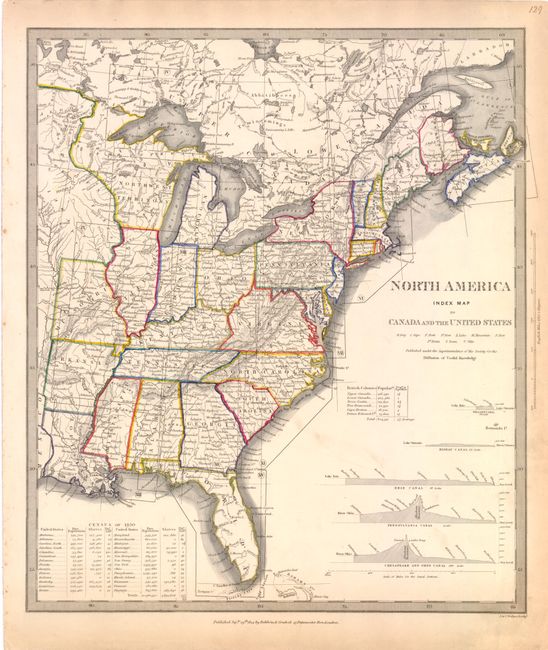
Auction 138, Lot 154
Subject: Eastern Canada & United States
SDUK Society for the Diffusion of Useful Knowledge
[Lot of 15 - North America], 1832-45
Size: 12 x 15 inches (30.5 x 38.1 cm)
Estimate: $900 - $1,200
Sold for: $3,250
Closed on 12/7/2011
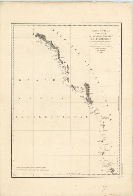
Auction 138, Lot 155
Subject: Western Canada & United States
La Perouse, Comte Jean F. Galoup, de
Carte Generale d'une Partie de la Cote du Nord-Ouest de l'Amerique reconnue par les Fregates Francaises la Boussole et l'Astrolabe, 1797
Size: 19.5 x 27 inches (49.5 x 68.6 cm)
Estimate: $250 - $300
Sold for: $190
Closed on 12/7/2011
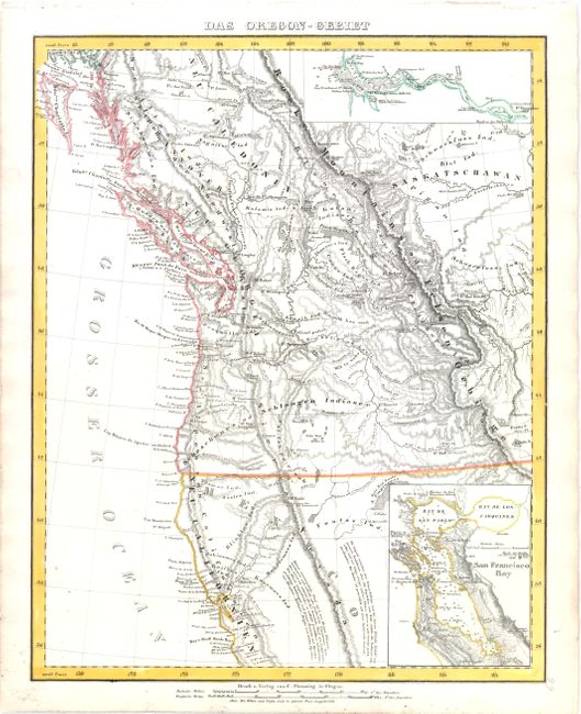
Auction 138, Lot 157
Subject: Western Canada & United States
Flemming, Carl
Das Oregon-Gebiet, 1848
Size: 12.5 x 15.5 inches (31.8 x 39.4 cm)
Estimate: $250 - $325
Sold for: $190
Closed on 12/7/2011
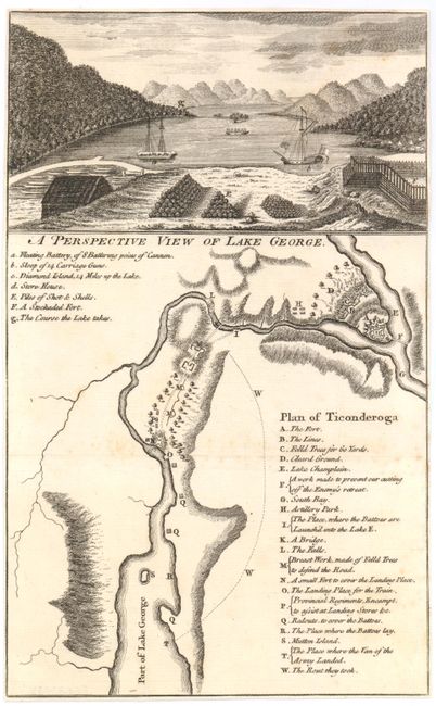
Auction 138, Lot 158
Subject: New York, United States & Quebec, Canada
[Lot of 3] Plan of Ticonderoga [and] A Particular Map, to Illustrate Gen. Amhersts, Expedition, to Montreal… [and] A Map of the Country between Crown Point and Fort Edward, 1759-60
Size: 4.5 x 7.5 inches (11.4 x 19.1 cm)
Estimate: $550 - $750
Sold for: $400
Closed on 12/7/2011
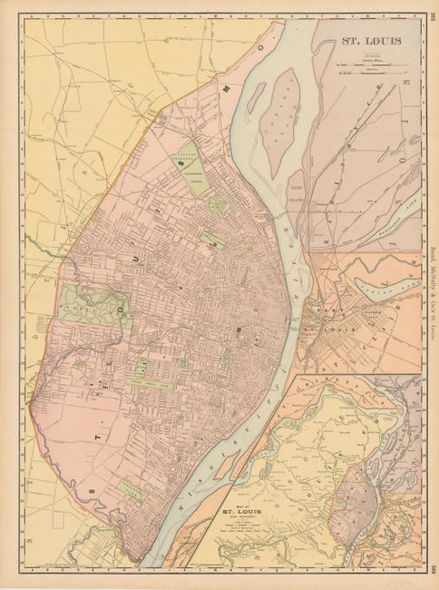
Auction 138, Lot 159
Subject: United States and Canadian Cities
[Lot of 7] St. Louis [and] Montreal [and] Toledo [and] Milwaukee [and] Cincinnati [and] Louisville [and] Colton's City of Baltimore, 1855-98
Size: See Description
Estimate: $250 - $325
Unsold
Closed on 12/7/2011
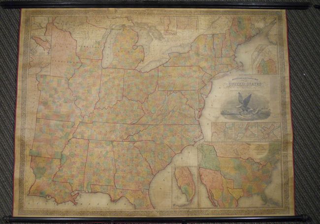
Auction 138, Lot 160
Subject: United States, Republic of Texas
Mitchell, Samuel Augustus
Mitchell's Reference & Distance Map of the United States, 1844
Size: 67 x 52.5 inches (170.2 x 133.4 cm)
Estimate: $6,000 - $8,000
Exceptional Wall Map Featuring the Independent Republic of Texas - 1844
Sold for: $3,000
Closed on 12/7/2011
Auction 138, Lot 161
Subject: United States, Republic of Texas
Bromme, Traugott
Die Vereinigten Staaten von Nord-America, 1843
Size: 25.2 x 18.5 inches (64 x 47 cm)
Estimate: $900 - $1,250
Sold for: $650
Closed on 12/7/2011
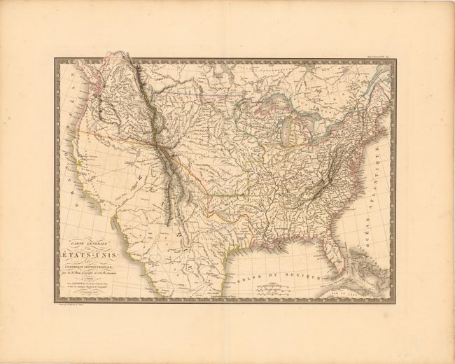
Auction 138, Lot 162
Subject: United States
Brue, Adrien Hubert
Carte Generale des Etats-Unis de l'Amerique Septentrionale, 1820
Size: 19.8 x 14.3 inches (50.3 x 36.3 cm)
Estimate: $375 - $450
Sold for: $250
Closed on 12/7/2011
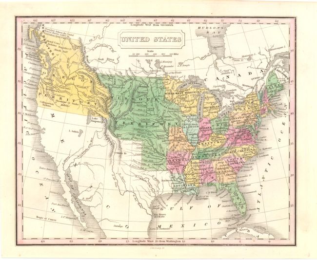
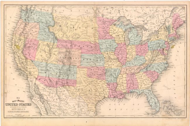
Auction 138, Lot 163
Subject: United States
Young, James H.
United States, 1830
Size: 9.8 x 8 inches (24.9 x 20.3 cm)
Estimate: $170 - $220
Sold for: $100
Closed on 12/7/2011
Auction 138, Lot 164
Subject: United States
Whitney, Asa
[Map of Proposed Routes of Western Railroads], 1846
Size: 15.8 x 9.5 inches (40.1 x 24.1 cm)
Estimate: $160 - $200
Sold for: $150
Closed on 12/7/2011
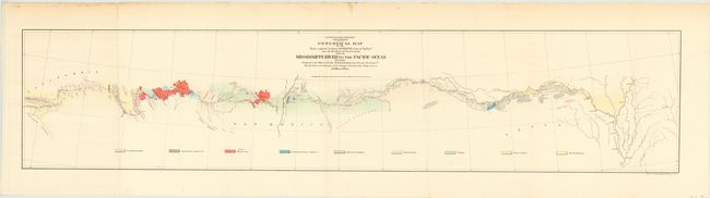
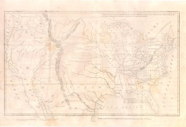
Auction 138, Lot 165
Subject: United States
Whipple, Amiel Weekes
Geological Map of the Route explored by Lt. A.W. Whipple…From the Mississippi River to the Pacific Ocean 1853-1854, 1854
Size: 36.5 x 8 inches (92.7 x 20.3 cm)
Estimate: $140 - $170
Sold for: $250
Closed on 12/7/2011
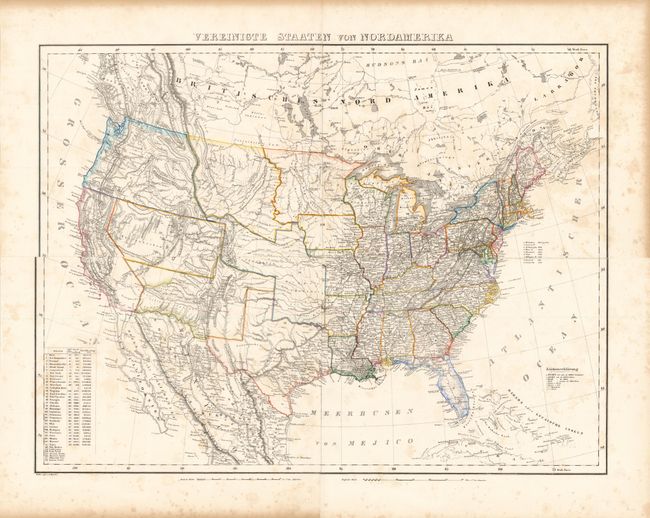
Auction 138, Lot 166
Subject: United States
Flemming, Carl
Vereinigte Staaten von Nordamerika, 1854
Size: 27 x 20.5 inches (68.6 x 52.1 cm)
Estimate: $350 - $450
Unsold
Closed on 12/7/2011
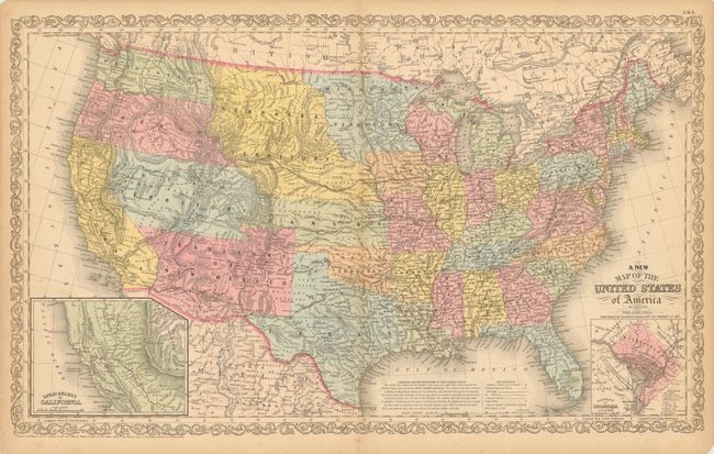
Auction 138, Lot 167
Subject: United States
Desilver, Charles
A New Map of the United States of America by J.H. Young, 1857
Size: 26.3 x 16 inches (66.8 x 40.6 cm)
Estimate: $300 - $400
Desilver's United States
Unsold
Closed on 12/7/2011
Auction 138, Lot 168
Subject: United States
Mitchell, Samuel Augustus
No. 5 Map of the United States, 1858
Size: 17.5 x 10.8 inches (44.5 x 27.4 cm)
Estimate: $150 - $180
Sold for: $110
Closed on 12/7/2011
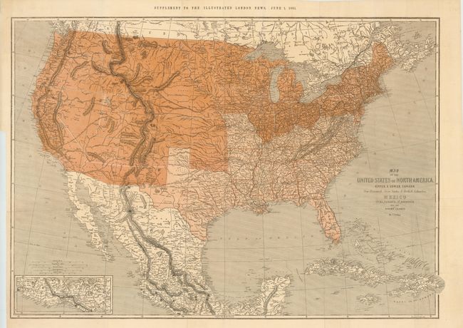
Auction 138, Lot 169
Subject: United States
Ettling, Theodor
Map of the United States of North America, Upper & Lower Canada New Brunswick, Nova Scotia & British Columbia. Mexico Cuba, Jamaica, St. Domingo and the Bahama Islands, 1861
Size: 36.8 x 26 inches (93.5 x 66 cm)
Estimate: $375 - $475
Great Civil War Period Map of the United States
Sold for: $275
Closed on 12/7/2011
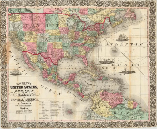
Auction 138, Lot 170
Subject: United States
Map of the United States, Canada, Mexico and the West Indies with Central America…, 1863
Size: 27 x 22 inches (68.6 x 55.9 cm)
Estimate: $800 - $1,000
Unsold
Closed on 12/7/2011
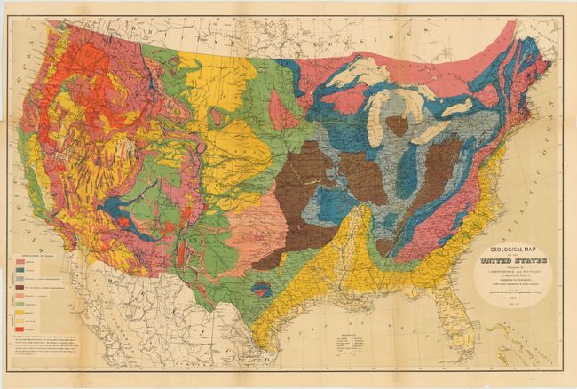
Auction 138, Lot 171
Subject: United States
Hitchcock, Charles Henry
Geological Map of the United States compiled by C.H. Hitchcock and W. P. Blake…, 1873
Size: 33.5 x 21.5 inches (85.1 x 54.6 cm)
Estimate: $275 - $350
Sold for: $650
Closed on 12/7/2011
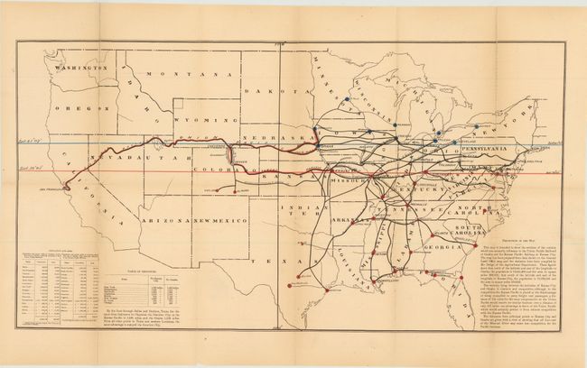
Auction 138, Lot 172
Subject: United States
Anon.
[Untitled - Map of the Pacific Railroads with Speech by Senator Allen Thurman], 1878
Size: 23.5 x 12.5 inches (59.7 x 31.8 cm)
Estimate: $200 - $250
Sold for: $100
Closed on 12/7/2011
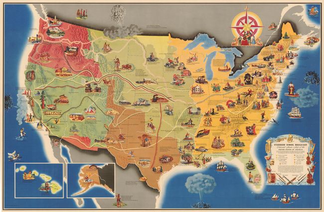
Auction 138, Lot 173
Subject: United States
Standard School Broadcast Pictorial Music - Map of the United States of America…, 1949
Size: 40 x 26 inches (101.6 x 66 cm)
Estimate: $400 - $500
Unusual Thematic Map of the United States
Sold for: $425
Closed on 12/7/2011
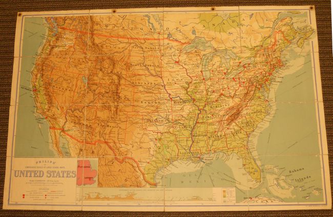
Auction 138, Lot 174
Subject: United States
Philip, George
Philips' Comparative Series of Large School Maps. United States, 1905
Size: 70 x 44.3 inches (177.8 x 112.5 cm)
Estimate: $220 - $275
Unsold
Closed on 12/7/2011
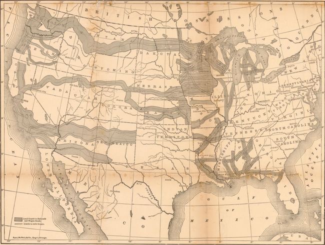
Auction 138, Lot 175
Subject: United States, Railroads
Rand McNally & Co.
How the Public Domain Has Been Squandered…, 1884
Size: 15.5 x 20.5 inches (39.4 x 52.1 cm)
Estimate: $750 - $900
Superb Example of Political Propaganda and Thematic Mapping
Sold for: $450
Closed on 12/7/2011
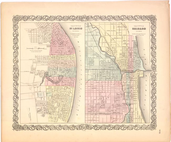
Auction 138, Lot 176
Subject: Chicago, St. Louis, Cincinnati
[Lot of 2] The City of St. Louis Missouri [on sheet with] The City of Chicago Illinois [and] Plan of Cincinnati and Vicinity, 1855-60
Size: See Description
Estimate: $100 - $130
Sold for: $50
Closed on 12/7/2011
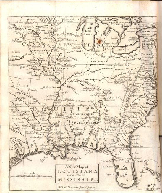
Auction 138, Lot 177
Subject: Colonial United States
Anon.
A New Map of Louisiana and the River Mississipi [within book] The Memoirs and Secret Negotiations of John Ker, 1726
Size: 9 x 10.2 inches (22.9 x 25.9 cm)
Estimate: $800 - $1,000
Sold for: $500
Closed on 12/7/2011
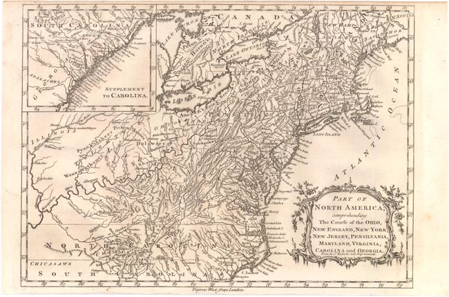
Auction 138, Lot 178
Subject: Colonial Eastern United States
Barrow, John (Sir)
Part of North America; Comprehending the Course of the Ohio, New England, New York, New Jersey, Pensilvania, Maryland, Virginia, Carolina and Georgia., 1760
Size: 11.8 x 8.5 inches (30 x 21.6 cm)
Estimate: $300 - $400
Sold for: $150
Closed on 12/7/2011
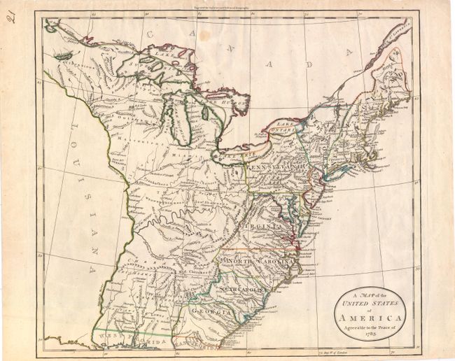
Auction 138, Lot 179
Subject: Eastern United States
Guthrie, William
A Map of the United States of America Agreeable to the Peace of 1783, 1783
Size: 15.5 x 13.8 inches (39.4 x 35.1 cm)
Estimate: $600 - $750
Sold for: $350
Closed on 12/7/2011
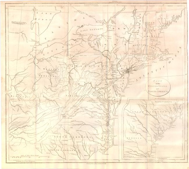
Auction 138, Lot 180
Subject: Eastern United States
Stockdale, John
Part of the United States of North America, 1798
Size: 18.3 x 16 inches (46.5 x 40.6 cm)
Estimate: $300 - $400
Sold for: $200
Closed on 12/7/2011
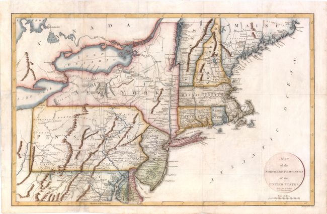
Auction 138, Lot 181
Subject: Eastern United States
Russell, John C.
Map of the Northern Provinces of the United States, 1799
Size: 20 x 12.5 inches (50.8 x 31.8 cm)
Estimate: $400 - $500
Unsold
Closed on 12/7/2011
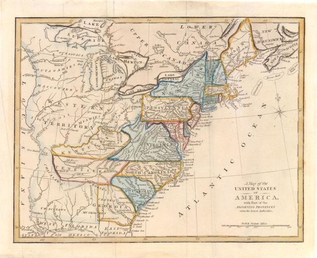
Auction 138, Lot 182
Subject: Eastern United States
Anon.
A Map of the United States of America, with Part of the Adjoining Provinces from the Latest Authorities, 1810
Size: 10.8 x 8.5 inches (27.4 x 21.6 cm)
Estimate: $160 - $200
Sold for: $120
Closed on 12/7/2011
236 lots
Page 1 of 5