Subject: Eastern Colonial United States and Canada
Period: 1755 (dated)
Publication:
Color: Hand Color
Size:
19.8 x 24.3 inches
50.3 x 61.7 cm
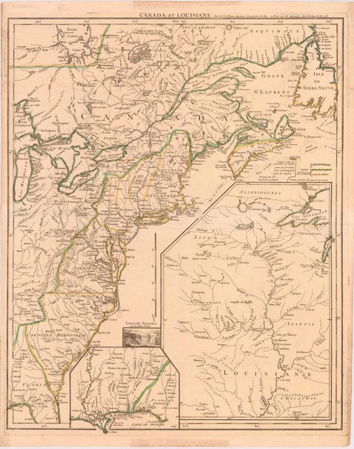
This important map was issued at the outbreak of hostilities in the French and Indian War. The detailed map depicts the entire eastern seaboard from northern Florida to the Strait of Belle Isle, and the Great Lakes region up to Lake Michigan and eastern Lake Superior. The American interests of France, England and Spain are shown in great detail and color-coded. Fort Duquesne is shown in two different places on the map - according to D’Anville and also to Jefferys. A large inset shows the upper Mississippi River valley with the important frontier forts. A smaller inset shows the lower Mississippi and Gulf Coast. A small vignette of Niagara Falls adds further interest to this fascinating map. This is the first state of four. The later issues have revised titles.
References: McCorkle #755.23; Sellers and Van Ee #33.
Condition: A
Original outline color on watermarked paper. There are some stains confined to blank margins caused by tape on verso, which has since been removed.