Subject: Canada & United States
Period: 1855-80 (circa)
Publication: Weekly Dispatch Atlas
Color: Hand Color
The Weekly Dispatch Atlas was published in monthly segments for subscribers of the Weekly Dispatch newspaper. The monthly editions eventually grew to include maps covering most of the known world. Published in various editions from 1855 through the early 1880s. Each map has the Dispatch Atlas seal above the title or in the margin.
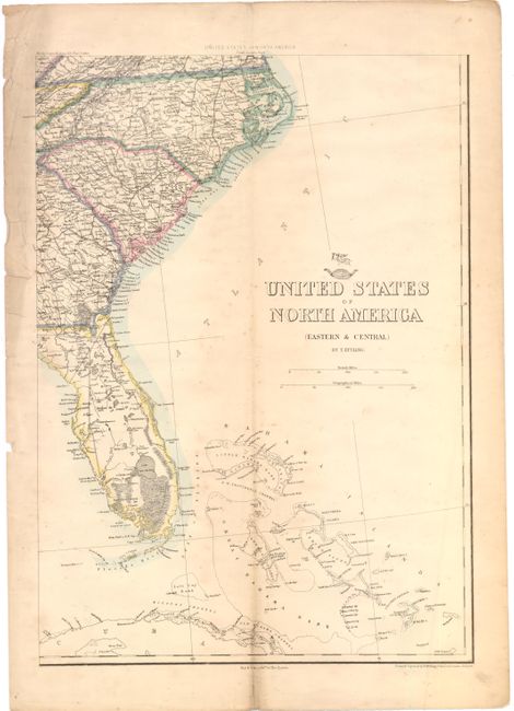
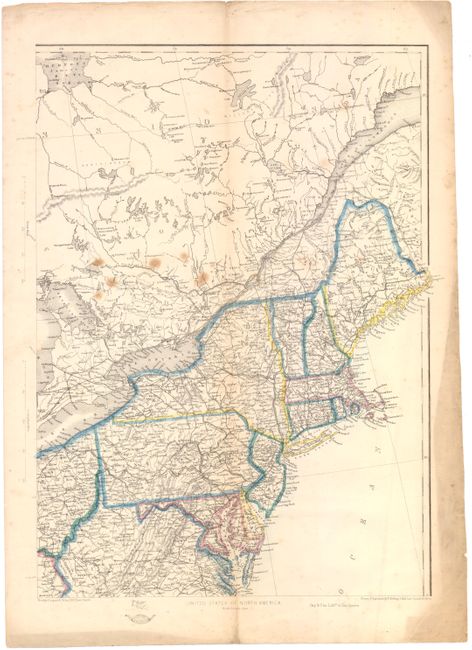
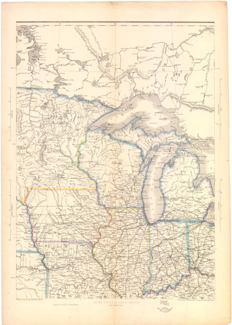
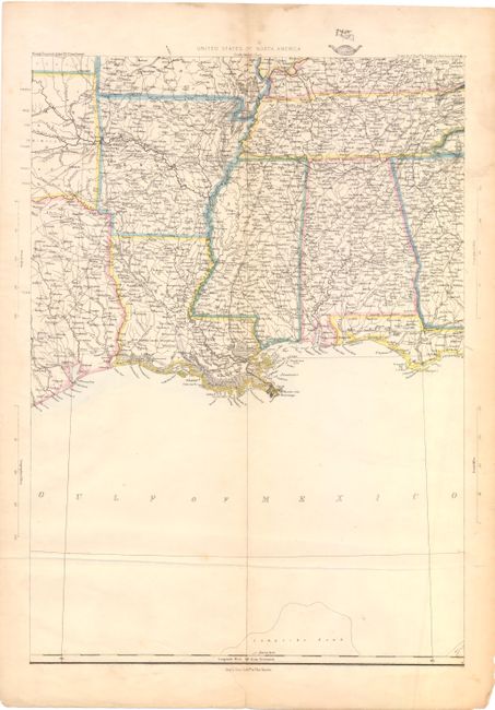
A. [On 4 Sheets] United States of North America. Each sheet measures 12" x 17.3". These are four sheets of a six-sheet map showing the westward growth of the emerging states and territories just before and during the Civil War. The maps cover the region from the eastern seaboard to the eastern portions of Texas, Oklahoma (Indian Territory), Kansas (Kanzas), Missouri and Minnesota territory. The sheets are as follows:
1) South Eastern Sheet shows the Carolinas, a portion of Georgia and most of Florida with some of the Caribbean islands noted. Condition: Toning along a vertical crease, with soiling in left margin just entering map image and a few short tears that do not enter map image. (B)
2) North Eastern Sheet depicts the eastern portion of the U.S. from Maine to Virginia, and including the St. Lawrence River and a portion of Canada. Condition: Several spots in map image, with faint toning along a vertical crease, and short fold separations in top and bottom blank margins far from map image. Toning in blank margins. (B)
3) North Central Sheet is focused on the Midwest region including Michigan, Wisconsin, Illinois, Ohio, Iowa and a portion of Missouri and Minnesota. Condition: Two short fold separations in top and bottom blank margin, far from map image, and marginal soiling. (B+)
4) South Central Sheet describes the area from the Gulf Coast to Arkansas and Tennessee. Condition: Two tears in blank margins at bottom and right have been closed on verso with archival tape. There is some soiling in blank margins and two light creases. (B+)
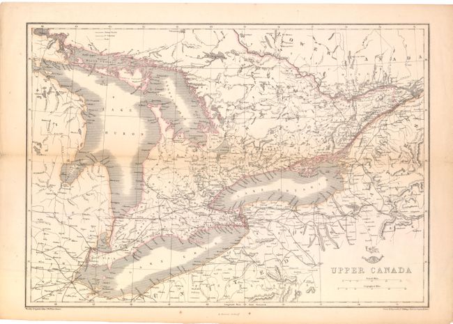
B. Upper Canada, (17.3" X 12"). This map covers the eastern Great Lakes region, including Lake Huron, Lake Erie and Lake Ontario, with parts of Michigan, New York, Ontario and Quebec. A legend at top identifies roads and finished and unfinished railroads. Condition: Lightly toned along a horizontal fold and in blank margins, with fold separations at right and left that do not enter map image. (B+)
References:
Condition:
All maps have original outline color. See description for additional details.