Subject: Canada & United States
Period: 1858 (dated)
Publication:
Color: Hand Color
Size:
25.3 x 20.8 inches
64.3 x 52.8 cm
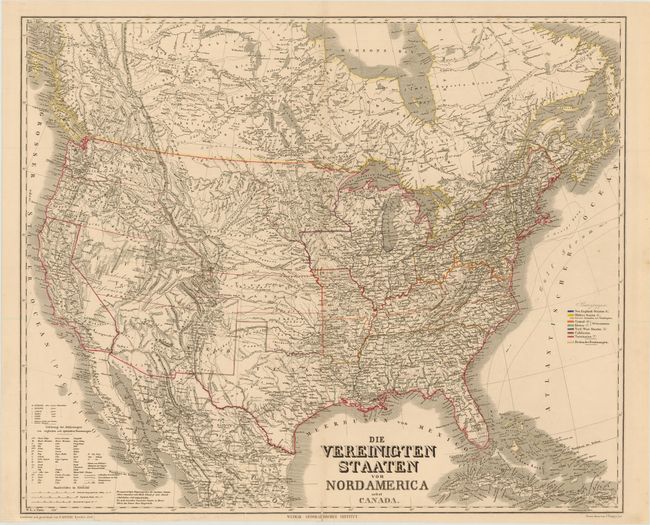
This large and very detailed German map covers the United States with parts of Canada and Mexico. There is superb detail of the railroads, emigrant roads and the locations of Indian tribes. This map was issued just prior to the Civil War, and shows state and territory boundaries, with a colored legend identifying regional divisions, including the slave states. Several large territories are named, including Kansas, Nebraska, Washington, Oregon, Minnesota, New Mexico and Utah.
References:
Condition: B+
Original outline color with centerfold separations that enter map image 3/4" at top and bottom and have been closed on verso with archival tape. A tear that enters 1/2" into map image at bottom has also been closed on verso with archival tape.