Subject: Eastern Colonial United States & Canada
Period: 1777 (dated)
Publication:
Color: Hand Color
Size:
20 x 18 inches
50.8 x 45.7 cm
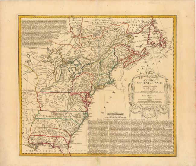
This is the Revolutionary War issue of Homann's map that was originally published during the French and Indian War in 1756 after Jeffery's map from the previous year. This edition includes several alterations and updates plus the line "et ad bellum praesentis temporis accomodata" added to the imprint. It shows the area from James Bay and Newfoundland in the north to northern Florida and the Gulf coast in the south, and depicts the British and French possessions during the first full year of the war. The western extent of the map is just west of the Mississippi River, and is called Mississippi or Louisiana. The boundaries, shown with dotted lines, of the southern colonies extend westward off the map. The map is embellished with a large title cartouche. The extensive German text at upper left and lower right describes the British claims and French encroachments with historical context.
References: McCorkle #756.1; Sellers & Van Ee #68.
Condition: A
Wide margins on watermarked paper. A centerfold separation at top just outside of neatline, and one at bottom that just enters map border, have both been repaired.