Catalog Archive
Auction 138, Lot 136

Small Version of a Keystone Map for Great Lakes Collections

"Le Canada, ou Nouvelle France, &c. Tiree de Diverses Relations des Francois, Anglois, Hollandois, &c.", Sanson/Mariette

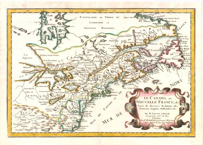
Subject: Colonial United States and Canada - Great Lakes

Period: 1662 (published)

Publication: L'Amerique en Plusieurs Cartes

Color: Hand Color

Size:
12.3 x 8.3 inches
31.2 x 21.1 cm
Download High Resolution Image
(or just click on image to launch the Zoom viewer)

This is a reduced version of one of the most influential seventeenth century maps of the French and English colonies in North America. It concentrates on the region of greatest French interest. The entire Great Lakes basin and the St. Lawrence River are shown in great detail. The most important aspect of the map is the first appearance of L. Erie, ou du Chat as a recognizable lake on an atlas map. This delineation influenced the cartography of the region for more than 100 years and was not superceded until Delisle's "Carte du Canada" in 1703. The map is also an outstanding source for Indian tribal names and locations. Two names (Aouentsiouaeron and Attiouandarons) appear here for the first time. Lake Superior and Michigan (Lac du Puans) are left open-end to the west. Embellished with a nice title cartouche. This is the second state.

References: Burden #325; Kershaw #135.

Condition: A

Marginal soiling.

Estimate: $850 - $950

Sold for: $600

Closed on 12/7/2011

Archived