Filtered by Category:United States(Show All Categories)
Showing results for:Auction 123
Catalog Archive
229 lots
Page 1 of 5
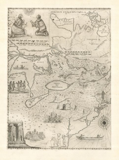
Auction 123, Lot 136
Subject: Colonial United States & Canada, Great Lakes
Bressani, Francesco
[Novae Franciae Accurata Delineatio 1657], 1657/1900
Size: 15 x 20 inches (38.1 x 50.8 cm)
Estimate: $1,500 - $2,000
Sold for: $4,500
Closed on 2/20/2008
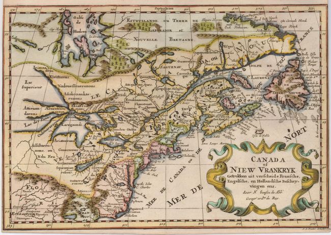
Auction 123, Lot 137
Subject: Colonial United States and Canada
Sanson, Nicolas
Canada of Niew Vrankryk Getrokken uit verscheide Fransche, Engelsche, en Hollandsche Beschryvingen enz, 1705
Size: 11.7 x 8.2 inches (29.7 x 20.8 cm)
Estimate: $750 - $850
Sold for: $650
Closed on 2/20/2008
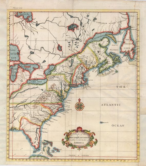
Auction 123, Lot 138
Subject: Colonial United States and Canada
Salmon, Thomas
A Map of the Brittish-Plantations on the Continent of America, 1739
Size: 12 x 13.8 inches (30.5 x 35.1 cm)
Estimate: $350 - $400
Sold for: $400
Closed on 2/20/2008
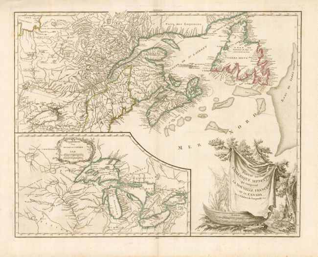
Auction 123, Lot 139
Subject: Colonial United States and Canada, Great Lakes
Robert de Vaugondy
Partie de l'Amerique Septent? qui comprend la Nouvelle France ou le Canada, 1755
Size: 24.5 x 19 inches (62.2 x 48.3 cm)
Estimate: $850 - $1,000
Sold for: $650
Closed on 2/20/2008
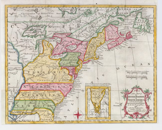
Auction 123, Lot 140
Subject: Colonial United States and Canada
Kitchin, Thomas
A New Map of the British Dominions in North America; with the Limits of the Governments Annexed thereto by the Late Treaty of Peace, and Settled by Proclamation, October 7th, 1763, 1763
Size: 11.8 x 9.4 inches (30 x 23.9 cm)
Estimate: $350 - $450
Sold for: $1,100
Closed on 2/20/2008
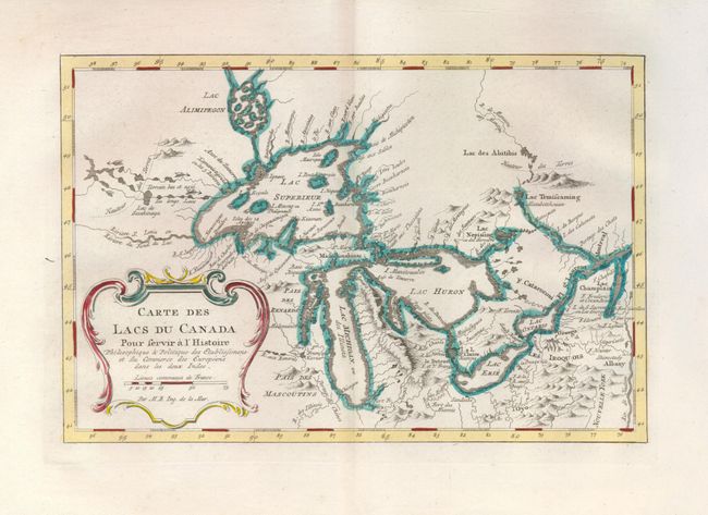
Auction 123, Lot 141
Subject: Colonial United States and Canada, Great Lakes
Bellin, Jacques Nicolas
Carte des Lacs du Canada…, 1773
Size: 11.3 x 7.4 inches (28.7 x 18.8 cm)
Estimate: $600 - $800
Sold for: $550
Closed on 2/20/2008
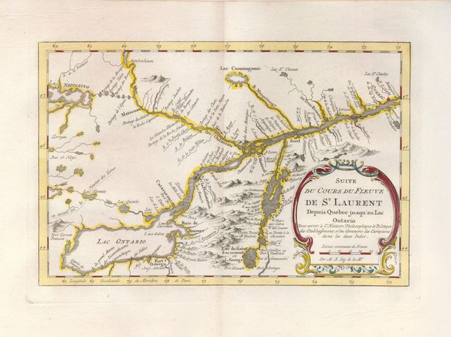
Auction 123, Lot 142
Subject: Colonial United States and Canada
Bellin, Jacques Nicolas
Suite du Cours du Fleuve de St. Laurent depuis Quebec jusqu'au Lac Ontario, 1773
Size: 11 x 7.3 inches (27.9 x 18.5 cm)
Estimate: $200 - $250
Sold for: $300
Closed on 2/20/2008
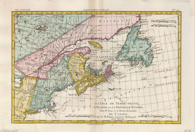
Auction 123, Lot 143
Subject: Colonial Canada and New England
Bonne, Rigobert
L'Isle de Terre-Neuve, L'Acadie, ou la Nouvelle Ecosse, l'Isle St Jean et la Partie Orientale du Canada, 1775
Size: 12.6 x 8.5 inches (32 x 21.6 cm)
Estimate: $200 - $250
Sold for: $150
Closed on 2/20/2008
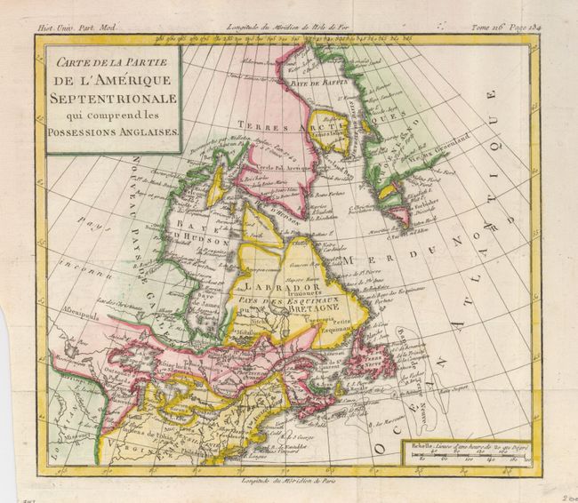
Auction 123, Lot 144
Subject: Colonial Canada & United States
Brion de la Tour, Louis
Carte de la Partie de l'Amerique Septentrionale qui Comprend les Possessions Anglaises, 1782
Size: 10 x 8.8 inches (25.4 x 22.4 cm)
Estimate: $150 - $200
Sold for: $170
Closed on 2/20/2008
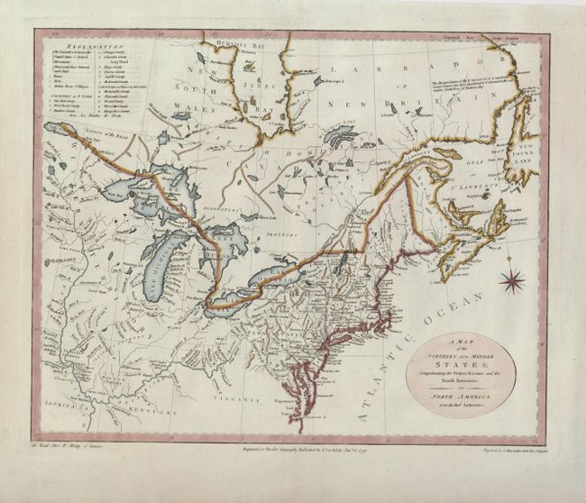
Auction 123, Lot 145
Subject: Canada & Northeast United States
Stockdale, John
A Map of the Northern and Middle States; Comprehending the Western Territory and the British Dominions in North America from the Best Authorities, 1792
Size: 15.8 x 12.8 inches (40.1 x 32.5 cm)
Estimate: $650 - $750
Sold for: $600
Closed on 2/20/2008
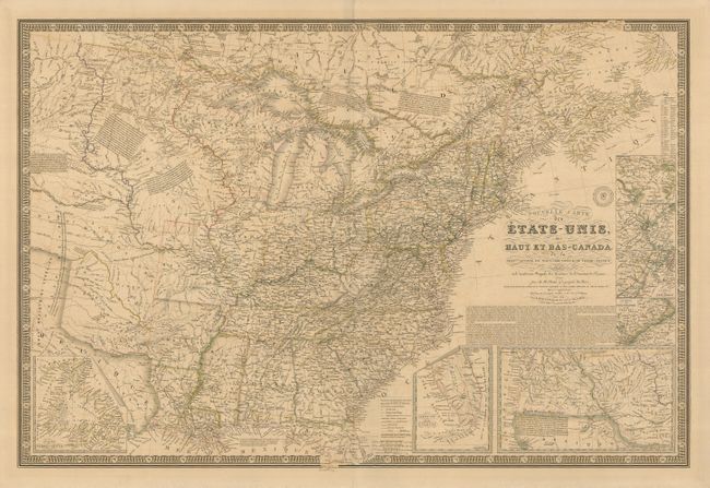
Auction 123, Lot 146
Subject: Canada & United States
Brue, Adrien Hubert
Nouvelle Carte des Etats-Unis des Haut et Bas-Canada…, 1836
Size: 37 x 25 inches (94 x 63.5 cm)
Estimate: $650 - $750
Unsold
Closed on 2/20/2008
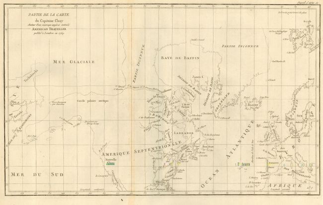
Auction 123, Lot 147
Subject: Canada & Alaska
Robert de Vaugondy, Didier
Partie de la Carte du Capitaine Cluny Auteur d'un ouvrage anglois intitule American Traveller, 1772
Size: 19 x 11.5 inches (48.3 x 29.2 cm)
Estimate: $180 - $230
Unsold
Closed on 2/20/2008
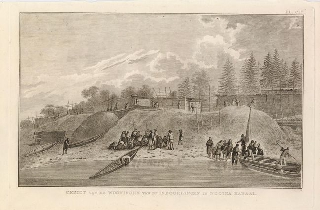
Auction 123, Lot 148
Subject: Alaska & Western Canada
Cook, James (Capt.)
[Lot of 3 Views], 1795
Size: 14 x 8.5 inches (35.6 x 21.6 cm)
Estimate: $150 - $200
Sold for: $110
Closed on 2/20/2008
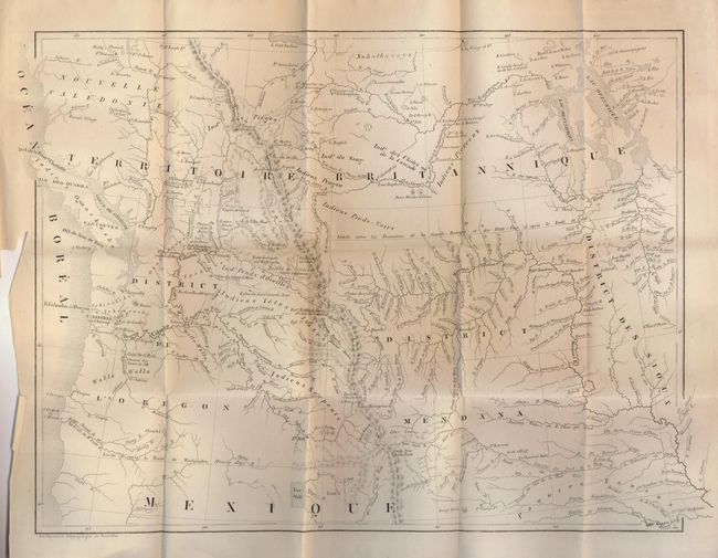
Auction 123, Lot 149
Subject: Western United States and Canada
De Smet, Father Pierre-Jean
Voyages Aux Montagnes Rocheuses, et une Annee de Sejour Chez les Tribus Indiennes du Vaste Territoire de l'Oregon, Defendant des Etats-Unis d'Amerique, 1844
Size: 15.5 x 12 inches (39.4 x 30.5 cm)
Estimate: $500 - $700
Sold for: $900
Closed on 2/20/2008
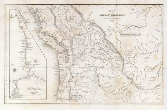
Auction 123, Lot 150
Subject: Western Canada and United States
Wilkes, Charles
Map of the Oregon Territory from the Best Authorities, 1849
Size: 13 x 8 inches (33 x 20.3 cm)
Estimate: $150 - $250
Sold for: $400
Closed on 2/20/2008
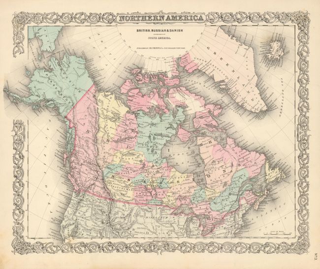
Auction 123, Lot 151
Subject: Canada and Alaska
Colton, Joseph Hutchins
Northern America British, Russian & Danish Possessions in North America, 1855
Size: 15.7 x 12.8 inches (39.9 x 32.5 cm)
Estimate: $120 - $150
Sold for: $160
Closed on 2/20/2008
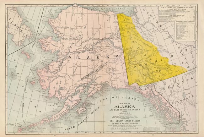
Auction 123, Lot 152
Subject: Alaska and Western Canada
Crowell Publishing Co.
New Map of Alaska and Part of British America…The Yukon Gold Fields and Routes by Which They are Reached, 1904
Size: 19 x 12.6 inches (48.3 x 32 cm)
Estimate: $100 - $130
Sold for: $70
Closed on 2/20/2008
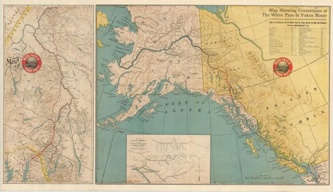
Auction 123, Lot 153
Subject: Alaska and Western Canada
Railroad Companies, (Various)
Map of White Pass & Yukon Route [on sheet with] Map Showing Connections of the White Pass & Yukon Route, 1905
Size: 27.3 x 15 inches (69.3 x 38.1 cm)
Estimate: $140 - $180
Sold for: $150
Closed on 2/20/2008
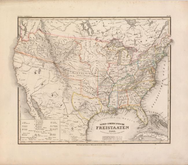
Auction 123, Lot 154
Subject: United States
Radefeld, Carl Christian Franz
Nord-Americanische Freistaaten, 1845
Size: 14.5 x 11.8 inches (36.8 x 30 cm)
Estimate: $350 - $450
Sold for: $200
Closed on 2/20/2008
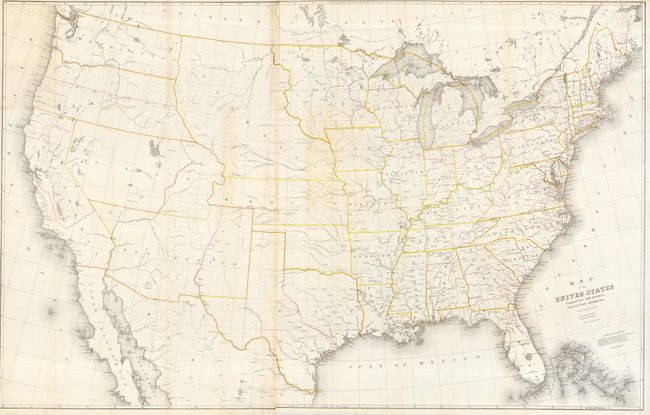
Auction 123, Lot 155
Subject: United States
Burr, David H.
Map of the United States Exhibiting the Several Collection Districts, 1856
Size: 49.3 x 31.5 inches (125.2 x 80 cm)
Estimate: $200 - $300
Sold for: $300
Closed on 2/20/2008
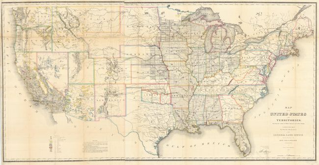
Auction 123, Lot 156
Subject: United States
General Land Office
Map of the United States and Territories Showing the extent of Public Surveys and other details constructed from the Plats and official sources of the General Land Office…, 1866
Size: 54.5 x 28 inches (138.4 x 71.1 cm)
Estimate: $400 - $500
Unsold
Closed on 2/20/2008
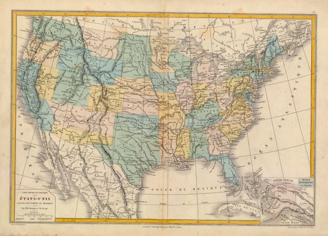
Auction 123, Lot 157
Subject: United States
Drioux & Leroy
Carte Physique et Politique des Etats-Unis Canada et Partie du Mexique, 1867
Size: 16.7 x 11.5 inches (42.4 x 29.2 cm)
Estimate: $120 - $160
Unsold
Closed on 2/20/2008
Auction 123, Lot 158
Subject: United States
Bryant, William C.
[Lot of 25 - U.S. Views], 1872
Size: 9 x 5.5 inches (22.9 x 14 cm)
Estimate: $350 - $450
Sold for: $250
Closed on 2/20/2008
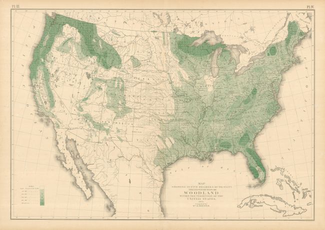
Auction 123, Lot 159
Subject: United States
General Land Office
Map Showing in Five Degrees of Density the Distribution of Woodland Within the Territory of the United States, 1873
Size: 29 x 20 inches (73.7 x 50.8 cm)
Estimate: $160 - $200
Sold for: $130
Closed on 2/20/2008
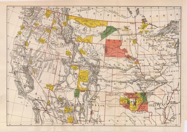
Auction 123, Lot 160
Subject: United States
U.S. Government
[Lot of 5 - Indian Reservations], 1874-1917
Size: See Description
Estimate: $180 - $240
Sold for: $230
Closed on 2/20/2008
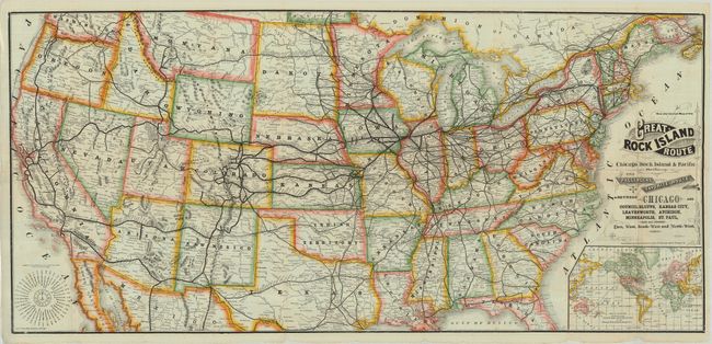
Auction 123, Lot 161
Subject: United States
Railroad Companies, (Various)
New and Correct Map of the Great Rock Island Route Chicago Rock Island & Pacific Railway The Passengers Favorite Route…, 1883
Size: 40.2 x 19 inches (102.1 x 48.3 cm)
Estimate: $200 - $275
Sold for: $160
Closed on 2/20/2008
Auction 123, Lot 162
Subject: United States - Civil War
U.S. War Records Office
[Lot of 26] Topographical Map Sheets No. I-XXVI, 1891
Size: 27.4 x 16.5 inches (69.6 x 41.9 cm)
Estimate: $400 - $500
Sold for: $325
Closed on 2/20/2008
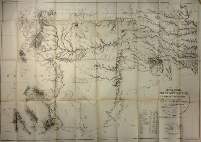
Auction 123, Lot 163
Subject: United States
U.S. Geological Survey (USGS)
Map of the United States and Texas Boundary Line and Adjacent Territory determined & surveyed in 1857-8-9-60, by J.H. Clark U.S. Commissioner, 1902
Size: 40 x 26 inches (101.6 x 66 cm)
Estimate: $180 - $220
Sold for: $130
Closed on 2/20/2008
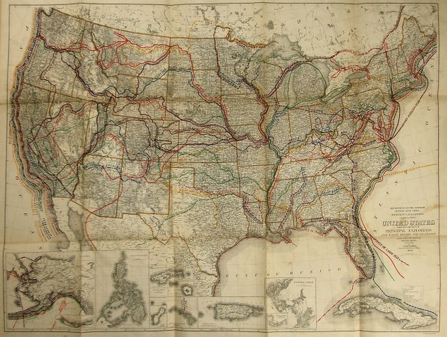
Auction 123, Lot 164
Subject: United States
General Land Office
United States Showing the Routes of Principal Explorers and Early Roads and Highways, 1908
Size: 32 x 23.3 inches (81.3 x 59.2 cm)
Estimate: $200 - $300
Sold for: $150
Closed on 2/20/2008
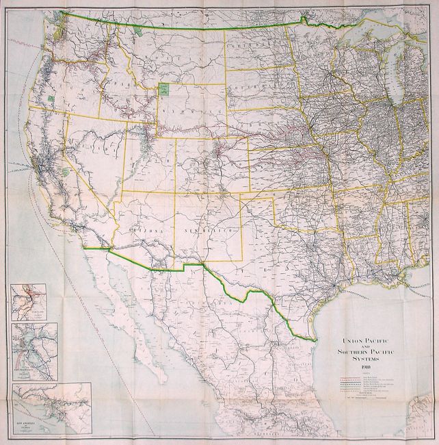
Auction 123, Lot 165
Subject: Central and Western United States
Railroad Companies, (Various)
Union Pacific and Southern Pacific Systems, 1910
Size: 43.6 x 43.5 inches (110.7 x 110.5 cm)
Estimate: $275 - $325
Unsold
Closed on 2/20/2008
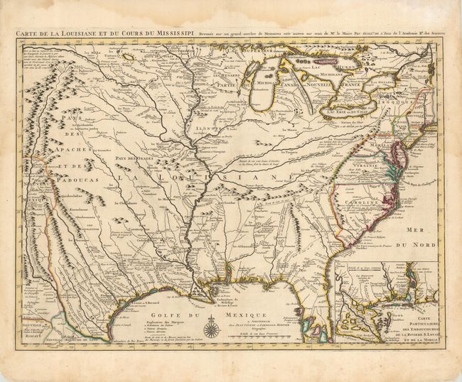
Auction 123, Lot 166
Subject: Colonial United States
Delisle/Covens & Mortier
Carte de la Louisiane et du Cours du Mississipi Dressee sur un Grand Nombre de Memoires entrautres sur ceux de Mr. le Maire, 1730
Size: 24.3 x 18 inches (61.7 x 45.7 cm)
Estimate: $2,400 - $2,750
Sold for: $1,900
Closed on 2/20/2008
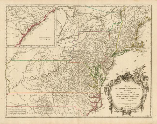
Auction 123, Lot 167
Subject: Colonial United States
Robert de Vaugondy
Partie de l'Amerique Septentrionale, qui Comprend le Cours de l'Ohio, la Nlle Angleterre, la Nlle York, le New Jersey, la Pensylvanie, la Maryland, la Virginie, la Caroline, 1755
Size: 25 x 19 inches (63.5 x 48.3 cm)
Estimate: $800 - $1,000
Sold for: $1,400
Closed on 2/20/2008
Auction 123, Lot 168
Subject: Eastern United States
Brion de la Tour, Louis
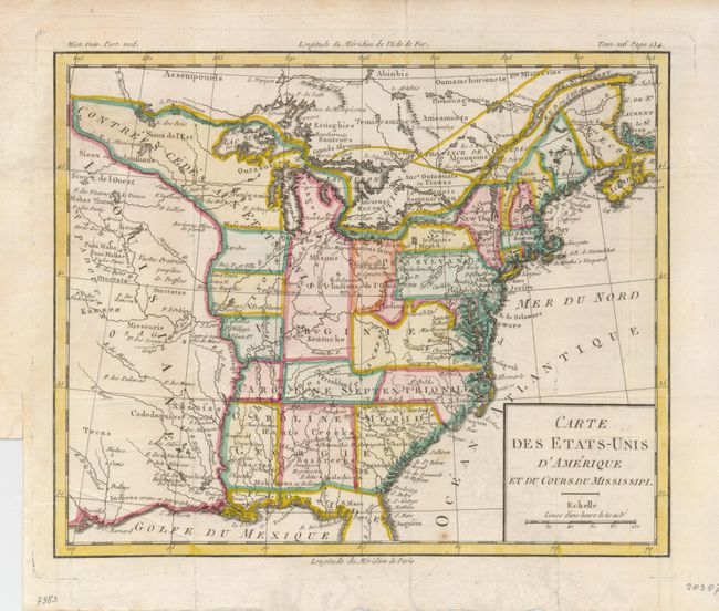
Carte des Etats-Unis d'Amerique et du Cours du Mississipi…, 1790
Size: 10.5 x 8.6 inches (26.7 x 21.8 cm)
Estimate: $600 - $700
Sold for: $600
Closed on 2/20/2008
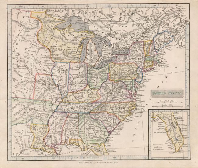
Auction 123, Lot 169
Subject: Eastern United States
Arrowsmith, Samuel
United States, 1819
Size: 9.5 x 8.3 inches (24.1 x 21.1 cm)
Estimate: $200 - $250
Sold for: $200
Closed on 2/20/2008
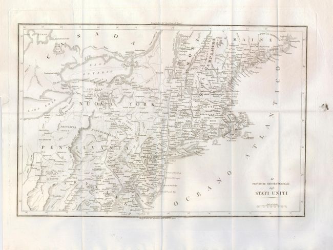
Auction 123, Lot 170
Subject: Eastern United States
Anon.
[Lot of 2] Le Provincie Settentrionali degli Stati Uniti [with] Le Provincie Meridionali degli Stati Uniti, 1822
Size: 17.4 x 12.4 inches (44.2 x 31.5 cm)
Estimate: $500 - $600
Unsold
Closed on 2/20/2008
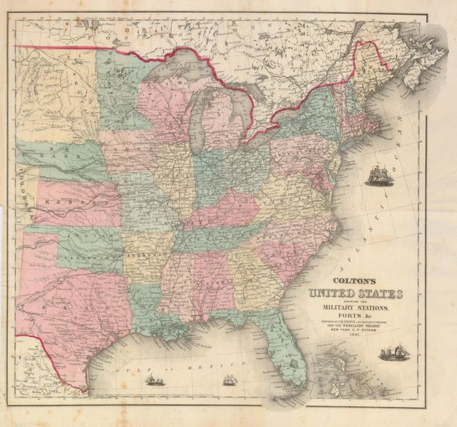
Auction 123, Lot 171
Subject: Eastern United States
Colton, Joseph Hutchins
[Lot of 2] Colton's United States Shewing the Military Stations, Forts &c…For the 'Rebellion Record'… [and] … For Victor's History of the Southern Rebellion, 1861-62
Size: 15.8 x 14.8 inches (40.1 x 37.6 cm)
Estimate: $300 - $400
Sold for: $200
Closed on 2/20/2008
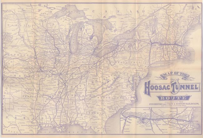
Auction 123, Lot 172
Subject: Eastern United States
Rand McNally & Co.
Map of the Hoosac Tunnel Route Comprising the Fitchburg and Troy & Boston Railroads, 1883
Size: 21.7 x 14.3 inches (55.1 x 36.3 cm)
Estimate: $120 - $180
Sold for: $90
Closed on 2/20/2008
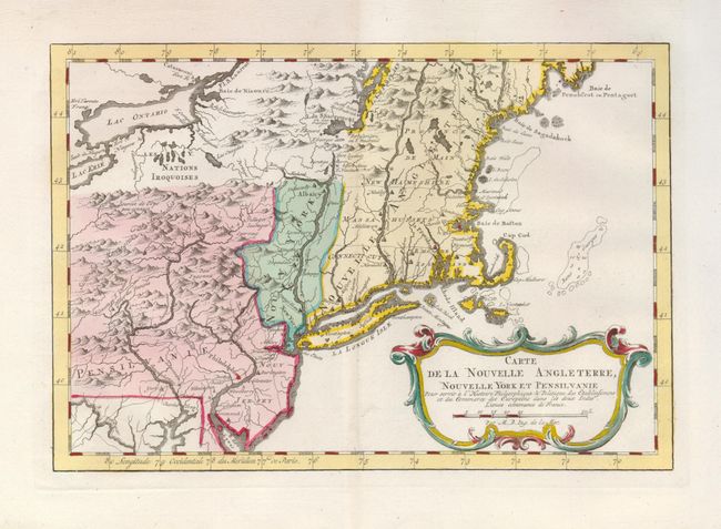
Auction 123, Lot 173
Subject: Colonial New England
Bellin, Jacques Nicolas
Carte de la Nouvelle Angleterre, Nouvelle Yorck et Pensilvanie, 1773
Size: 11.5 x 8 inches (29.2 x 20.3 cm)
Estimate: $400 - $475
Sold for: $300
Closed on 2/20/2008
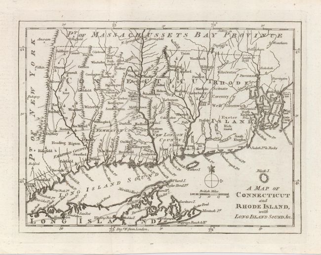
Auction 123, Lot 174
Subject: Colonial New England
Gentleman's Magazine
A Map of Connecticut and Rhode Island with Long Island Sound, &c., 1776
Size: 9 x 6.8 inches (22.9 x 17.3 cm)
Estimate: $250 - $350
Sold for: $190
Closed on 2/20/2008
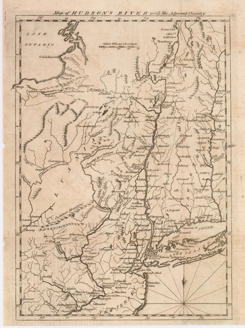
Auction 123, Lot 175
Subject: Colonial New England
Anon.
Map of the Hudson's River with the Adjacent Country, 1777
Size: 8 x 11.5 inches (20.3 x 29.2 cm)
Estimate: $120 - $180
Sold for: $120
Closed on 2/20/2008
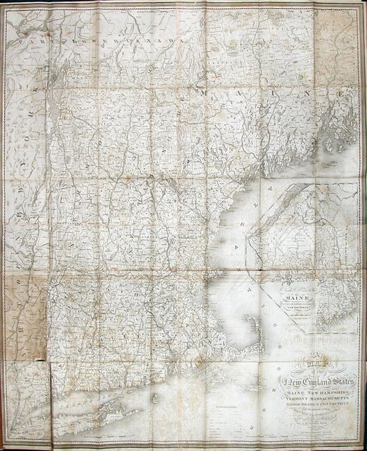
Auction 123, Lot 176
Subject: New England
Hale, Nathan
A Map of the New England States, Maine, New Hampshire, Vermont, Massachusetts, Rhode Island & Connecticut with the Adjacent Parts of New York & Lower Canada, 1826-53
Size: 37.5 x 44 inches (95.3 x 111.8 cm)
Estimate: $600 - $800
Sold for: $450
Closed on 2/20/2008
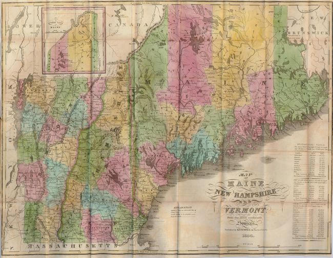
Auction 123, Lot 177
Subject: New England
Sumner & Co.
Map of Maine, New Hampshire and Vermont, from the Most Authentic Sources, 1834
Size: 19 x 15 inches (48.3 x 38.1 cm)
Estimate: $250 - $300
Sold for: $150
Closed on 2/20/2008
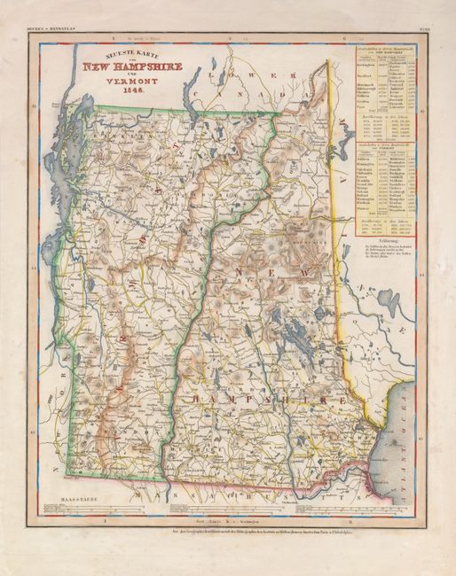
Auction 123, Lot 178
Subject: New Hampshire and Vermont
Meyer, Joseph
Neueste Karte von New Hampshire und Vermont, 1846
Size: 12 x 15 inches (30.5 x 38.1 cm)
Estimate: $100 - $130
Sold for: $120
Closed on 2/20/2008
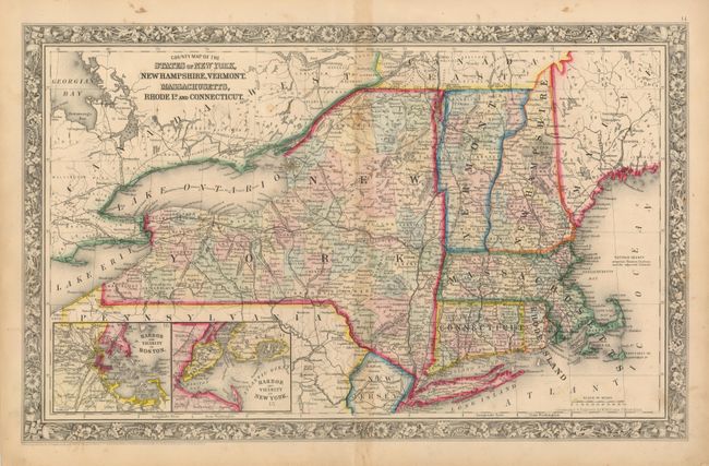
Auction 123, Lot 179
Subject: New England
Mitchell, Samuel Augustus
County Map of the States of New York, New Hampshire, Vermont, Massachusetts, Rhode Id. and Connecticut, 1860
Size: 21.2 x 13.3 inches (53.8 x 33.8 cm)
Estimate: $80 - $120
Unsold
Closed on 2/20/2008
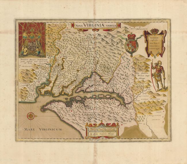
Auction 123, Lot 180
Subject: Colonial Mid-Atlantic
Hondius/Blaeu
Nova Virginiae Tabula, 1680
Size: 18.3 x 14.5 inches (46.5 x 36.8 cm)
Estimate: $2,000 - $2,500
Sold for: $1,500
Closed on 2/20/2008
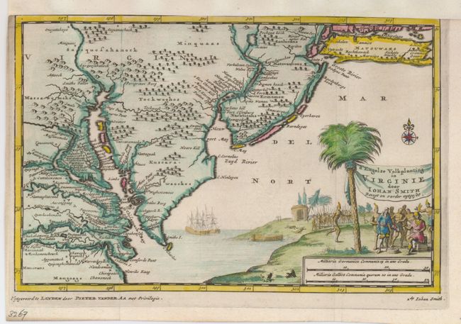
Auction 123, Lot 181
Subject: Colonial Mid-Atlantic
Aa, Pieter van der
d'Engelze Volkplanting in Virginie door Iohan Smith Bezogt en Verder Uytgeset, 1706
Size: 9 x 6 inches (22.9 x 15.2 cm)
Estimate: $400 - $500
Sold for: $475
Closed on 2/20/2008
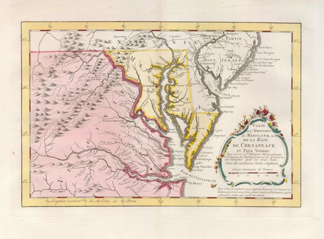
Auction 123, Lot 182
Subject: Colonial Mid-Atlantic
Bellin, Jacques Nicolas
Carte de la Virginie et du Maryland, ou de la Baie de Chesapeack et Pays Voisins…, 1773
Size: 11.2 x 7.4 inches (28.4 x 18.8 cm)
Estimate: $500 - $600
Sold for: $425
Closed on 2/20/2008
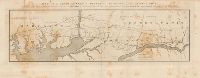
Auction 123, Lot 183
Subject: United States - Mid-Atlantic
U.S. Corps of Engineers
Map of a Reconnaissance Between Baltimore and Philadelphia exhibiting the several routes of the Mail Road contemplated by the resolution of Congress approved on the 4th of May 1826, 1826
Size: 31 x 10 inches (78.7 x 25.4 cm)
Estimate: $200 - $250
Sold for: $160
Closed on 2/20/2008
Auction 123, Lot 184
Subject: Colonial Southern United States
Sanson, Nicolas
Florida, 1679
Size: 10 x 7 inches (25.4 x 17.8 cm)
Estimate: $600 - $700
Sold for: $500
Closed on 2/20/2008
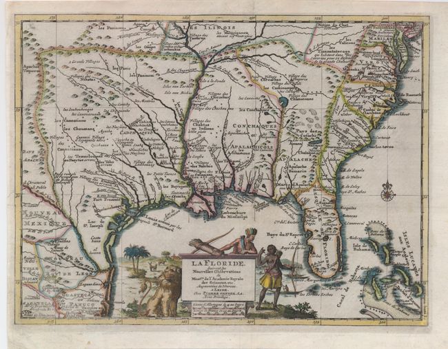
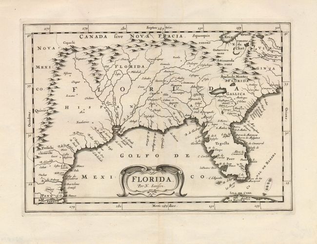
Auction 123, Lot 185
Subject: Colonial Southern United States
Aa, Pieter van der
La Floride, Suivant les Nouvelles Observations…, 1713
Size: 12 x 9 inches (30.5 x 22.9 cm)
Estimate: $850 - $950
Sold for: $650
Closed on 2/20/2008
229 lots
Page 1 of 5